PHOTOS: Significant damage after severe storms, tornadoes hit Sask., Manitoba
A significant severe weather event took place Tuesday across parts of southern Saskatchewan and Manitoba, with tornado warnings issued and numerous reports of hail, supercells, localized flooding and tree damage. Multiple tornadoes have also been reported
Favourable, atmospheric conditions lined up again on Tuesday to support the development of severe thunderstorms in southern Saskatchewan and Manitoba, with impactful weather across sections of both provinces.
The severe weather erupted mid-Tuesday afternoon, with multiple supercells forming and several tornado sightings. The storms initialized in southern Manitoba, with others forming towards the southern Saskatchewan-Manitoba border, before severe storms fired up in Saskatchewan towards the evening.
RELATED: Tornado warning safety: Here’s what you should do
Tornado watches went up for southeastern Saskatchewan and southern Manitoba ahead of the storms, before tornado warnings were issued, lasting for hours in both provinces.
Tornado warnings were first issued in Manitoba just after 3:30 p.m. CT, with the first reported twister sighting occurring shortly after. It was reported east of Morris, Man. Wall clouds and funnel clouds were also reported.
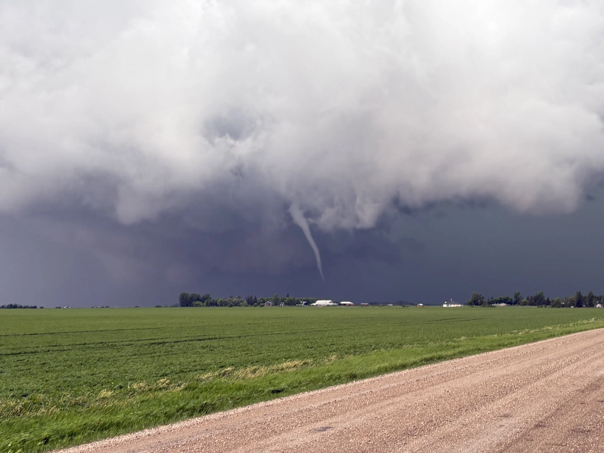
A confirmed tornado in the Oxbow, Sask., area east of Estevan caused significant damage after directly hitting at least one farmstead. Fortunately, no injuries have been reported at this time. Several additional tornado reports have been received from both Saskatchewan and Manitoba, and further details will be shared as the information is analyzed.
Aside from the multiple tornado warnings, which had included Winnipeg at one point, there were reports of large hail, torrential downpours and strong winds, as well as power outages.
In addition to that, tree damage was reported in multiple locales, including northeast of Oakburn, Man.
There has also been reports of localized flooding, including in Winnipeg and Regina.
A negatively tilted trough over the Rockies, along with a strong jet stream extending into Manitoba, enhanced the severe weather. As well, a surface low developed east of the Rockies in Montana and tracked northeast, acted as the main trigger for explosive storm development.
Storms were also fed by an environment with high instability, ample CAPE, moisture, and steep lapse rates.
As soon as the storms fired up, it didn't take long for social media to light up with visuals. Below is just a selection of what's currently making the rounds.

Shelf cloud near Ste. Anne, Man. (Claudette Gabbs (@ClaudetteGabbs)/X/Submitted to The Weather Network)
Stay tuned as this is a developing story.
Thumbnail courtesy of Janelle (@janelleg014/X), taken near St. Anne, Man.
Stay with The Weather Network for all the latest on conditions across the Prairies.