PHOTOS: Record-setting snowstorm buries parts of Ontario in 20+ cm

Rapidly accumulating snow and reduced visibility made travel difficult at times in southern Ontario Sunday.
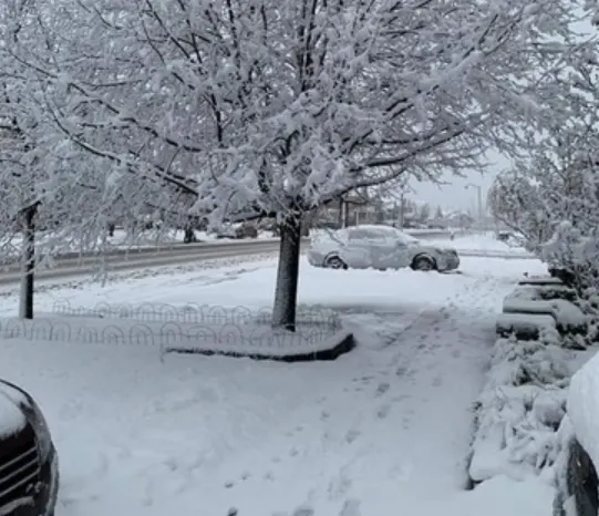
Even though it's still officially fall, many regions in southern Ontario looked and felt like a winter wonderland on Sunday as a potent stateside system brought hours of snow that quickly piled up.
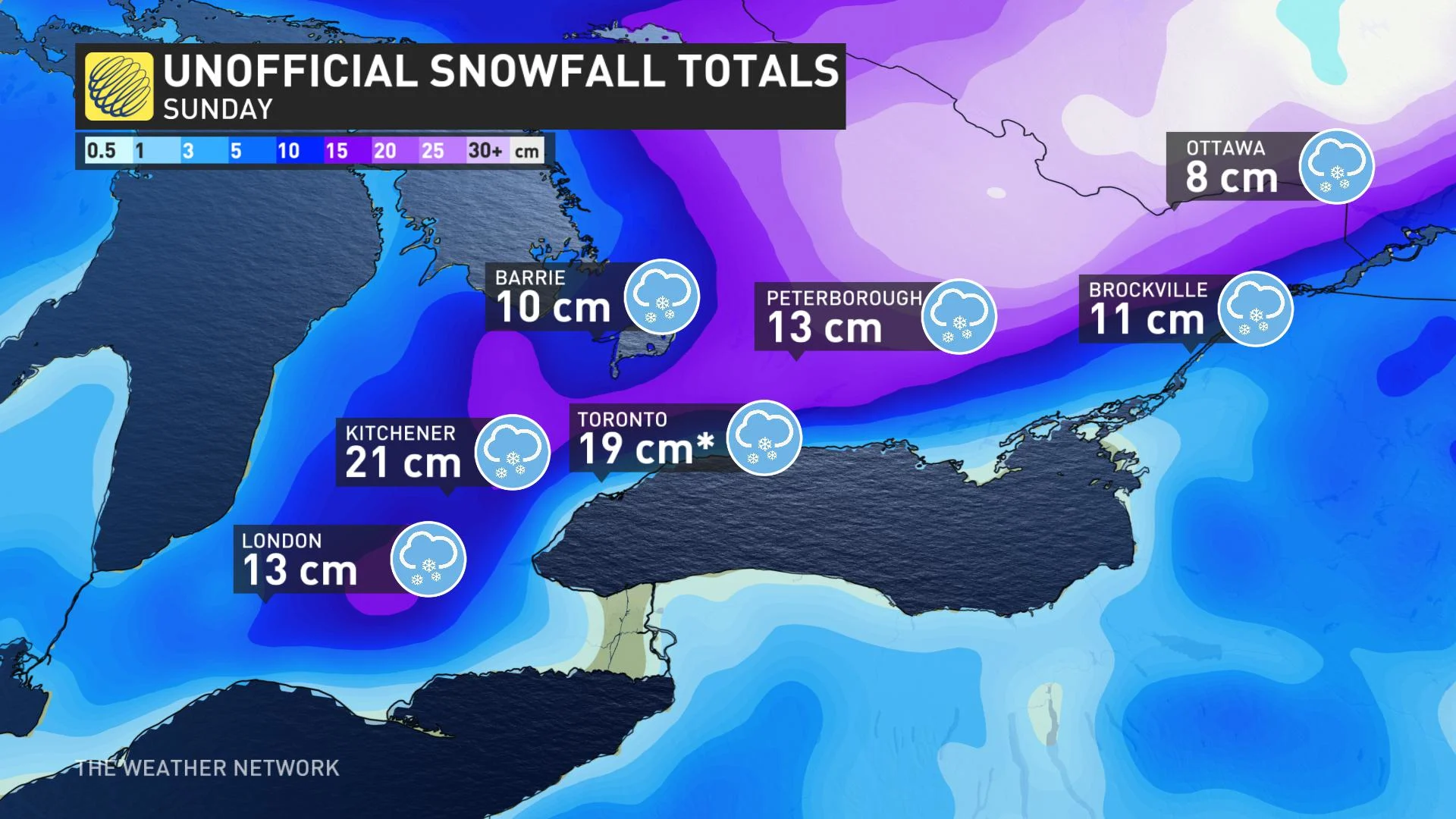
As predicted, snow totals varied greatly across the region due to the distance from Lake Ontario, temperature gradient and elevation. The heaviest accumulations were reported in Brampton, with 24.5 cm recorded in northeastern parts of the city. Meanwhile Toronto's Pearon airport hit a new daily snow record for November 22 with the 19 cm that piled up, smashing the old record of 7.6 cm set back in 2007.
Special weather statements, weather advisories, and snowfall warnings were all issued by Environment Canada at the height of the storm, which highlighted the possibility of hazardous travel due to the rapid snowfall rates. Slippery road conditions and periods of low visibility also served as a reminder that it is that time of year when many will transition to winter tires. Some lingering snow and ice may continue to make for difficult travel through Monday, so drivers are urged to adjust to the road conditions.
See below for a look at southern Ontario's first widespread snow of the season:

Credit: Doug Bell, Ridgetown, ON
Thumbnail credit: Raushanara Saleem


