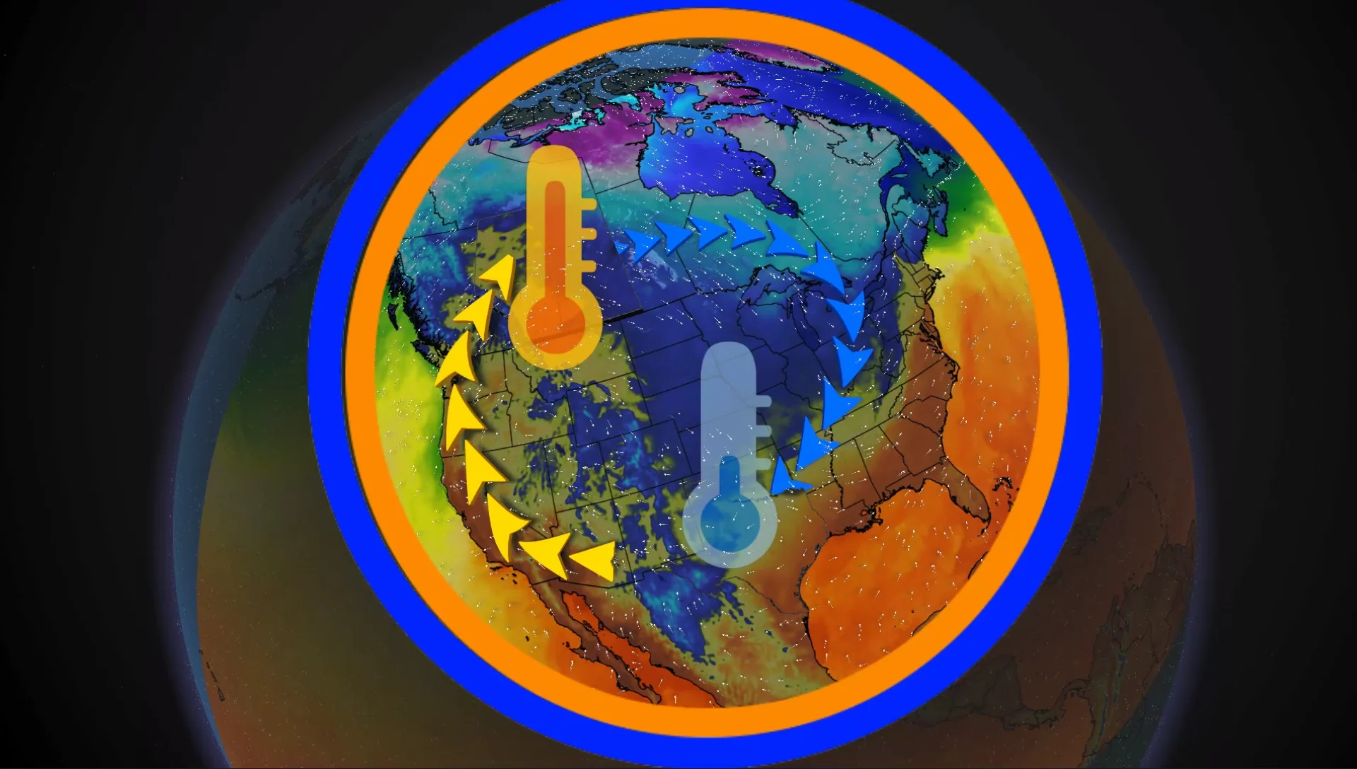
Pattern swap will see parts of Western Canada get warmer than Texas

A wonky temperature pattern will unfold across North America this week, resulting in warmth in Western Canada while parts of the U.S. Deep South cool off
People from Texas and Oklahoma may want to take a trip to the Great White North soon to get some heat.
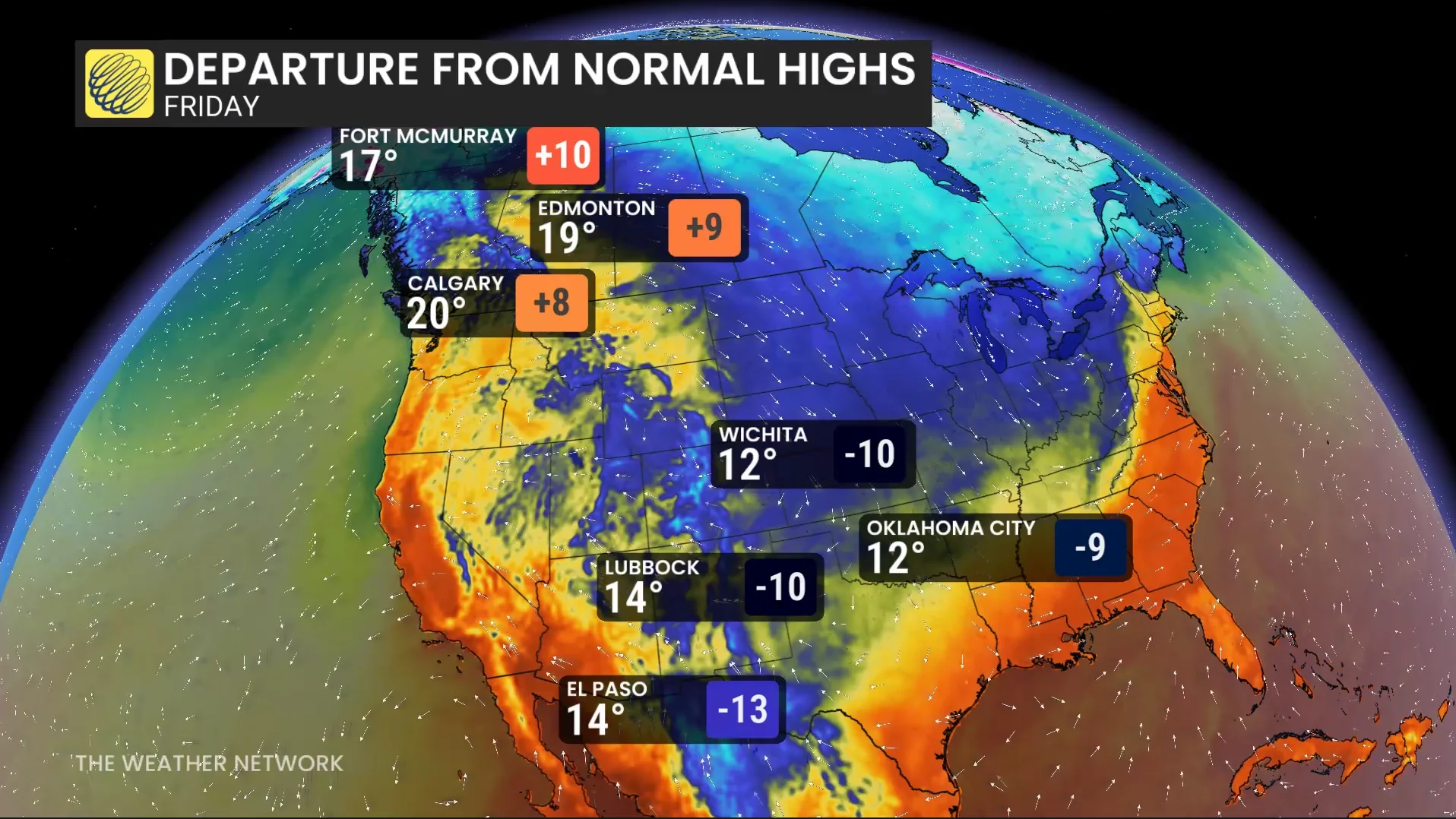
A cut-off low over the southwestern U.S. is plunging the two states in an October cooldown, with some major cities experiencing temperatures 10-15 degrees below seasonal.
Meanwhile, Alberta and Saskatchewan are expected to be up to 10 degrees above seasonal.
On Friday and Saturday, a low-pressure system cuts off from the jet stream to form a cut-off low over the Four Corners (where Arizona, Colorado, New Mexico and Utah meet).
The cut-off low is expected to bring heavy rain across the Southwest, followed by the cold front on the backside to send temperatures plummeting.
Friday into Saturday will see the cold front pass, bringing a temperatures plummet to 10-15 degrees below seasonal.
It will be colder in cities like El Paso, Wichita and Oklahoma City than in parts of Alberta and Saskatchewan on Friday and Saturday.
A ridge of high pressure forms across Alberta and Saskatchewan Friday, bringing sunshine and warmth back into the region.
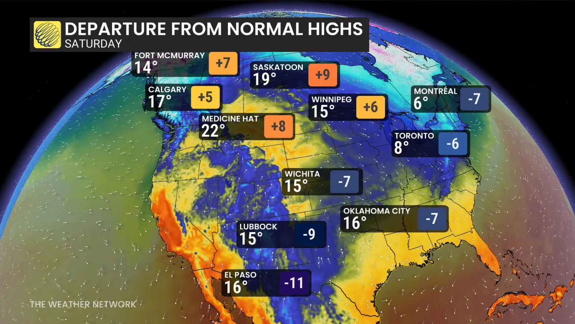
The southerly flow brings temperatures up to the high teens, and even to the 20s, across the region.
Temperatures are expected to be up to 10 degrees above seasonal.
In Eastern Canada, the low pressure will ride the high pressure in the southeast and make its way to the region.
It will be reinjected into the jet stream, pulling the trough farther south across Ontario and Quebec.
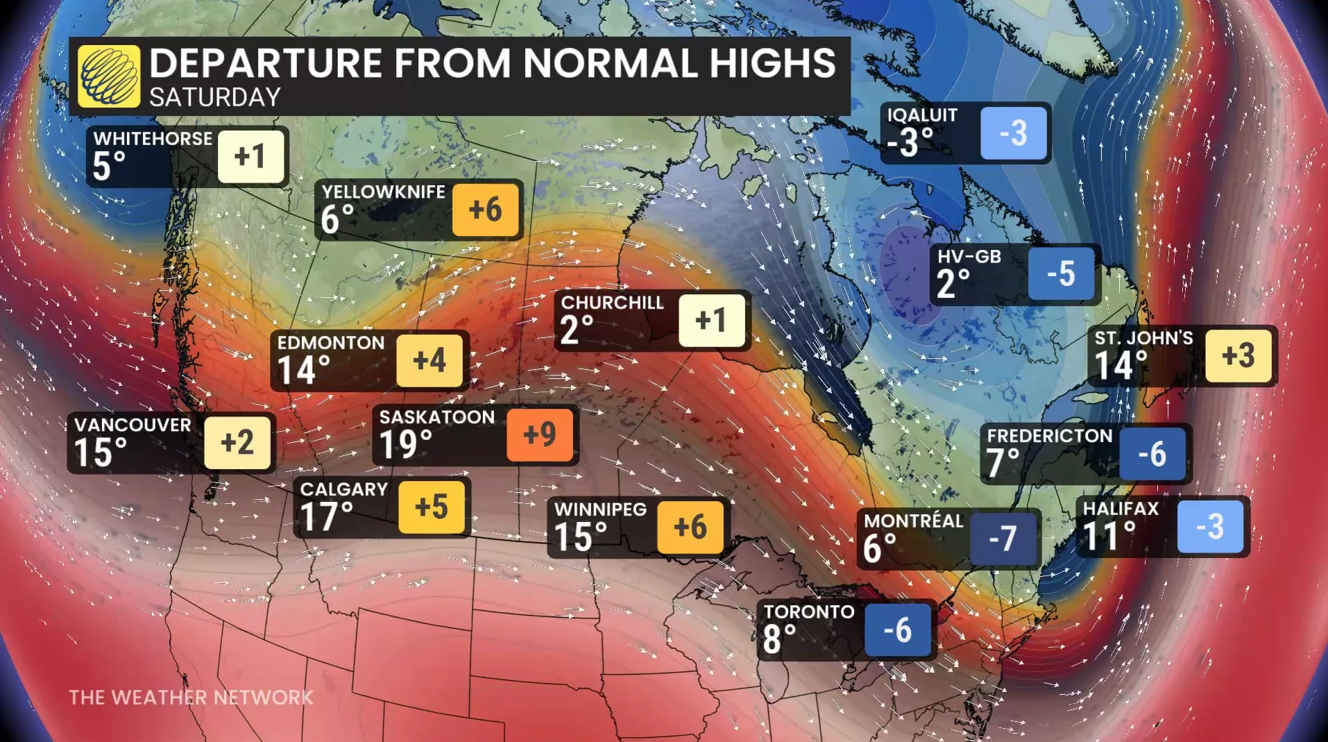
Into Saturday, temperatures drop 5-10 degrees below normal in southern Ontario, with highs staying in the single digits.
Yellowknife, N.W.T., and Montreal, Que., are forecast to hit the same temperature on Saturday.
Toronto and Montreal will experience their coldest, daytime high since April 20, and the first, single-digit high of the season.