Pattern sees threat of thunderstorms shift back into Alberta Thursday
Alberta will take on the next chance for thunderstorms on the Prairies on Thursday, with most likely to remain below warning criteria, but an isolated, severe storm can't be ruled out
The Prairies have been a focal point for severe weather across Canada this week, highlighted by three confirmed tornadoes in southern Manitoba on Tuesday.
On Thursday, storm chances will expand and shift westward into parts of Alberta. Most of the storms should remain non-severe, but an isolated, stronger storm isn't out of the question.
DON'T MISS: PHOTOS: Twin tornadoes, hail spotted in Manitoba amid volatile storms
Be sure to stay alert to the changing conditions and stay updated on any weather warnings in your area.
Thunderstorm risk shifts to Alberta Thursday
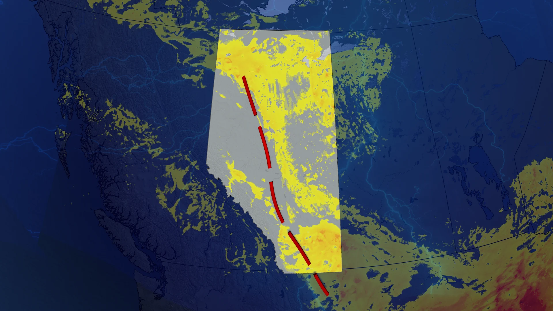
By Thursday, thunderstorm activity will become more widespread in Alberta as a surface trough forms east of the Rockies, from Whitecourt to Medicine Hat, providing the necessary trigger.

In the southeast corner of Alberta, a weak, surface low develops. That will act as the secondary trigger for storm development during the afternoon.
At this point, most storms will likely stay non-severe, but an isolated, severe storm is not out of the question. Moderate thunderstorm energy exists in the southwest corner.
In the long-range, a deep area of low pressure developing on the West Coast moves into the Rockies this weekend.

The disturbance will dip the jet stream into a trough, allowing for active weather to continue into and through the weekend for Alberta and B.C.
Expect a continuation of isolated thunderstorms over the next several days.