
Big pattern change sends millions into cooler territory for early August

Pattern reversal develops during first week of August
July has featured contrasting weather patterns across Canada.
The various shades of blue and green on the map below show the regions that have been cooler than normal so far during July.
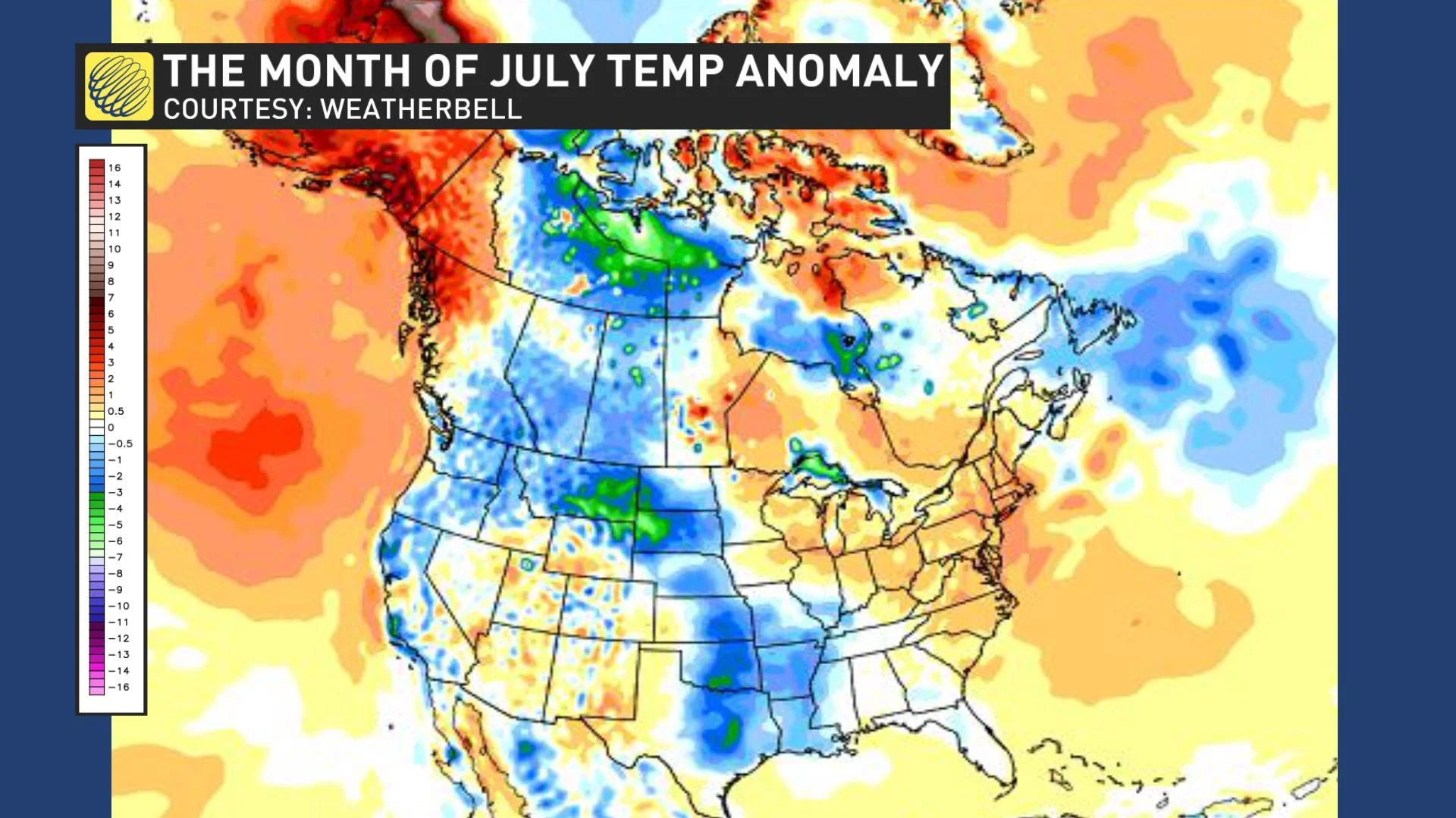
For most of Ontario and southern Quebec, the various shades of orange highlight the well above seasonal temperatures that have dominated during July. This has been quite a dramatic change from the chilly spring and sluggish start to the summer season that these regions experienced.
However, another pattern change is expected during early August. After the first weekend of August (a long weekend for many), we expect a reversal in the dominant jet stream pattern, which will bring warmer weather to British Columbia and Alberta and a cooler pattern to Ontario and Quebec.
The image below is a model forecast for August 6 through 12.
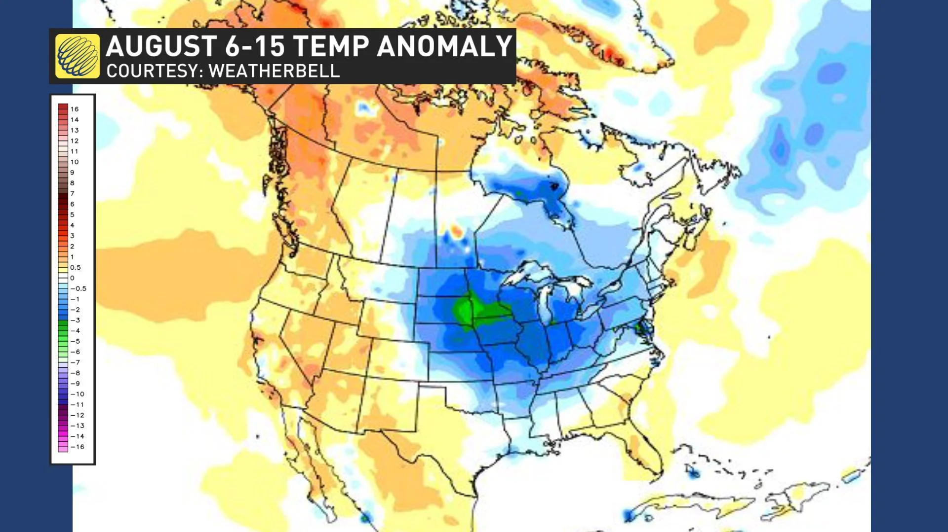
This model may well be too cool (some of the “blue” areas could end up near seasonal rather than cooler than seasonal) and there is some uncertainty as to exactly how quickly the pattern will develop. However, this does provide a good depiction of the overall pattern that we expect to develop.
The map below is our forecast pattern map for August 5 – 15, but we will have more details on what you can expect for the rest of the month of August on Tuesday, August 6 when we will release an update for the final weeks of summer.
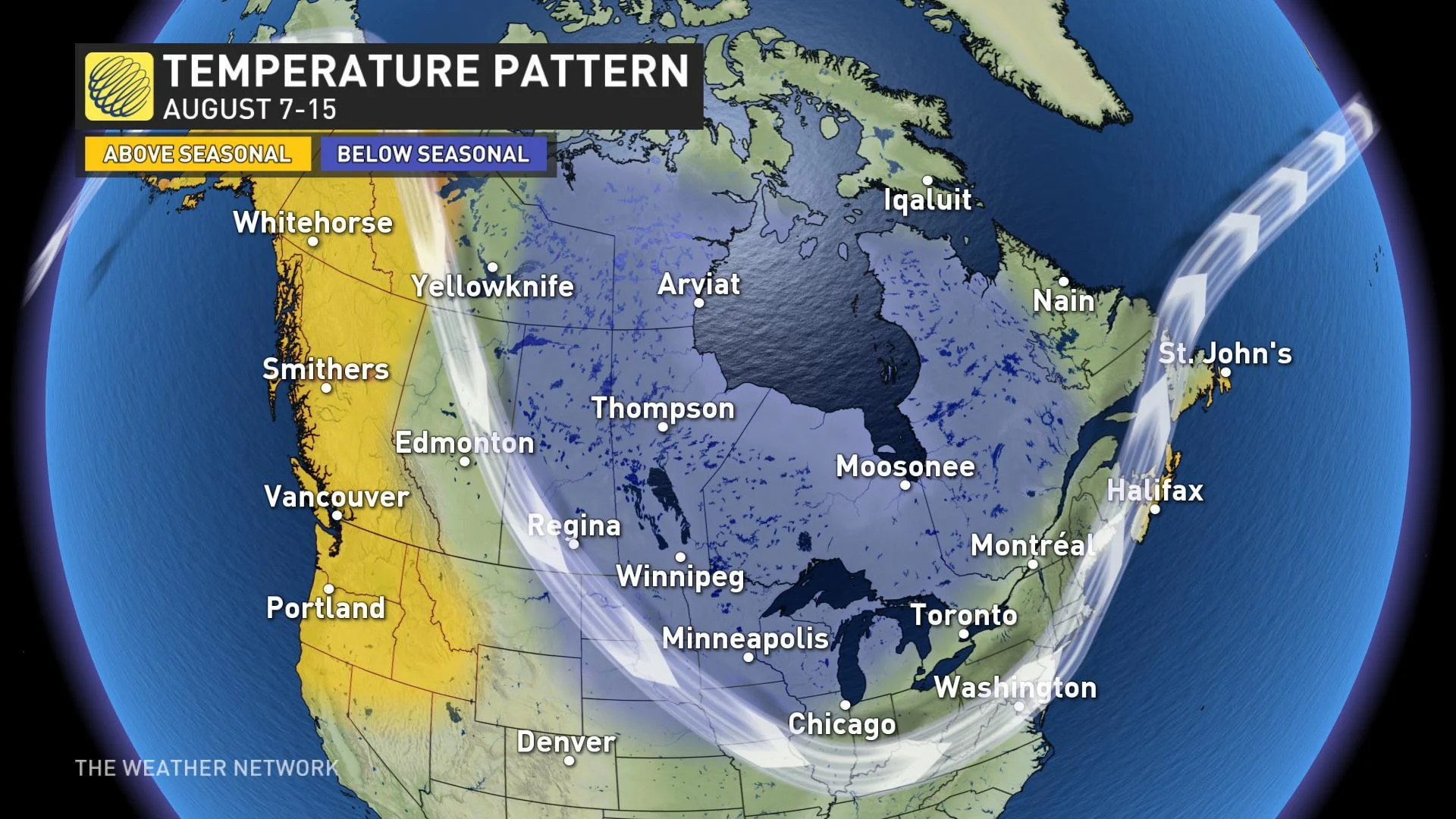
For the areas that see a period of cooler weather as we approach mid-August, this does not represent the end of summer or an early start to fall. Our Summer Forecast highlighted that these regions would see a changeable summer and we expect that at least one more pattern change will occur before the end of summer with a return to above seasonal temperatures.