Pattern flip brings cold air, rain and snow to a dry B.C. coast
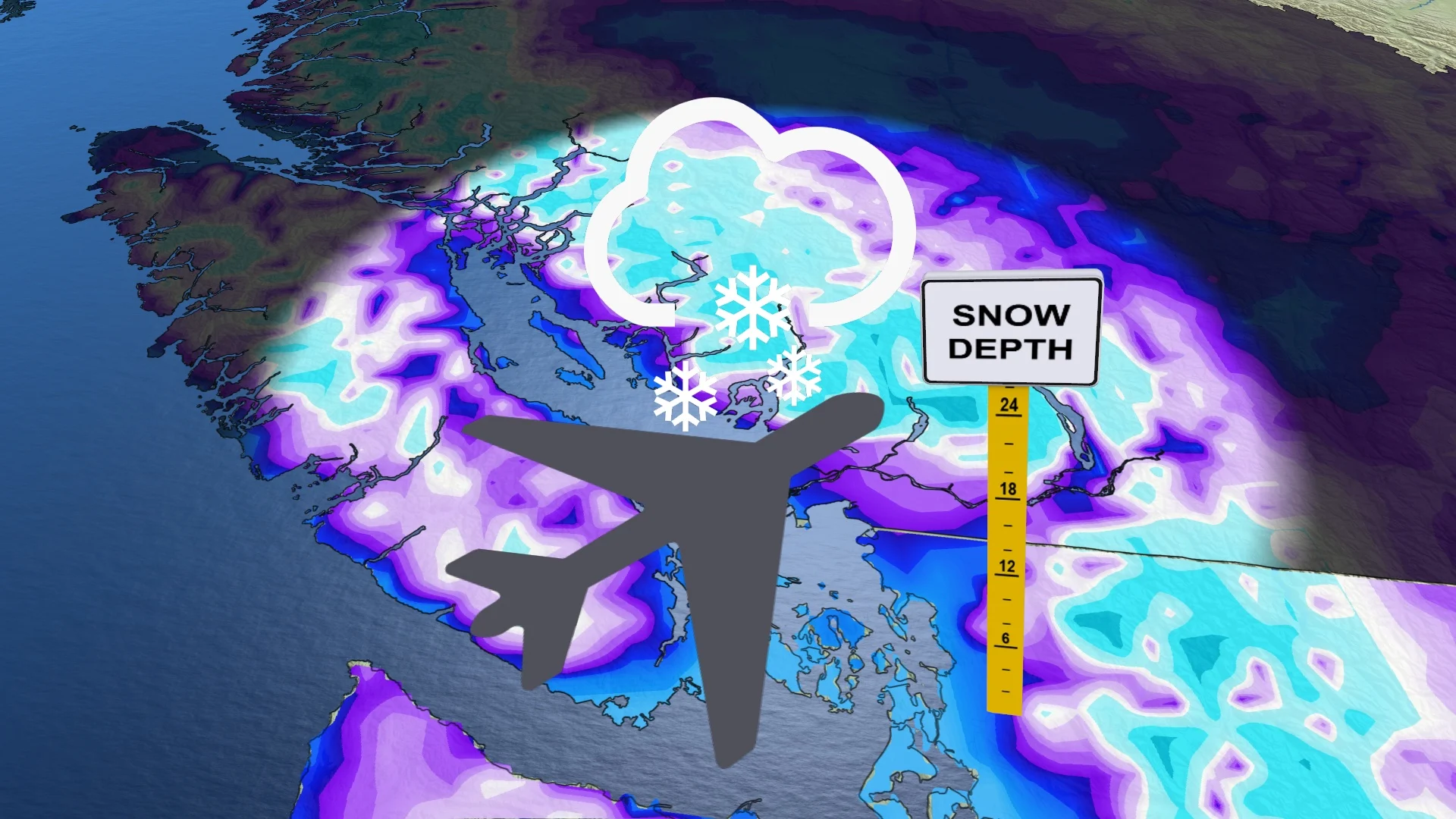
An influx of cold air from the Arctic will finally bring B.C. some precipitation as the dry streak comes to a close, but it also means the chance of low-elevation snow on the weekend
As we near the end of January and await February's arrival this weekend, B.C. is finally going to see a bit of a changeover as the prolonged dry streak will come to an end as a pattern flip unfolds across the South Coast.
The multi-week, precipitation-free streak Vancouver and other areas experienced is all but over soon, with rain, below-normal temperatures and even some snow showing up for many locales.
DON’T MISS: Will this chill end a snowless winter across B.C.’s South Coast?
In fact, some lower-elevation communities along B.C.'s South Coast could see mixing or some snow by Sunday as the cooler air makes it down the coast.
Thursday through the weekend: Dry January leads to wet February start
Vancouver has not seen a trace of precipitation since the middle of the month -- 13 days and counting as of Jan. 29. This is particularly unusual because January is typically one of the rainiest months for the region, climatologically speaking.

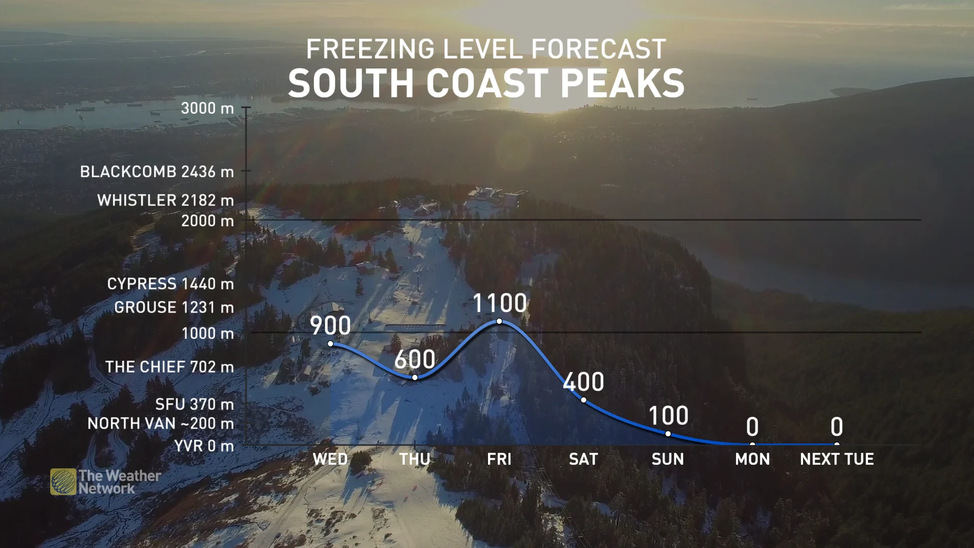
Rain will make a welcome return to the South Coast on Thursday while snow appears in the alpine regions. However, lower-elevation communities could see some mixing Thursday overnight due to the temperature gradient.
MUST SEE: Global temperature records smashed despite recent cold snap

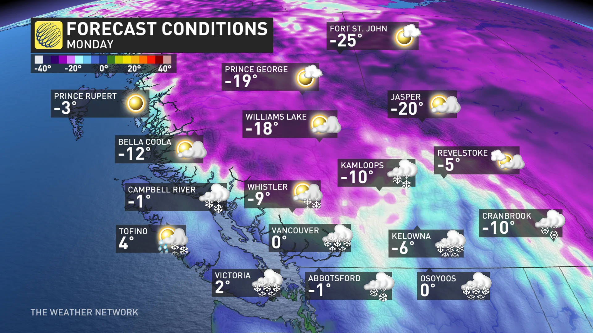
Cold air will leave the Arctic and infiltrate Western Canada, bringing below-seasonal temperatures across B.C. for this weekend and beyond.
Over the weekend, temperatures will take a bit of a nosedive with below-freezing values extending all the way to the coast.
This forthcoming temperature flip will be the coldest air of the season for most of the province, including Vancouver, Victoria and much of the South Coast.
Vancouver’s coldest daytime high this season has been a 4.3 C reading in December, a number that could be beat on Sunday and for several days afterwards.
As a result of the cold air, there is the chance for some sea-level snow as early as Sunday.
The interior of B.C. has seem some chilly days lately but the forthcoming cold air mass will also bring negative double-digit temperatures overnight and daytime highs around -5 C and -6 C.
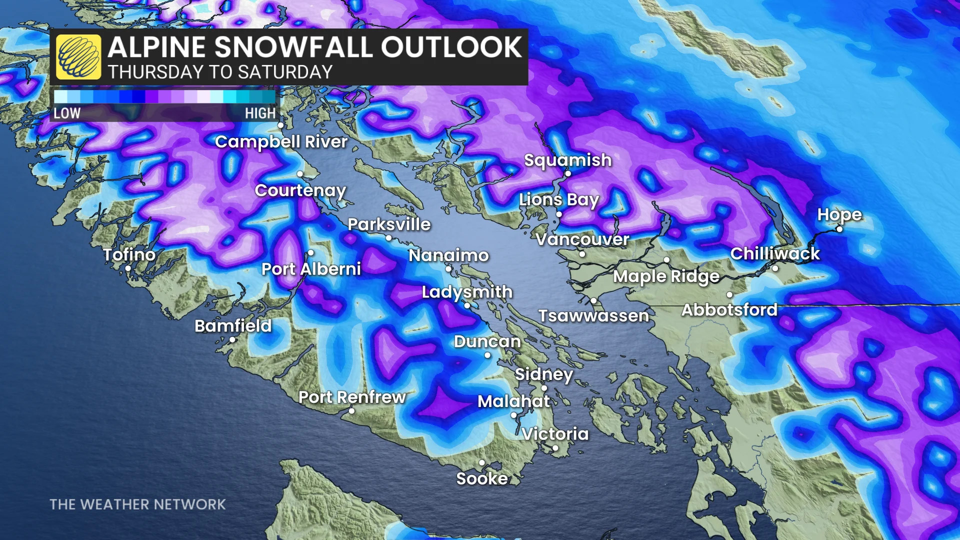
The pattern will be good news for the province's ski resorts. It will help replenish the ski hills with some fresh, new snow and finally bring winter to coastal sections, which have been missing it so far this season.
The culprit for this snow is a weak low-pressure system that will hover around the coast and sink south from Haida Gwaii on Saturday, and down to southwest of Vancouver Island by Tuesday. That will lead to a difficult forecast on the exact timing and location of the snow, and will be more off and on.
Stay with The Weather Network for all the latest on your forecast across British Columbia.