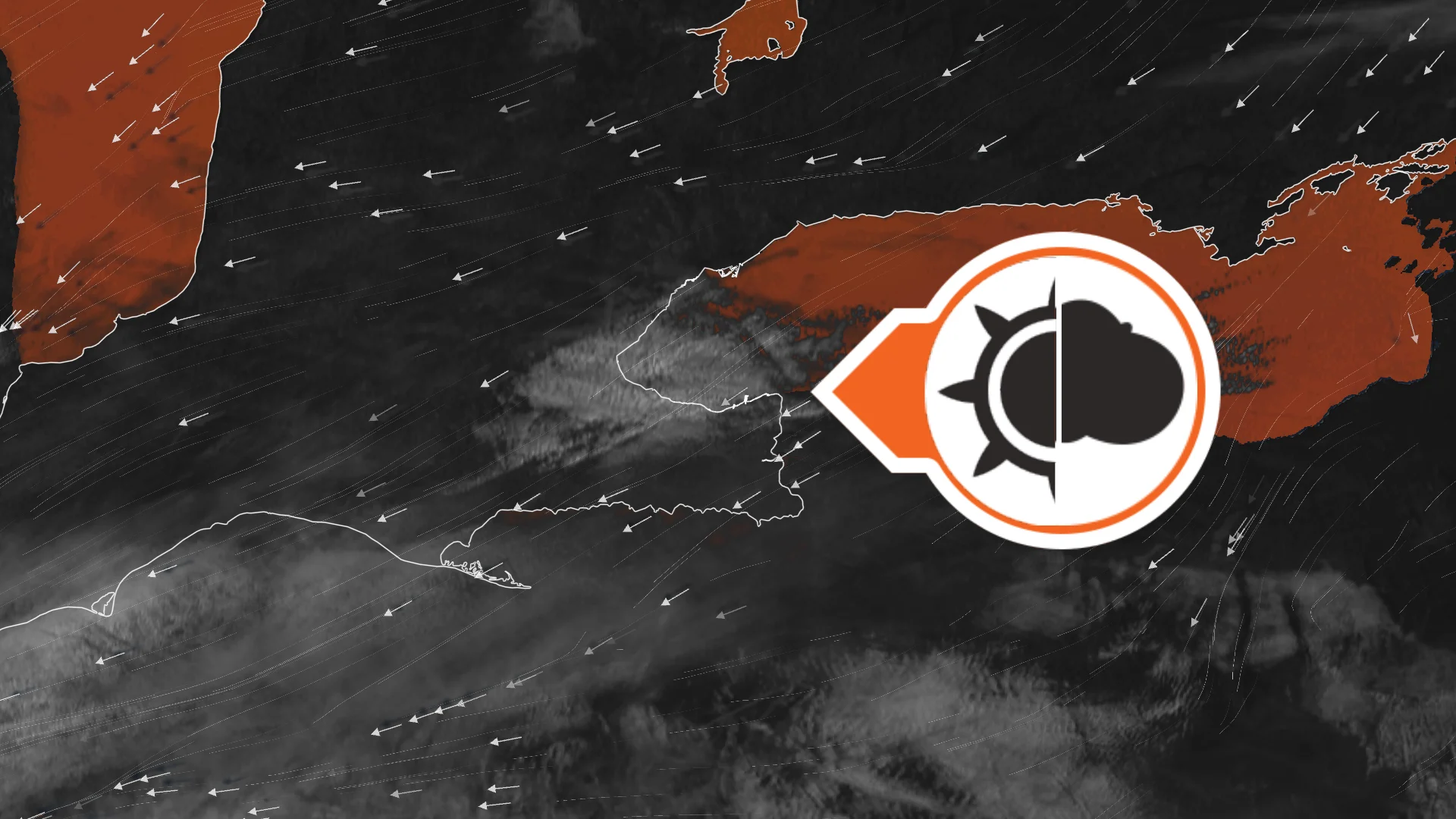
Sharp GTA weather divide precedes temperature matchup with Churchill

After a contrasting weather setup across the Greater Toronto Area (GTA) on Tuesday, parts of the region could be cooler than Churchill, Man., on Wednesday.
Even though fall is here, not every part of Canada is seeing the same, seasonal weather this week.
Some areas could see snow, while at least one northern location on the Prairies could end up seeing a warmer temperature than multiple Southern Canadian communities on Wednesday.
DON'T MISS: Three reasons why you could see an early-fall snow in Canada
Such may be the case in Churchill, Man., which is forecast to see a daytime high of 18°C-- the same value that is projected in Toronto, Ont. It's possible that Churchill or Toronto ends up warmer than the other locale.
That will come after a contrasting weather divide in the Greater Toronto Area (GTA) on Tuesday to kick off the fall.
Wednesday remains cool in southern Ontario after a contrasting Tuesday
On the Priaries, there is a seperate high pressure and ridge that's bringing in sun and a warm, southerly wind, allowing for above-normal temperatures in northern areas of the region, including Churchill.
Meanwhile, in southern Ontario, temperatures aren't quite as rosy.
On Tuesday, the western GTA to Hamilton were stuck under persistent, cloudy skies and chilly temperatures while locales east and in the northern GTA saw brighter, sunny skies to usher in the first day of fall.
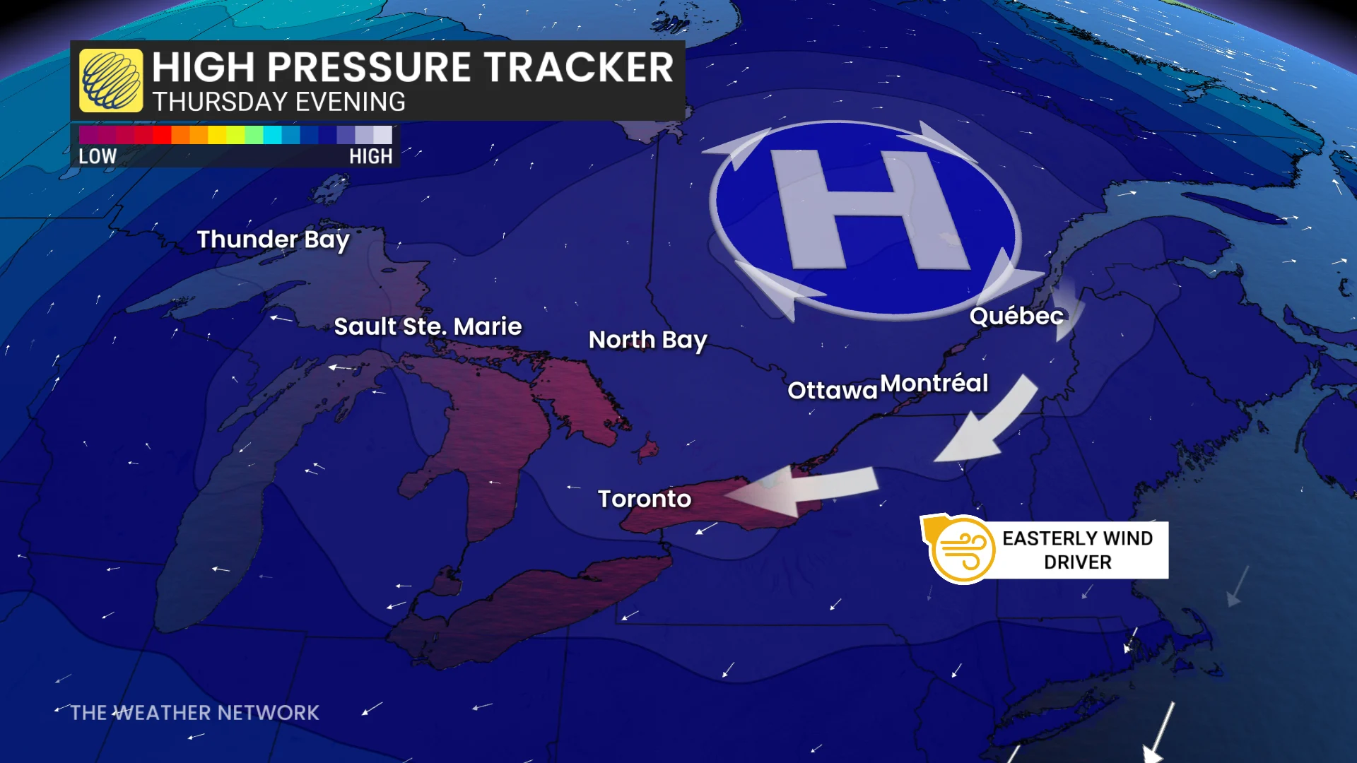
Why? A strong, potentially record-breaking high over Quebec is causing sinking air and cloud-free skies over much Ontario, but a select few are notably missing out.
In addition to that, the high is also driving a clockwise wind direction. For the GTA, that meant an easterly wind on Tuesday.
This time of year, Lake Ontario can be slightly warmer than the air mass above, creating a temperature contrast. The difference causes rising air over the lake that condenses and forms clouds.
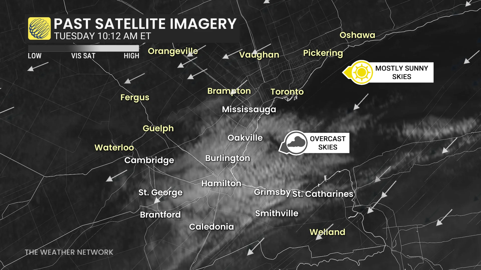
The easterly wind then pushes the cloud deck onto the shores, driven towards Hamilton, Burlington and Oakville, Ont.
Hamilton and Burlington saw windier conditions and were a degree or two cooler than downtown and Pearson airport as a result.
As that temperature contrast grows into the heart of fall, the result will kick-start the lake-effect precipitation that we typically see during the season.
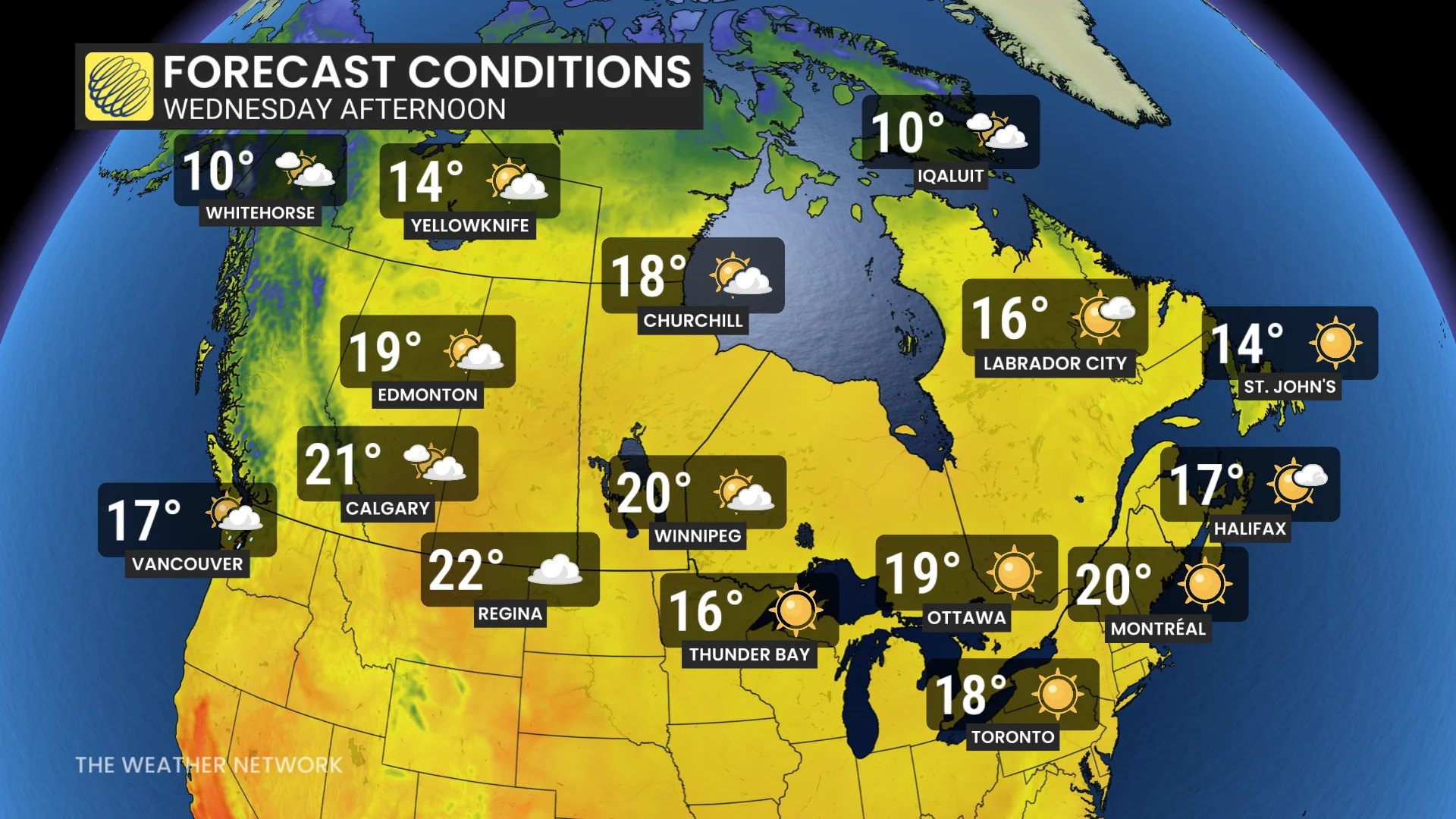
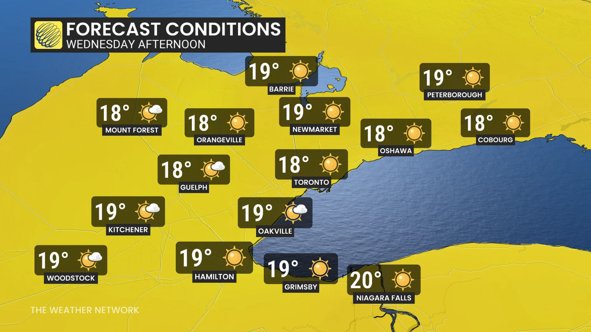
As for Wednesday, similar conditions are expected for southern Ontario, parts of which could see a cooler temperature than in northern Manitoba.
Wednesday is calling for a high of 18°C in Toronto, the same projected high as the remote Manitoba community of Churchill-- nearly 2,000 kilometres farther north than Toronto.
A high of 19°C is forecast for Hamilton, but that could drop a degree if the cloud deck comes back.
On Thursday, the easterly wind remains in place but will slowly show signs of weakening as Friday begins to see a shift with the high moving north.
By the weekend, sunnier skies and return of 20-degree weather are expected for the GTA.
Stay tuned to The Weather Network for the latest forecast updates for southern Ontario.