Parts of Newfoundland face their biggest snowfall of the winter so far
While the exact track is up in the air, Newfoundland could see a hefty dose of snow at the end of the week, with St. John's potentially in the crosshairs of seeing its heaviest amount so far this season
After St. John’s, N.L., airport saw its driest December on record with 55 mm of precipitation, and 42 cm of snow, Newfoundland will be in the crosshairs for some active weather later this week.
St. John’s hasn’t seen a snowfall event with 15 cm of accumulation or higher, yet, this winter, but that could soon change.
SEE ALSO: Where did December go? Canada's winter wonderland turned upside down

On Thursday, a system will pass by the Avalon Peninsula with precipitation just skimming by the island, but consistency amongst the models is leading to a lower confidence forecast.
There is the chance for a more westward track that could bring some heavier snow inland on the Avalon, with some heavier rain along the coast.

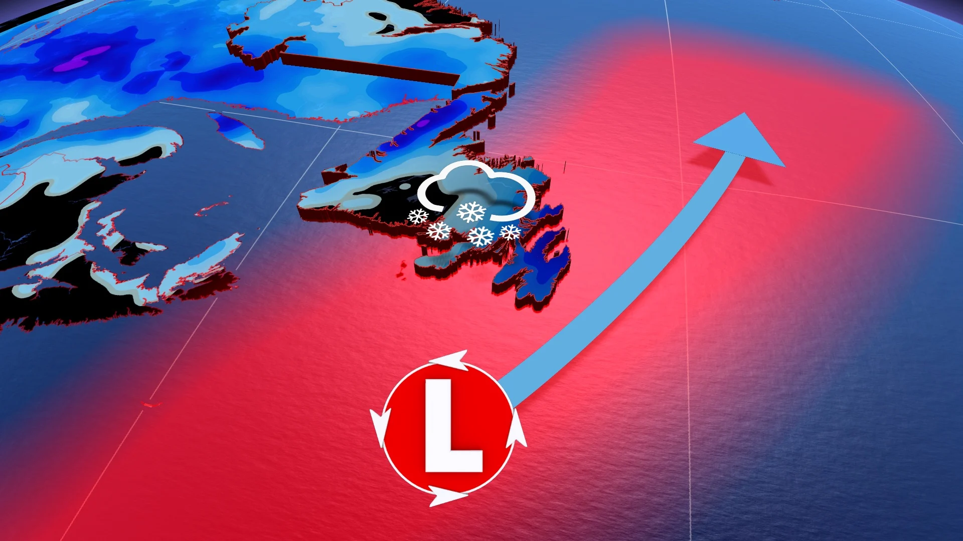
Friday to Saturday morning
Another system is forecast to track east of the Avalon on Friday, but this time, the precipitation will be more widespread and heavier.

The exact track of the system is still uncertain, which can change the forecast. However, compared to the system on Thursday, there is more agreement that a bigger snowfall is possible on Friday, potentially bringing St. John’s its first 15+ cm snowfall of the season.
Snow can even reach into central Newfoundland, leaving accumulating snow in its path. A track farther offshore could lead to lower snowfall amounts and a track closer to shore could lead to heavier amounts for central Newfoundland, and some mixing for the Avalon.

The current forecast is for cooler temperatures to remain over Newfoundland, leading to an all-snowfall event.
Stay with The Weather Network for the latest on your forecast across Newfoundland.