Pacific jet versus the polar vortex: Who wins November?

Will the Pacific jet stream or the polar vortex dominate November's weather? A 'blowtorch pattern' sets up, but for how long? We look at the deciding factors.
Two well-known, atmospheric heavyweights are shaping the forecast ahead--with one having a massive head start.
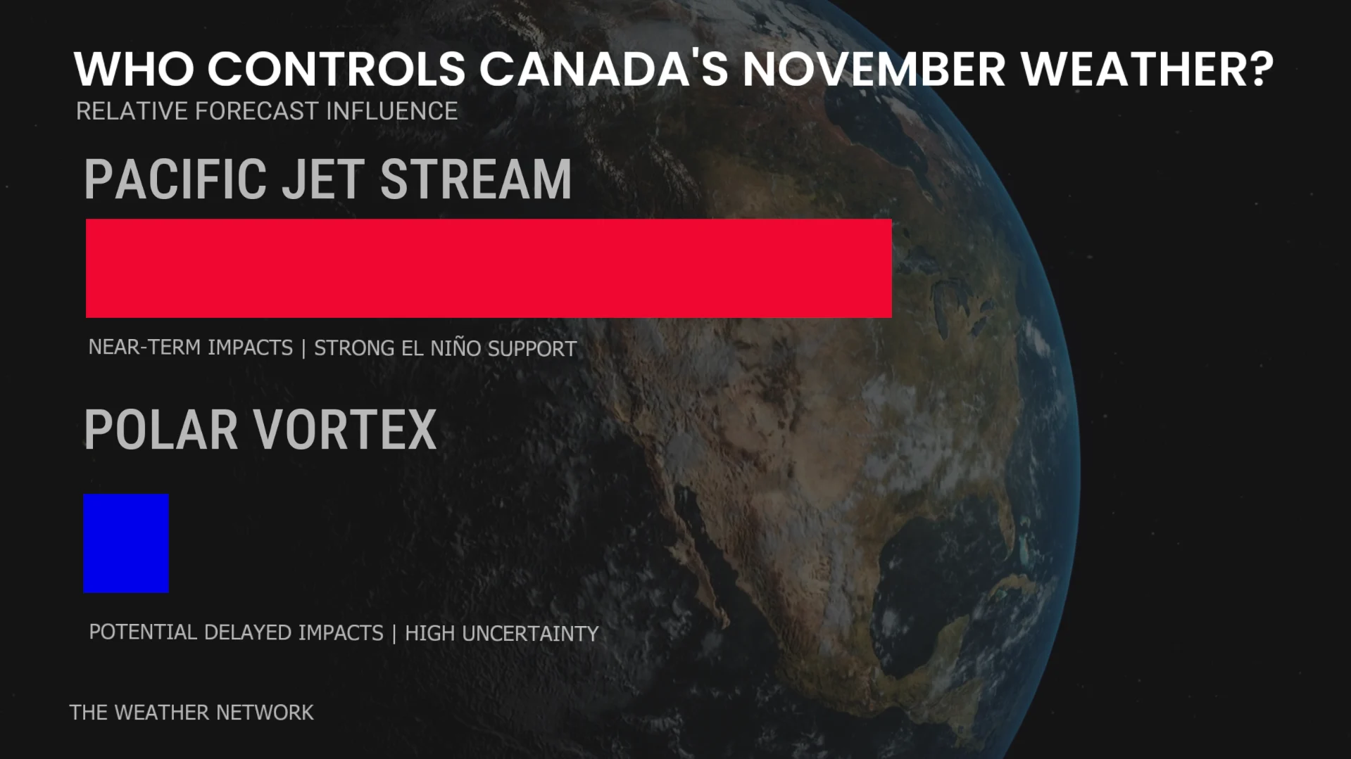
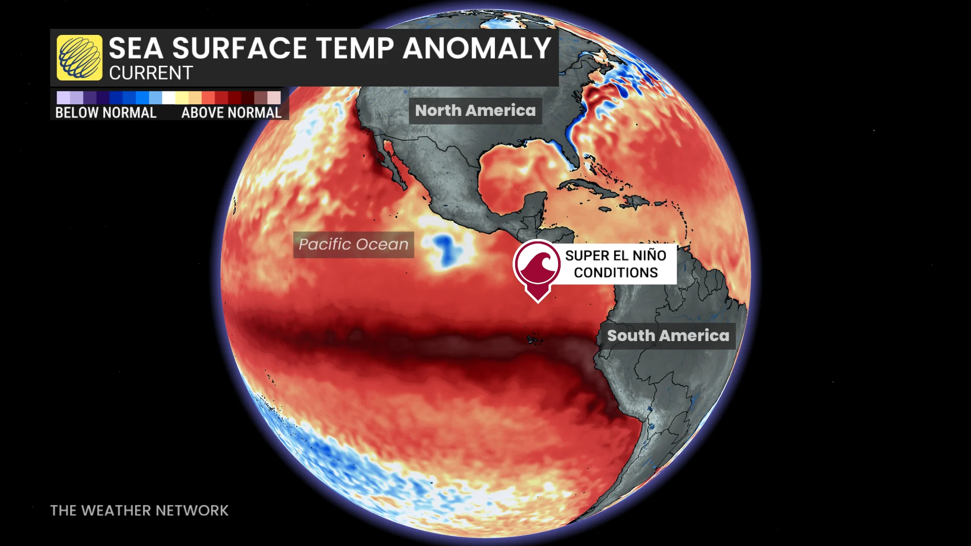
On one side of the weather ring, we have a powerful Pacific jet stream, influenced by a powerful El Niño, which will usher in the return of mild Pacific air across much of Canada.
On the other side, an unprecedented disruption is unfolding high above the Arctic, where the polar vortex is disintegrating at a time when it should be strengthening.
Strange weather times ahead.
But, which feature has the upper hand? Timing is everything.
Coming out of hibernation: The Pacific jet stream
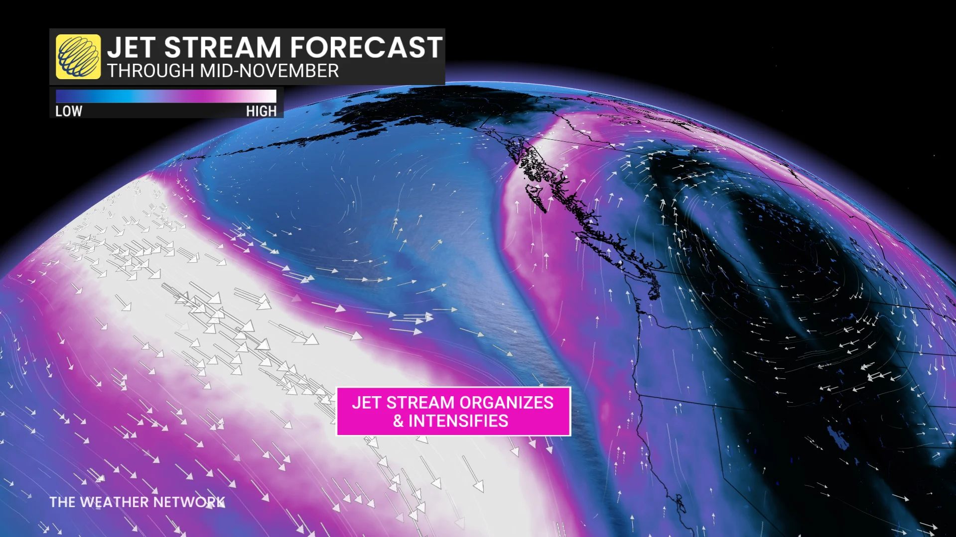
For much of September and October, the jet stream over the North Pacific struggled to organize into a consolidated flow. Instead of a classic river of fast-moving air sweeping across the ocean, this fall has featured large bends, split flow, and blocking patterns.
Change is coming.
As the Northern Hemisphere moves closer to winter; increasing temperature contrasts help strengthen the jet stream and encourage the transition into a more powerful, wintertime flow.
This season, El Niño is helping shape that transition. Historically, strong El Niños have favoured an eastward extension and southward shift of the Pacific jet stream, often bringing milder conditions across Canada.
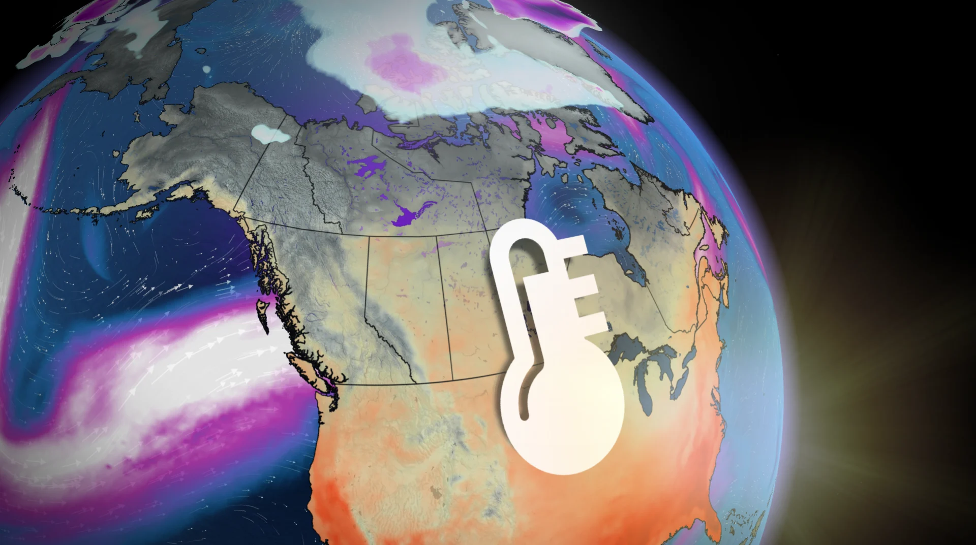
With this powerful Pacific jet expected, November could feature a remarkable stretch of warmth, with a "blowtorch" pattern taking shape across the continent:
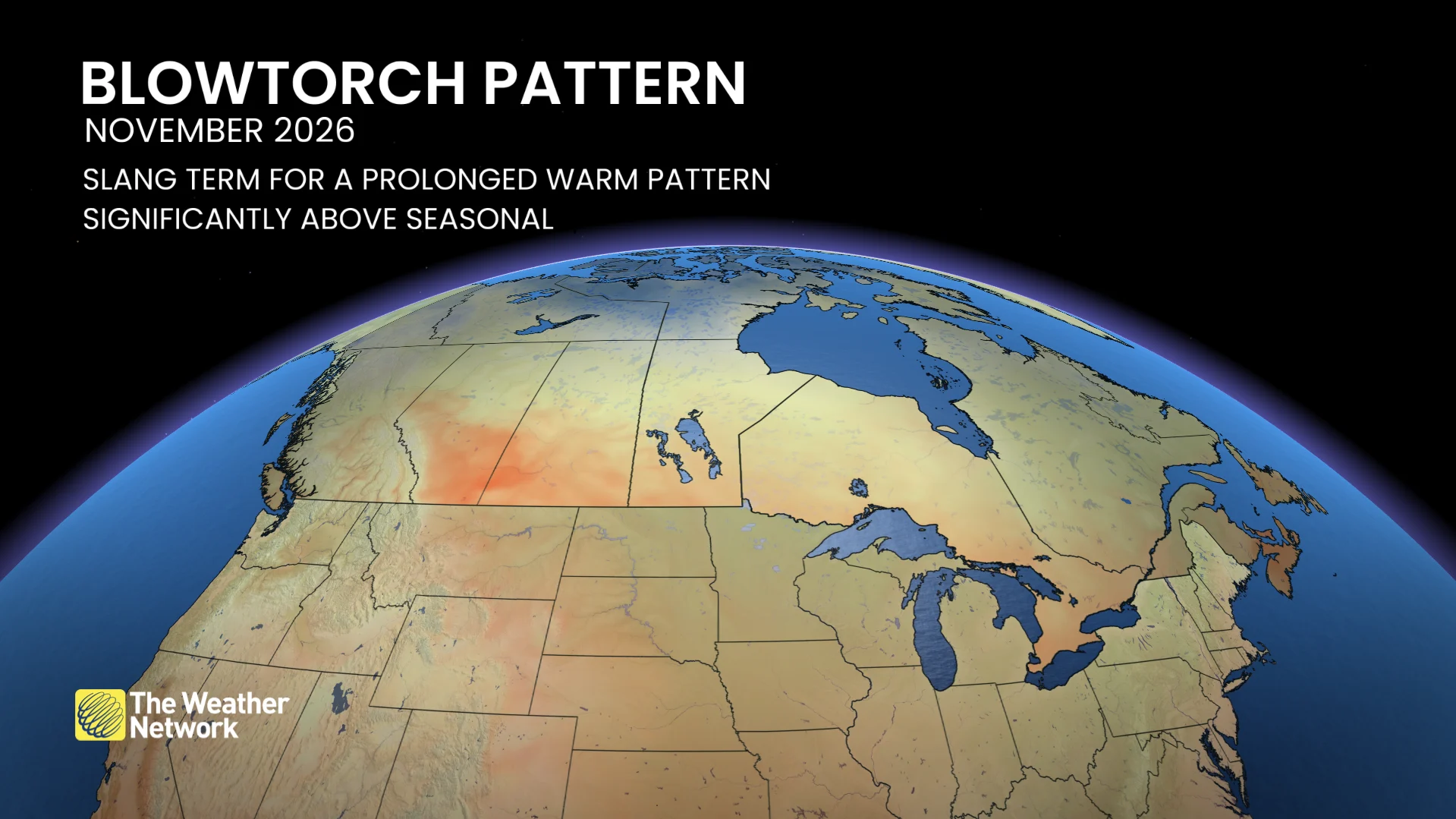
The question will be if it’s able to dominate the entire month.
The polar vortex: A wrench in the long-range forecast
If you’ve been following along, you know about the other major weather player entering the picture, spinning roughly 30 kilometres above the Arctic.
The stratospheric polar vortex is experiencing a profound weakening, with forecast models highlighting a brief reversal of the powerful, westerly winds during the next week.
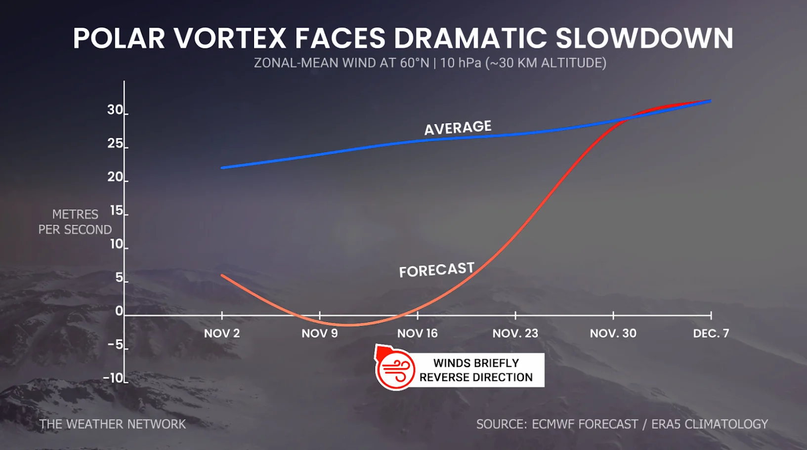
This is the opposite of what typically happens in autumn, when the polar vortex rapidly strengthens before reaching peak intensity in the winter.
So, what?
Disruptions to the polar vortex will influence the jet stream and the weather at the surface, which can increase the likelihood of atmospheric blocking and give Arctic air a path farther south.
By the final week of November into December, any resulting Arctic air outbreaks could favour Asia, western North America, or eastern North America.
This leaves considerable uncertainty about whether Canada would face the brunt of the cold.
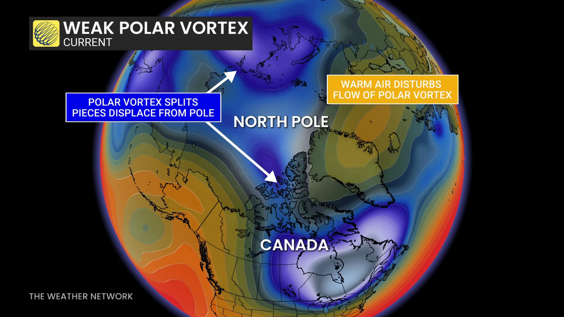
But, this connection can be messy and often finicky, with a baked-in time delay. It typically takes several weeks for the disruption high in the stratosphere to influence cold air outbreaks in our backyard, and sometimes there’s little meaningful impact at all.
With no precedent for such an early polar vortex weakening, considerable uncertainty surrounds how the atmosphere will respond. A powerful super El Niño will likely mute some impacts and duration of cold air outbreaks.
So, who wins November?
The jet stream and its mild signal, by a long shot.
For much of November, the strengthening Pacific jet stream is expected to favour mild air across large portions of Canada, consistent with our November outlook.
But, we shouldn’t dismiss the polar vortex disruption, just because its impacts aren’t immediately apparent.
We can’t forecast the precise impacts of wild cards like the weakening polar vortex or recurving typhoons several weeks in advance.
That leaves the final days of November, and the first half of December as the real wild card.