Ontario's wild ride: From wet to windy, and back to wintry. Brace for impacts
Rapid warming and rainfall in southern Ontario are contributing to snowmelt, increasing water levels in rivers and streams. High winds are expected to pick up on Friday, as temperatures drop sharply throughout the day
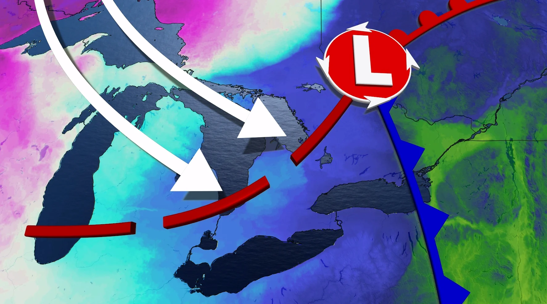
Ontario will face a mix of impactful weather over the next 12 hours, including rain, strong winds, a sharp temperature drop, and bursts of snow.
High winds may cause localized power outages, with gusts reaching 60-80+ km/h and over 90 km/h near shorelines.
SEE ALSO: Powerful winter storm wallops 4 provinces, leading to major travel disruptions
High water levels along shorelines and rivers bring a risk of localized flooding, with flood statements currently in effect.
Rapidly falling temperatures will create slick and icy surfaces, adding to travel concerns. Stay alert to the changing and deteriorating conditions, and monitor the latest weather warnings in your area.
Risk of outages and poor travel as winds and snow pick up on Friday
Southern Ontario experienced rain through Thursday night, with temperatures in the mid to upper single digits. Rain continues across eastern Ontario, including Ottawa, Friday morning before transitioning to mixed precipitation and snow from west to east throughout the day.
Strong winds will intensify as a cold front sweeps through. Widespread gusts of 60-80+ km/h are expected, with shoreline gusts possibly exceeding 90 km/h in the afternoon and evening.

As rain transitions to snow, widespread snow bursts along with blowing and drifting snow could impact southern and central Ontario, especially snowbelt regions.
Communities with existing snow cover are particularly vulnerable.

Lake-enhanced snow squalls are forecast to develop with west-northwesterly winds later in the day, potentially bringing 5-15 cm of new snow by Saturday morning.
Temperatures will drop rapidly from mid-single digits early Friday to wind chills that feel like the minus teens by the evening.

Residents are urged to prepare for hazardous travel conditions, icy surfaces, and potential disruptions due to high winds.
RELATED: Canada’s odds of a white Christmas may hinge on this single storm