Snowfall warnings issued as Ontarians prepare March break travels

A round of snow arriving on Friday may hamper March break travel plans across southern Ontario.
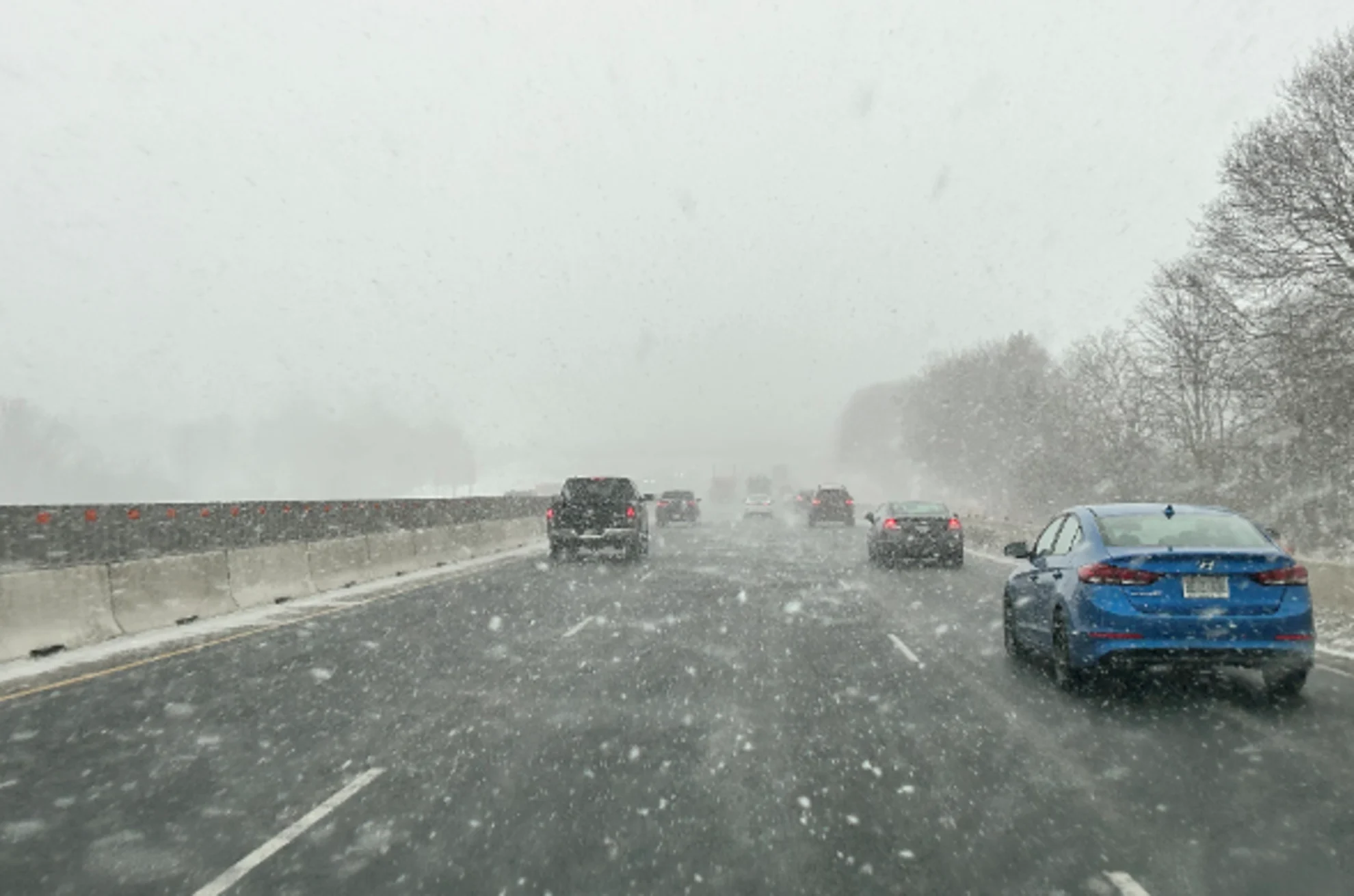
A snowy system pushing in for our Friday could make for tough commutes on either end of the workday, and it’ll cause some headaches for travellers heading south to begin their March break getaways.
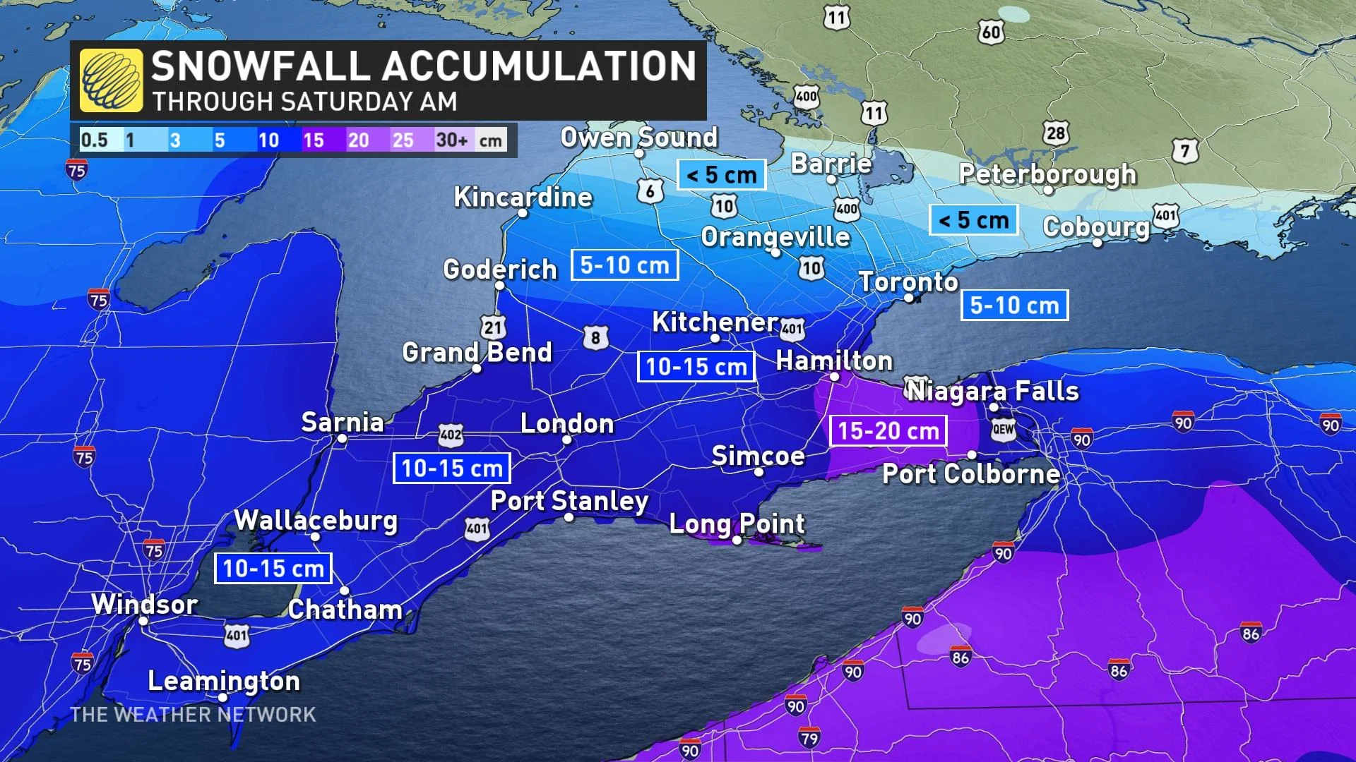
A snowfall warning is in effect for the City of Hamilton and the Niagara Peninsula, with widespread weather advisories up for the rest of the region, ahead of a system expected to drop a widespread swath of 10-15 cm of snow.
It’s certainly not the most snow, especially compared to recent storms, but it’s bound to affect travel given the number of folks getting an early start to March break vacations.
DON'T MISS: March came in like a lion, but can and will it go 'out like a lamb?'
A Colorado low sliding across the southern Great Lakes will leave southern Ontario in prime position for a thump of snow through the day Friday.
Snow will start from west to east through the wee morning hours on Friday, eventually pushing into the Greater Toronto Area (GTA) during the morning commute. We’ll see the snow continue through the evening commute before tapering off during the overnight hours.
The worst driving conditions across southwestern Ontario are likely during the morning and into the early afternoon, while the potential for very low visibilities will move toward Lake Ontario through the afternoon and early evening hours.
Easterly winds will enhance the snowfall on the western shores of Lake Ontario, where snowfall rates could reach 2-3 cm per hour by the evening commute. This enhancement could bump up accumulations for parts of the Golden Horseshoe, prompting a snowfall warning from Environment and Climate Change Canada (ECCC).
“The evening commute will be greatly affected by this snowfall,” ECCC said in its snowfall warning for the City of Hamilton and the Niagara Peninsula.
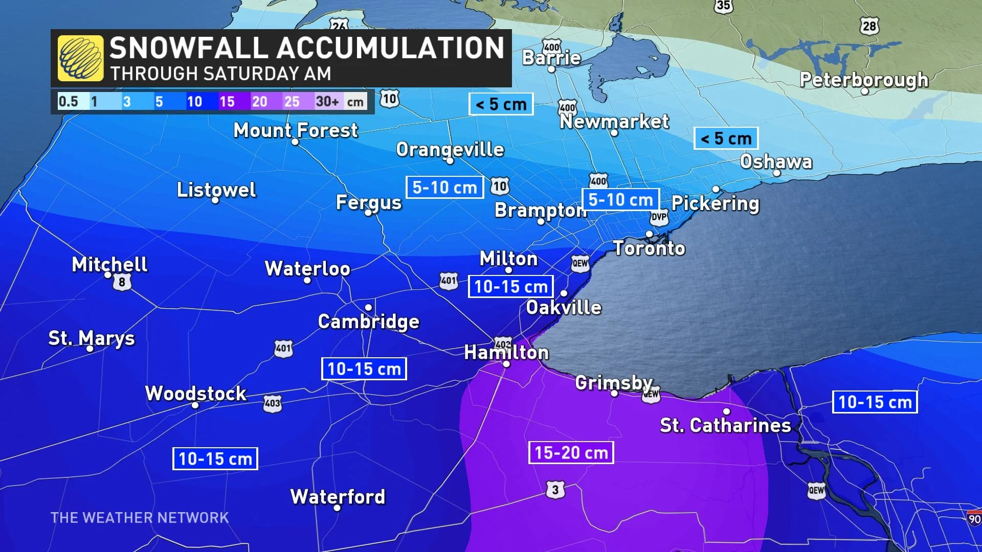
The heaviest snowfall should remain in southwestern Ontario this time around, with a general swath of 10-15 cm possible from Windsor to Hamilton and east toward the Niagara Peninsula. That lake enhancement could bump totals up to 15-20 cm along and south of the QEW between Hamilton and St. Catharines.
A sharp northern cutoff will result in a corresponding sharp cutoff in accumulations north of the GTA, with less than 5 cm of snow expected north of Orangeville and Oshawa. No snow is expected farther east in Ottawa and Montreal.
WATCH: Not an ideal journey for March break travellers
MUST SEE: Ontario hit by 3 blockbuster snowstorms since autumn. Will there be more?
Regardless of total amounts, this system will have some impact on those who will be driving south for the start of March break. Between 10-20 cm of snow is expected across western New York, northern Pennsylvania, and northern Ohio as well.
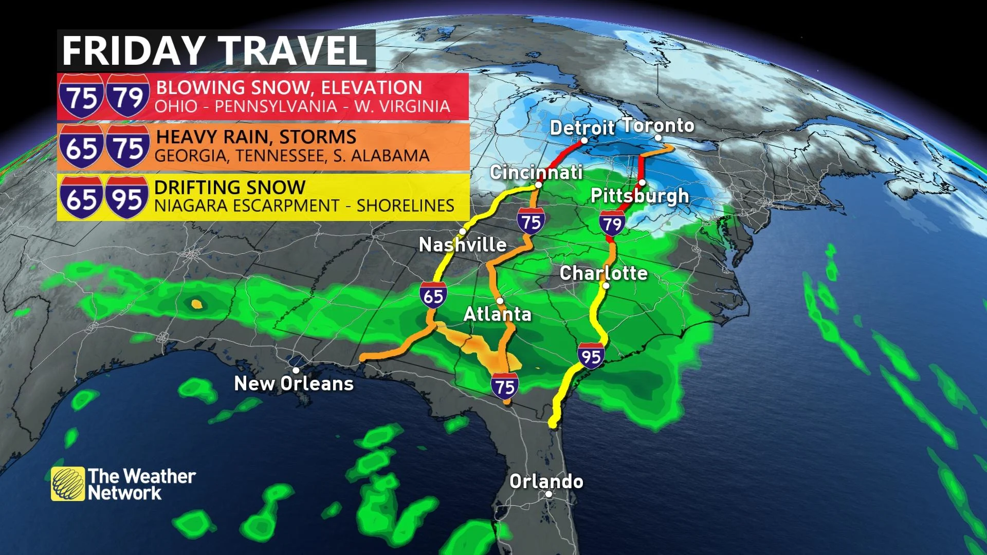
The snow departs through Friday evening, but light flurries will remain into Saturday morning. Another system is expected to track south of the region early next week, but it's too early to have confidence in whether this complex set-up will have a significant impact on the region. Temperatures will be colder than seasonal for March break.
__WATCH: Daylight Saving can be tough for kids, tips to help soften the change __
Be sure to check back for the latest weather updates across Ontario.