Ontario's longest dry stretch in months will come to an end this weekend
Dry spell in Ontario to end as rain and thunderstorms return this weekend
After an unusually dry start to meteorological summer, with more than a week of sunny skies across much of Ontario, a shift in the weather pattern is set to bring showers and thunderstorms by the weekend.
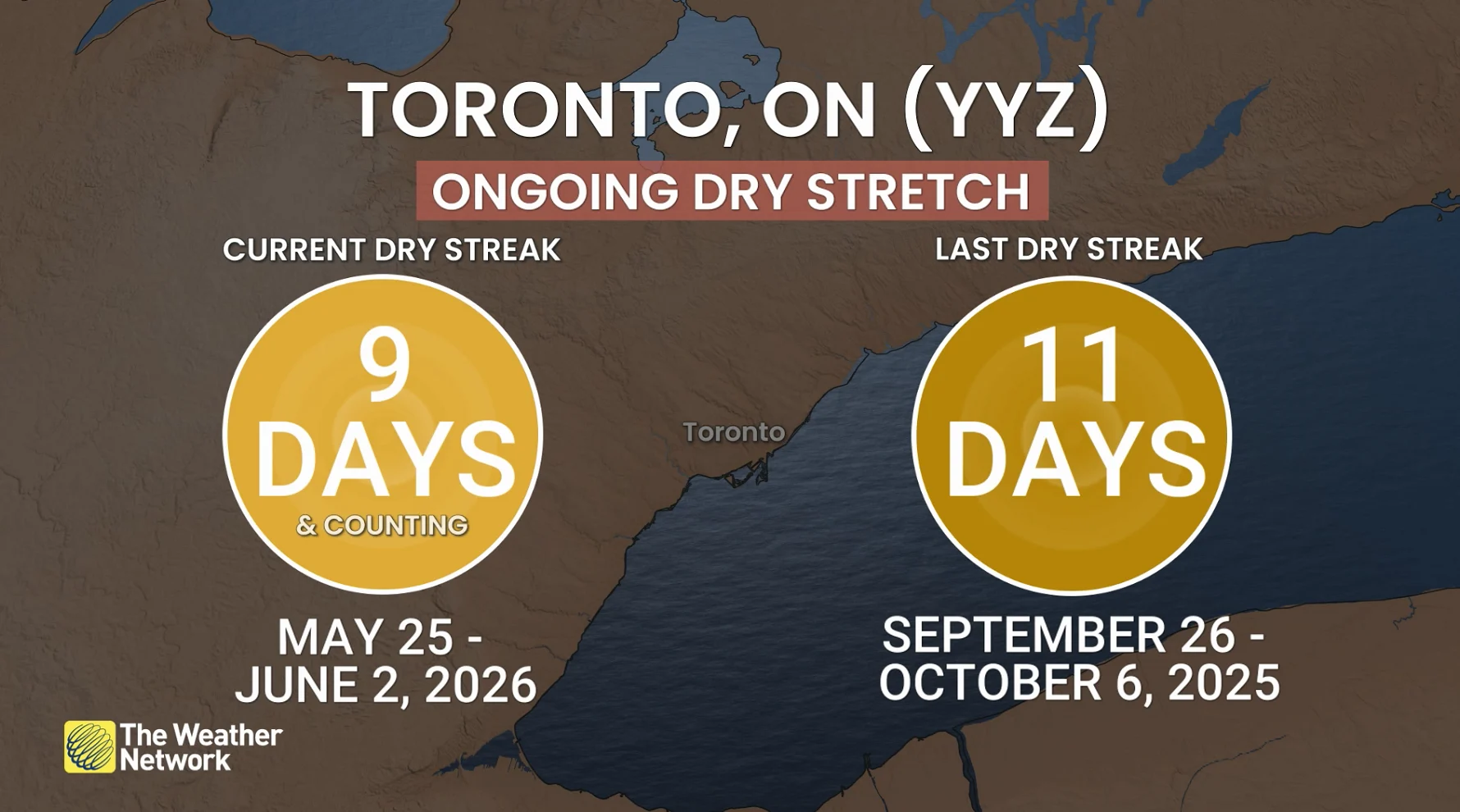
As of Wednesday evening, Toronto Pearson International Airport (YYZ) will have experienced 10 consecutive rain-free days, marking the longest dry spell since late September to early October 2026—nearly eight months ago!
DON'T MISS: Visit our complete guide to Summer 2026 for an in-depth look at the Summer Forecast, tips to plan for it and much more!
While Thursday will continue the streak with another day of sunshine, rain chances will start to creep into the forecast by Friday evening.
Weekend rain and storm outlook
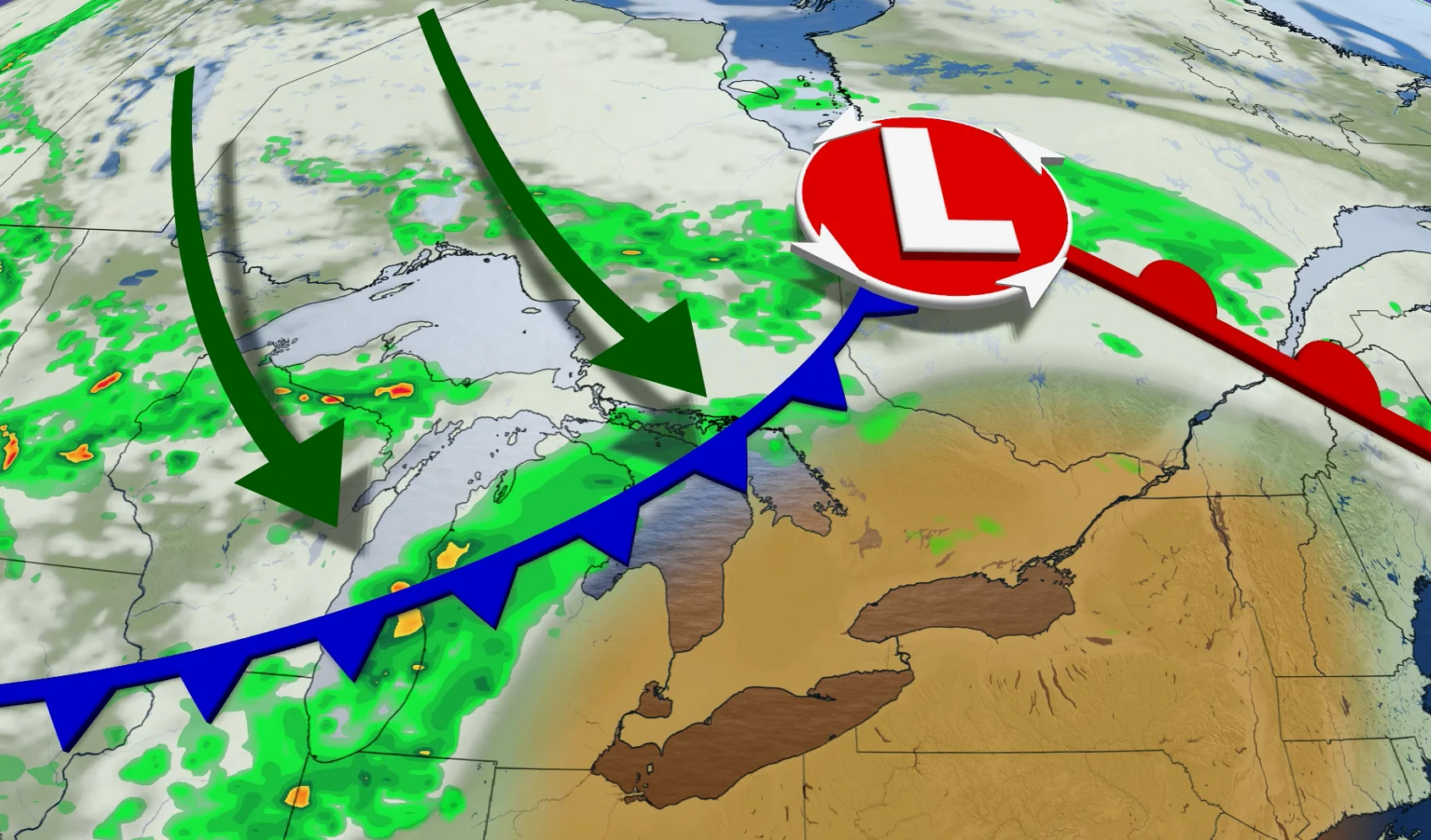
A system moving in from the northwest is expected to bring an active weather pattern to central and southern Ontario starting Friday night. Showers and thunderstorms are likely to develop and continue into Saturday.
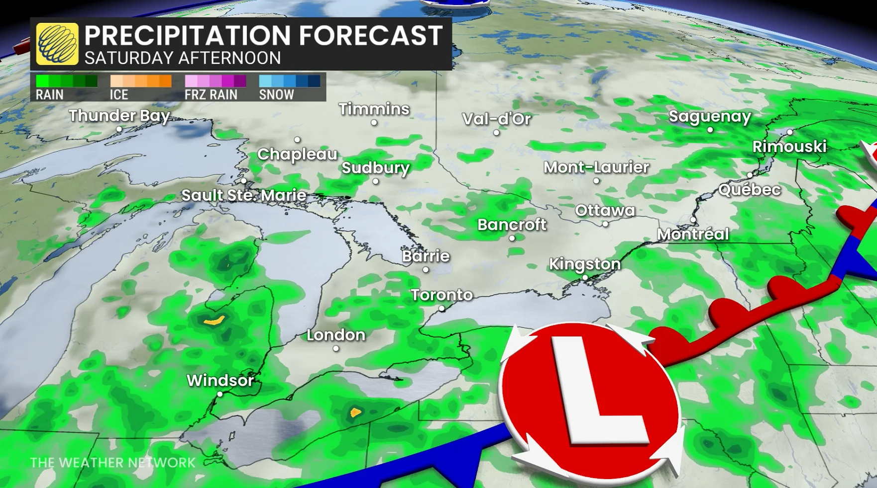
While some regions may see improving conditions on Sunday, isolated storms could persist in local areas.
SEE ALSO: The pros and cons of an El Niño summer across Canada
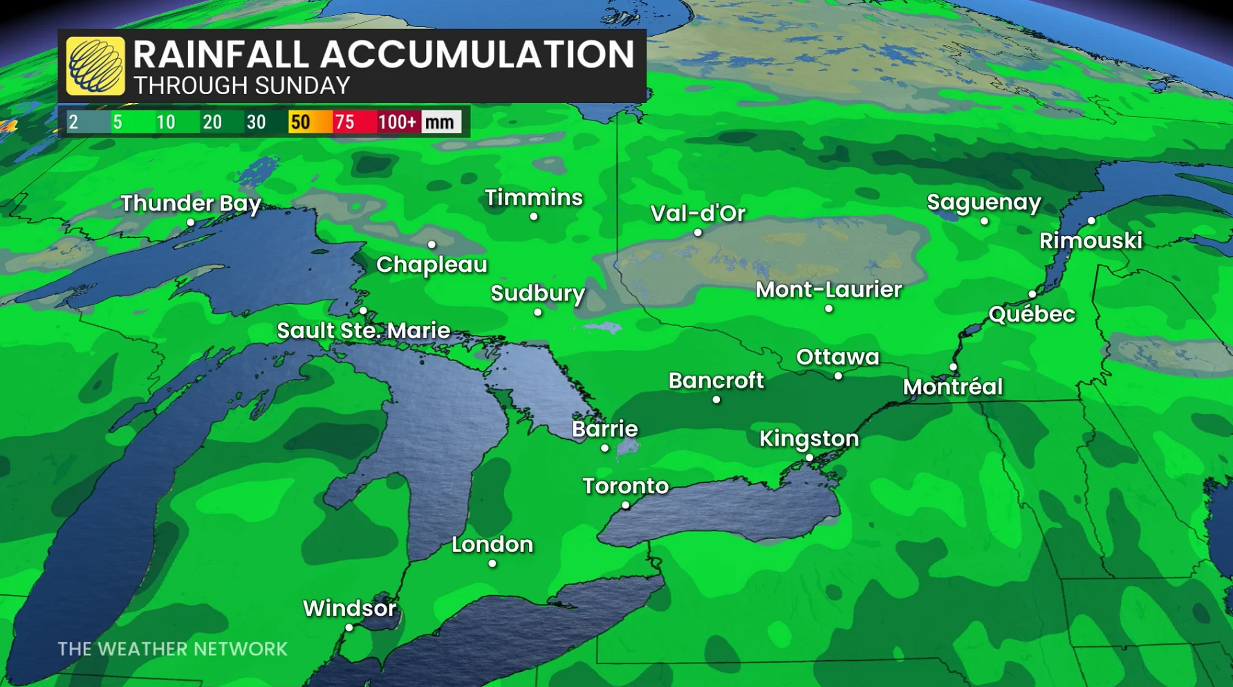
Forecast models suggest rainfall amounts between 10-20 mm across southern Ontario, with some areas potentially seeing higher localized totals.
Residents are advised to stay weather-aware heading into the weekend, and as conditions change.
Be sure to check back for the latest weather updates across Ontario.