Ontario will see a hot finish to May but a cool start to June

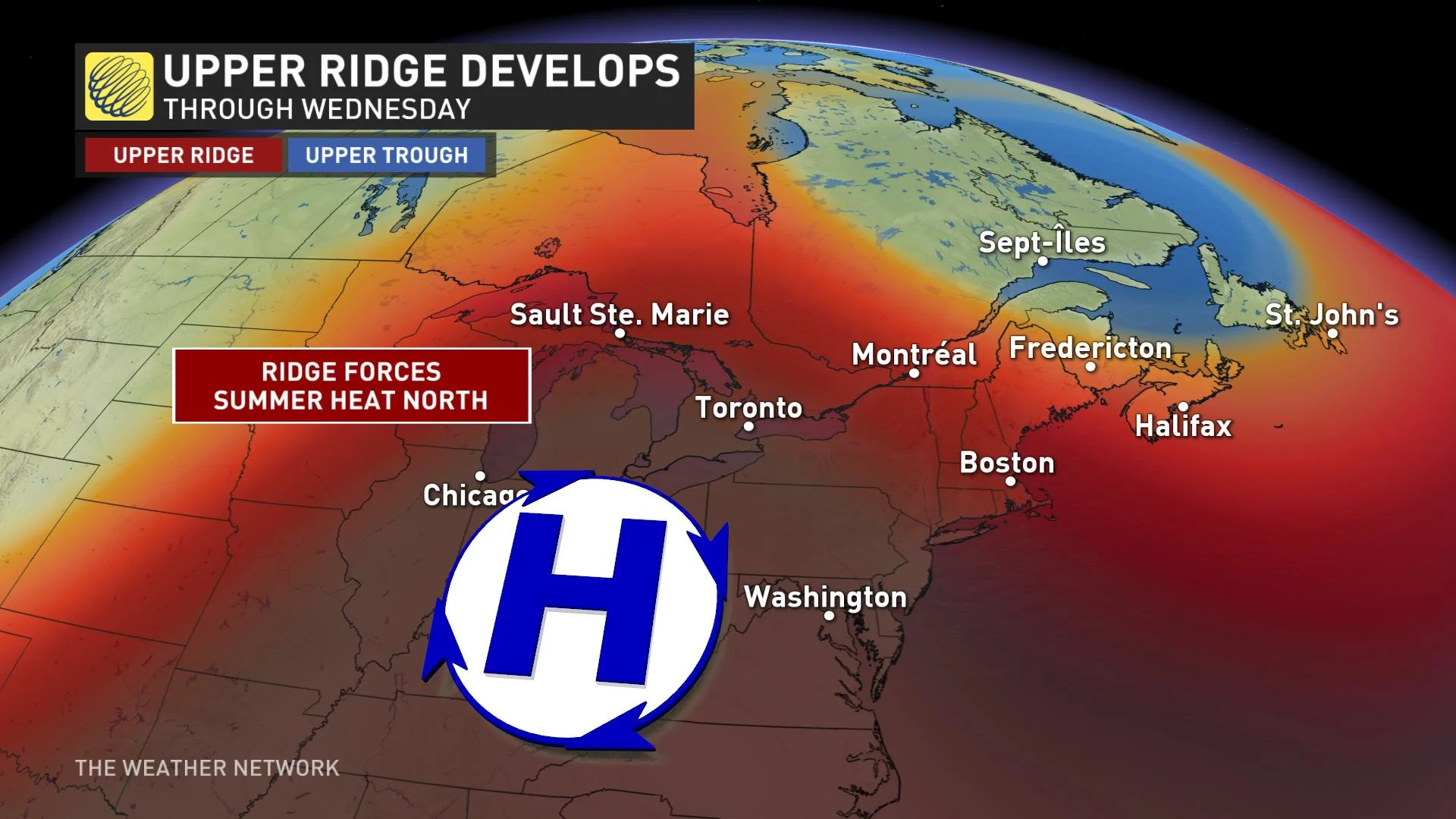
Ontario is in reaping the benefits of a well-placed ridge of high pressure for the next few days, allowing for summer-like heat to soar into the province, even reaching northern areas.
Those in Ontario will want to get out and enjoy the summer-like weather this week while they can because it won't last long. Monday and Tuesday will feature the return of heat and humidity, albeit for a quick appearance to end off May. Environment Canada has issued heat warnings for parts of southern Ontario. The hot temperatures are expected to cool by Wednesday due to a cold front cutting through the region, resulting in cooler temperatures to return for the first days of June. More on what to expect through mid-week and for the beginning of June, below.
Visit our Complete Guide to Summer 2022 for an in-depth look at the Summer Forecast, tips to plan for it and much more!
THIS WEEK: QUICK SHOT OF SUMMER-LIKE HEAT TO END THE MONTH, BUT JUNE STARTS OFF COOLER
A strong ridge of high pressure anchored over the U.S. Midwest will help usher in summer-like heat early this week from the Gulf Of Mexico. It will even reach into northern Ontario, however brief.
Hot and humid weather will reach southern Ontario Monday, with daytime highs hitting the upper 20s and low 30s, especially in the Greater Toronto Area (GTA) and the southwest.
Environment Canada has issued a heat warning for parts of southern Ontario including Windsor, Leamington and Chatham-Kent. Maximum temperatures in these specified areas may see both low to mid thirties Monday and Tuesday.
Humidex readings will be into the mid-to-upper 30s in the south, accompanied by plenty of sunshine and high UV rays, so be prepared with sun protection if going outside.
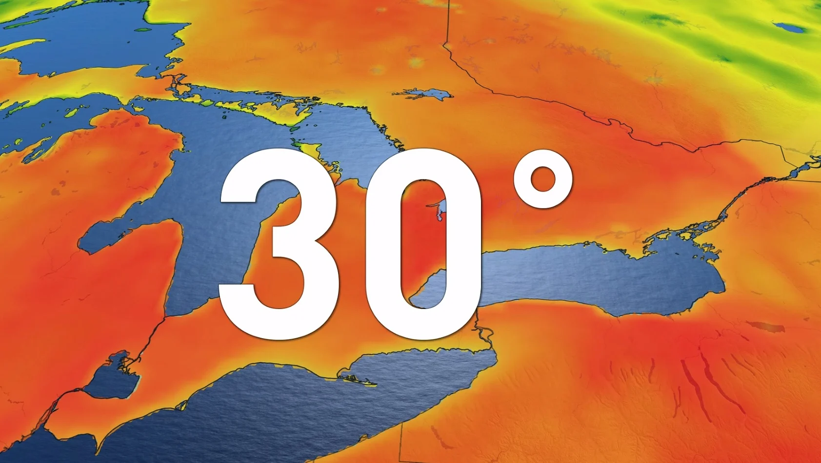
Tuesday will see the heat continue, spreading into northern sections with widespread 30°C temperatures, as well. Similar feels-like values can be expected, with even higher readings for some locales while they will also be felt in northern Ontario.
Although the heat will extend into northern areas Tuesday, extreme eastern sections along the Quebec border will feel the effects of a sharp temperature boundary as cooler air attemps to push back in but the ridge won't budge much.
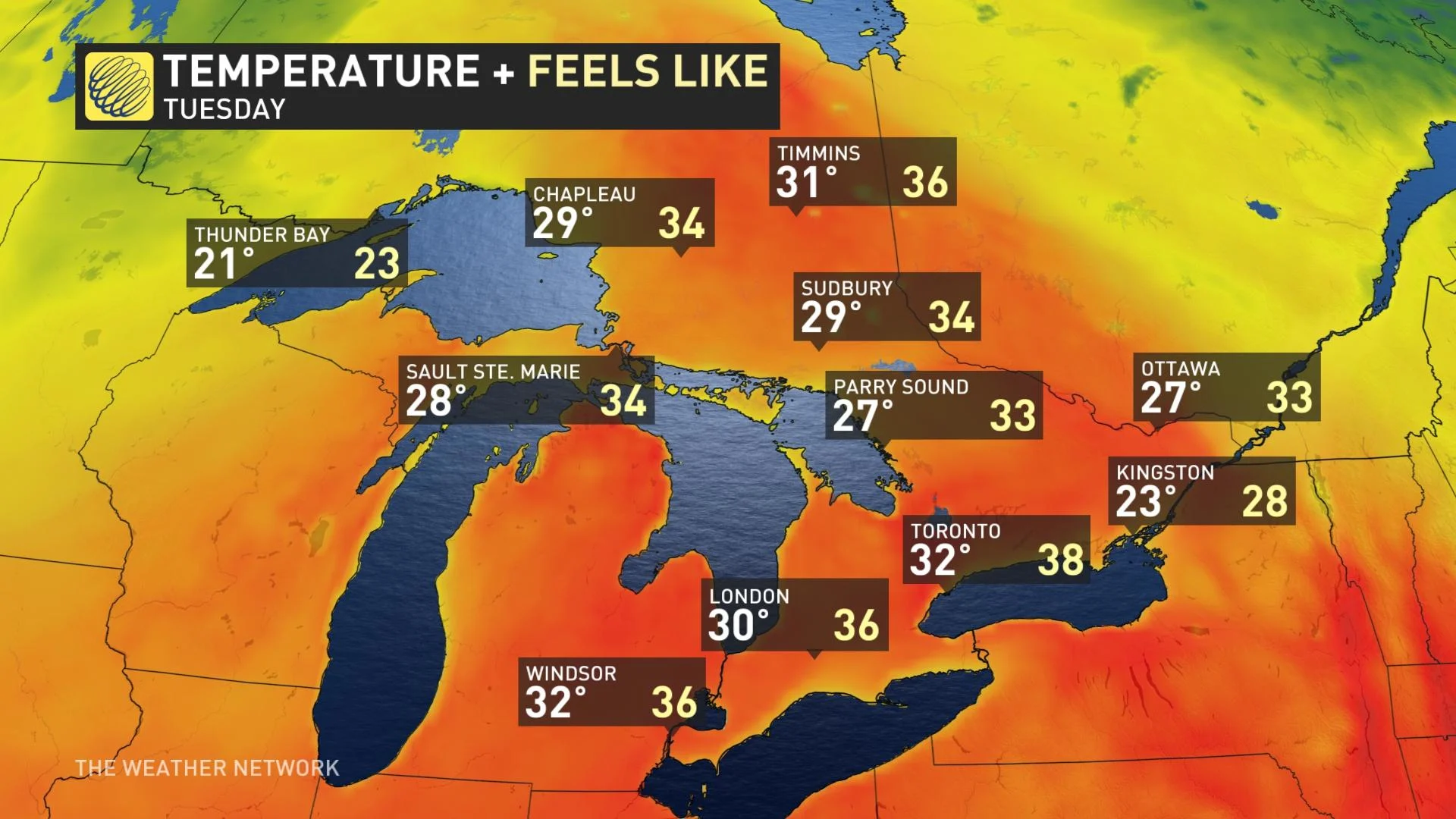
So, as a result, a considerable temperature contrast ranging from the low 20s to near 30°C are expected over a rather short distance -- with Ottawa still sitting in the upper 20s.
Savour the warmth while it lasts, though, because temperatures will moderate beyond Wednesday. Temperatures will still be warm Wednesday, but will drop back below the 30-degree mark and humidity will linger.
A cold front is expected to cross the region late Wednesday with a period of showers and thunderstorms, followed by cooler weather for the end of next week and continuing through the first weekend of June.
Don't forget to check out our Summer Forecast reveal on Tuesday, May 31!
WATCH BELOW: WHY SHOULD YOU NOT SEEK SHELTER UNDER AN OVERPASS DURING A SEVERE STORM
Stay tuned to The Weather Network for all the latest on conditions across Ontario.