Ontario faces high wildfire danger with dry spell, but there's rain coming

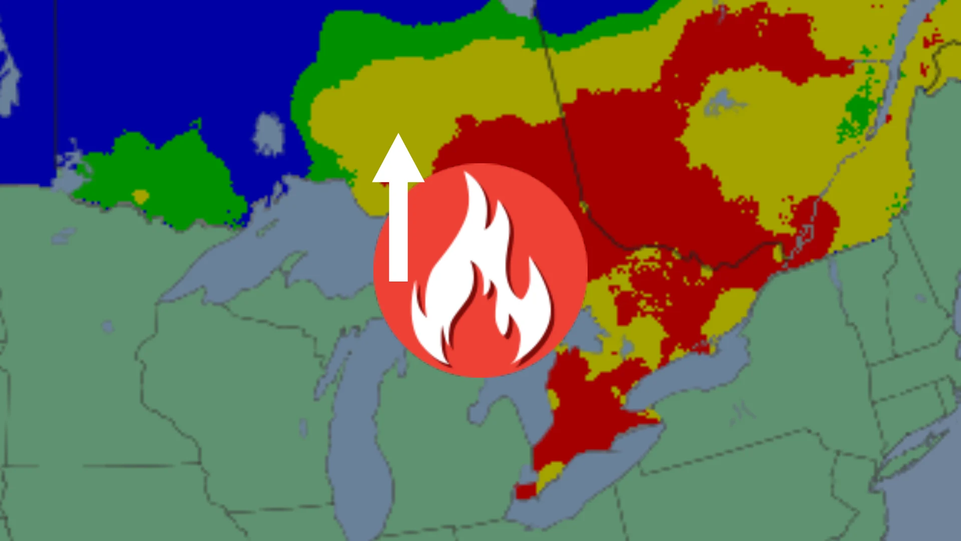
Ontario's wildfire danger has escalated to high and extreme ratings after nearly two weeks of sunshine and dry weather across parts of the province, but there is needed rainfall coming for the end of the week and into the weekend
Ontario's unusually long bout of dry conditions is elevating the wildfire danger for Thursday, but there will be relief coming this weekend that will lower the threat.
The total number of wildland fires inside Ontario’s fire region for the 2026 season so far is 131, as of June 3.
Several active and out of control wildfires are occurring in northern Ontario. The largest blazes are near Armstrong, with two fires adding to 5,200 hectares in size.

One wildfire of note south of Timmins, impacting Mattagami First Nation, currently more than 400 hectares in size.
On Thursday, June 4, the wildfire danger increases in Ontario and Quebec.
Northern, southern and eastern Ontario is still hot and dry, but some much-needed rain is on the way by the end of this week and weekend.

Showers will be spotty but 5-15 mm is possible in the northeastern section, with heavier amounts in the southern end from Friday to Saturday.
Northerly wind gusts will be near 40 km/h on Thursday and Friday, potentially aiding in wildfire development.
Thumbnail (file photo) courtesy of Ontario Forest Fires/X.