Lingering snowflakes after Saturday storm, unsettled start to the week ahead

Rain, freezing rain and snow all made for an eventful Saturday in Ontario, depending on location, but calmer days are ahead.
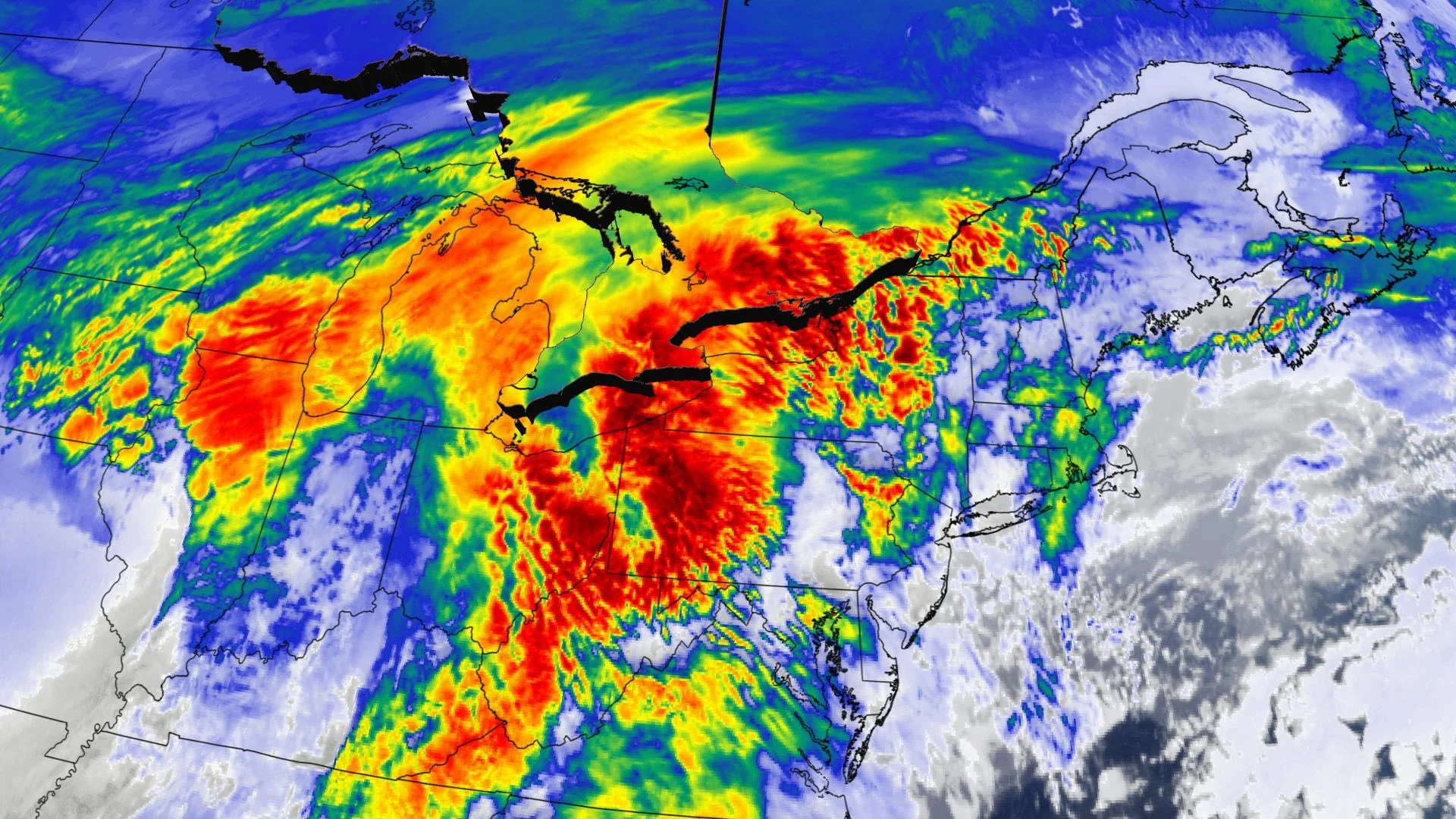
After a messy Saturday, the Texas low that brought, depending on location, heavy snow, heavy showers and periods of freezing rain, will have all but exited the province by Sunday morning, though some wayward flakes will remain here and there. Beyond, the first half of the week won't be as impactful, but will feature light or trace snow here and there, with a midweek dip in temperatures. A closer look, below.
WEATHER HIGHLIGHTS:
System snow ends by Sunday morning in eastern Ontario
Some chance of lake-effect snow near Georgian Bay, but light amounts expected
Potential for snow next week, general lack of cooler temperatures in the lead up to Christmas
Visit our Complete Guide to Winter 2021 for an in depth look at the Winter Forecast, Canada's ski season, and tips to plan for everything ahead!
SUNDAY: WINDY, LAKE-EFFECT FLURRIES
The system will have brought copious amounts of snow and rain to parts of the province, but by Sunday morning its last effects in eastern Ontario will amount to little more than lingering flurries or drizzle.
Ottawa, Cordwall and areas near the shores of Lake Ontario will be somewhat warmer than the southwest and communities on and inland of Lake Huron and Georgian Bay, where temperatures will still be around zero.

Winds will be a bit on the gusty side, in the 30-50 km/h range. That, combined with the cool temperatures and as-yet unfrozen lakes will make for some light lake-effect snow for the usual snowbelts, and possibly, but not likely, with a few wayward snowflakes in the northern GTA.
Blustery and more seasonal conditions are expected, as well, with daytime highs hovering close to where they should be for this time of the year. Wind gusts will be in the 30-50 km/h range.
BEYOND: NO EXTENDED PERIODS OF COLD AHEAD OF CHRISTMAS, STORMY WEATHER POTENTIAL
Beyond the weekend, near seasonal temperatures await southern Ontario Monday, along with snow showers, primarily north of the 401 corridor as a second cold front tracks across the region. Minor lake-effect snow continues into early Tuesday as the chilliest air of the season thus far arrives then.
By Wednesday, there will be a sharp temperature divide between east and west, with the former staring down daytime highs potentially as cold as the negative single digits.

Weatherwise, forecasters are watching the potential for a significant winter storm for the northeastern U.S., tracking well south of Ontario and Quebec during the middle of next week. Models at this time suggest this will bring heavy snow to parts of the U.S. northeast, with the potential for light snow for southern Ontario and Quebec.
"However, we will continue to closely watch this system, which could still track further to the north and have a more significant impact on southern Ontario and southern Quebec," says Weather Network meteorologist Dr. Doug Gillham.
The aforementioned midweek cooldown notwithstanding, milder weather is expected to push back into the region during the final days leading up to Christmas, with the potential for a system or two during that week, as well.

"Therefore, whether or not we see a white Christmas will likely come down to the wire and depend on the exact track of a system right before Christmas," says Gillham, adding that system could either bring rain or snow to the region.
Be sure to check back for the latest weather in your area.