Ontario: Potential record downpours, freezing rain inbound

All-time January records are in jeopardy for parts of Ontario this weekend as a mess of a storm threatens significant rain, ice and snow.
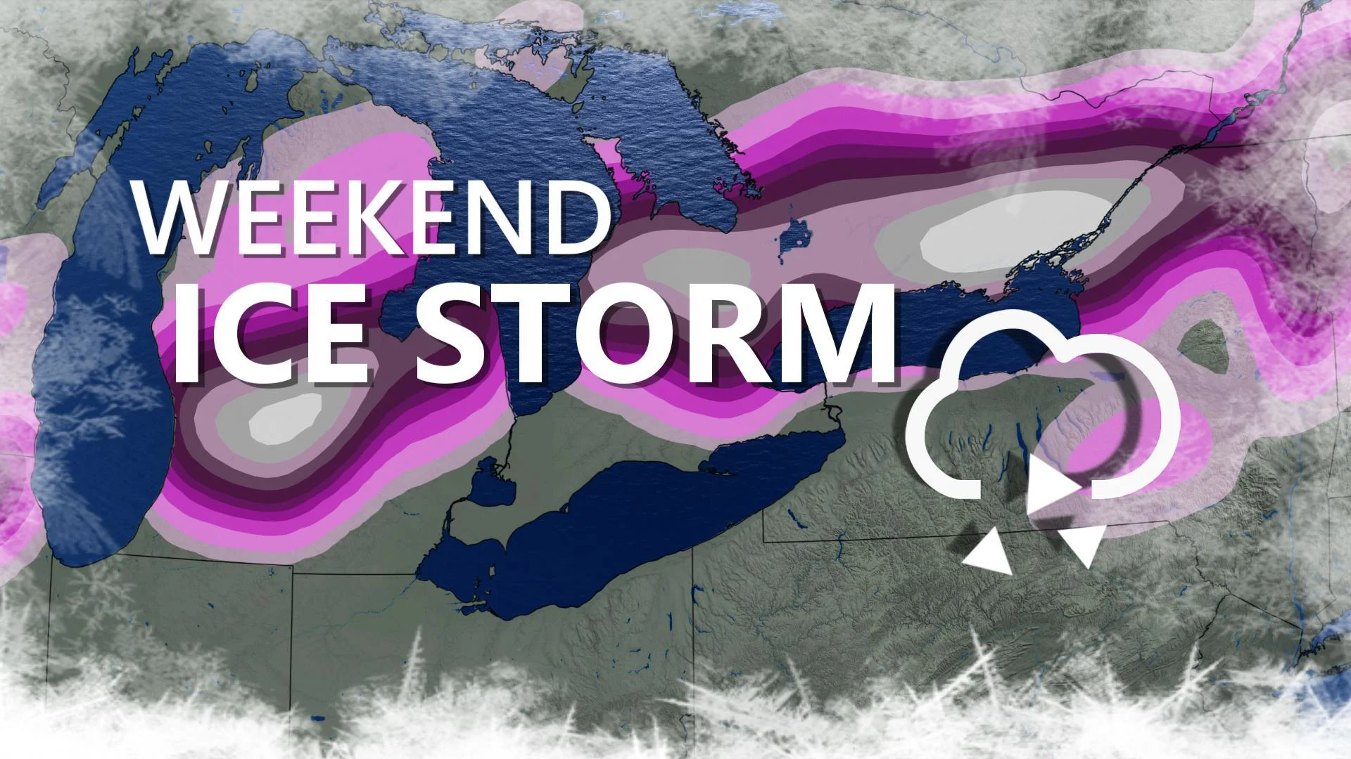
Parts of Ontario are set to get more rain from a single incoming system than their entire January average, starting Friday night. But for travellers, a return of cold air Saturday, while the storm is still ongoing, will make for a switchover to freezing rain that will last for several hours. A more granular look at the timing, and amounts, down below.
Visit our Complete Guide to Winter 2019/2020 for an in-depth look at the Winter Forecast, tips to plan for it and a sneak peek at the spring season next year
WEATHER HIGHLIGHTS:
Mild temperatures close out the week
Rain begins Friday evening, may topple January records into Saturday and Sunday
Return of cold air Saturday will mean a few hours of freezing rain
Stay up-to-date on the ALERTS in your area
FRIDAY: BIG BUMP IN TEMPERATURES AHEAD OF INCOMING STORM
Thursday's temperatures were markedly less frigid than earlier in the week, and a surge of even warmer air will take daytime highs into the high single digits for Friday -- possibly even breaking the 10ºC mark for the extreme southwest.
Before the mild air moves in, however, the leading edge of theincoming system will encounter the lingering cold. That spells the potential for a mix of rain and snow moving northeastward through southern Ontario and lasting into early Friday. By the time the morning alarm goes off, however, we should be looking at widespread rain across the board, ahead of some very significant impacts for the weekend.
SATURDAY: RAIN SLOWLY CHANGES TO FREEZING RAIN
The rain will be in full swing by Saturday morning, and temperatures will peak a little warmer than Friday, likely even cracking the double-digit mark for some communities.
By the late morning, however, temperatures begin to fall once again, and communities in cottage country and around the Bruce Peninsula may already be seeing the first drops of freezing rain.

That band will continue to gradually creep southward across the province into the afternoon, such that the GTA and areas south of the 401 are likely to remain largely as rain at least into the evening.

SUNDAY: FREEZING RAIN WIDESPREAD INTO THE MORNING
By the early morning hours of Sunday, a full switchover to freezing rain is likely to have occurred for most if not all of the GTA, while almost all of the rest of the province will also be experiencing it, with the southwest the only likely exception.

Milder air will spread back into southern Ontario Sunday morning, however, allowing for a brief chance for the ice on trees and roads to melt before the colder weather returns once again later in the day. Temperatures are expected to drop well below freezing on Sunday night, with the risk for any standing water to become solid ice through the overnight, though the rain will have ended gradually through the day.
In all, some parts of the province will have received some 6-12 hours of freezing rain, with the heaviest accretions around the Bruce Peninsula and parts of eastern Ontario.

RECORD RAIN?
Abundant subtropical moisture from the Gulf of Mexico will fuel this messy weekend weather, and it will make for copious rainfall, the bulk of which will fall Friday overnight into Saturday.
Some parts of the southwest could exceed 75 mm of rain, and even the Golden Horseshoe could pick up 50-90 mm -- rare for a single event in the summer months, much less the early days of January.

In fact, many spots in southern Ontario could be looking at getting their entire January average rainfall with this incoming storm.

"All-time January daily precipitation records are in jeopardy with this storm, depending on the timing of the rainfall as it spills into two days," says meteorologist Tyler Hamilton. "But some stations could hit their monthly precipitation average with the single storm this weekend."


"This will bring a heightened threat for flooding, especially for areas where the ground is still frozen," says Weather Network meteorologist Dr. Doug Gillham.
Be sure to check back as we continue to follow this weekend forecast closely.


