
Ontario: Narrow band of snow slicks up morning commute

The western GTA isn't out of the woods, yet -- another round of 'sneaky snow' impacting the Friday commute.
Drivers across parts of southern Ontario could face another challenging commute as some lake-effect snow threatens reduced visibilities and poor travel on this last day of autumn. Snow totals won't be anything overly significant, but a few centimetres aren't out of the question through early Friday afternoon. More on the timing of this latest wintry blast, below, plus a look at how a much milder pattern locks in for the official start of winter this weekend and beyond.
WEATHER HIGHLIGHTS:
Another shot of lake-effect snow for the western end of Lake Ontario from Burlington to Grismby through Friday
Extreme cold continues Friday, milder air to return Saturday and remain in place for Christmas
Stay up-to-date on the ALERTS in your area
FRIDAY -- NARROW BAND OF LAKE-EFFECT SNOW THREATENS COMMUTE TIMES
East winds that developed early Friday morning are helping to generate a very narrow band of lake-effect snow from western Lake Ontario through the first half of the day.
With the cold air aloft and just enough moisture left in the lower levels of the atmosphere, this swath will impact the western edges of the GTA with a few centimetres of accumulation likely, and locally up to 5 cm if the band does maintain its strength.
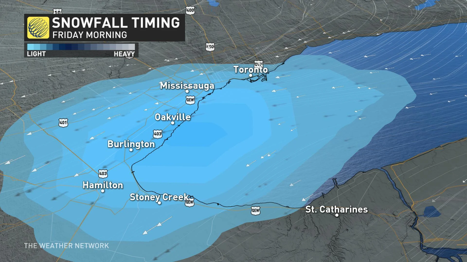
Environment Canada issued a winter weather travel advisory for areas from Hamilton through to Burlington and Oakville with the threat for low visibility at times during the morning commute.
"Motorists are advised to leave extra time for their morning commute and prepare for quickly changing and deteriorating travel conditions," EC warns.
LAST OF THE FRIGID AIR FOR A WHILE
Friday will also offer one more day of cold and below seasonal temperatures ahead of a significant warm-up that sees daytime highs climb well above freezing.
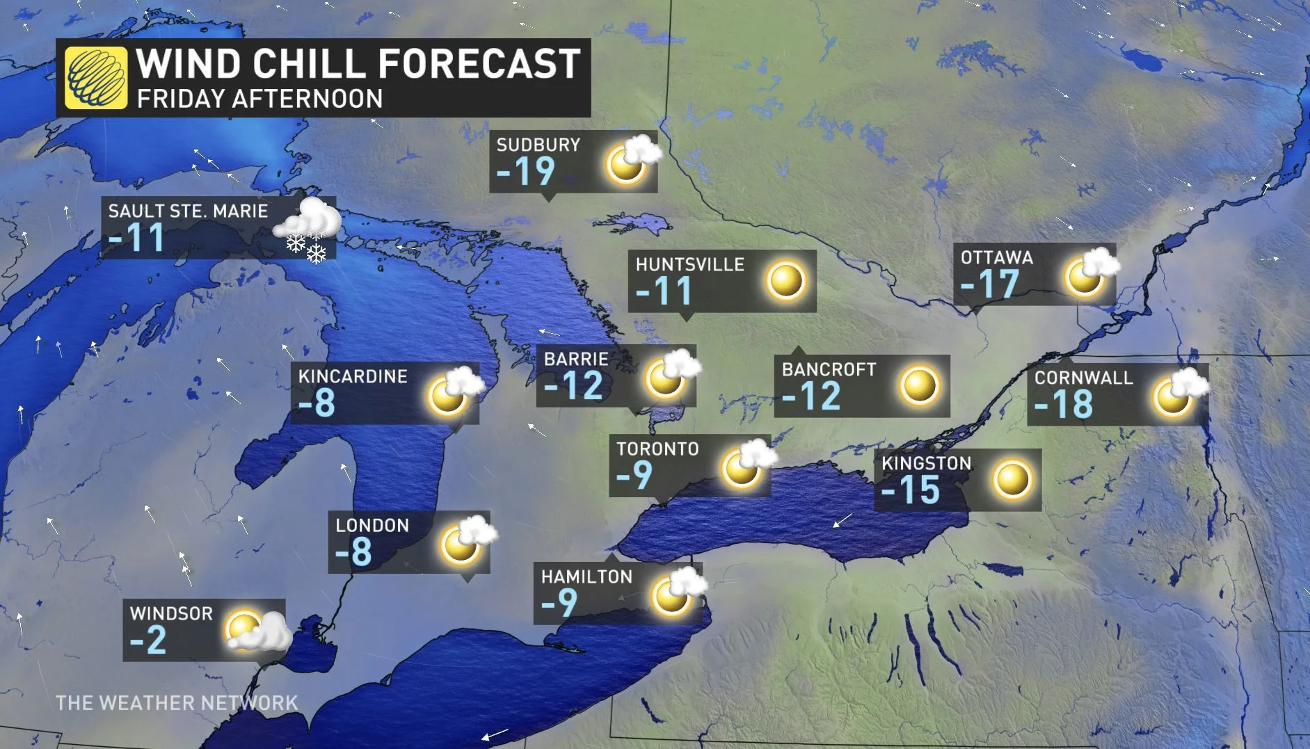
On Thursday, Toronto recorded its coldest temperature of the season so far with an early morning low of -17°C reported at Pearson airport.
SEE ALSO: PHOTOS: Snow squalls create chaos on Ontario roads Wednesday
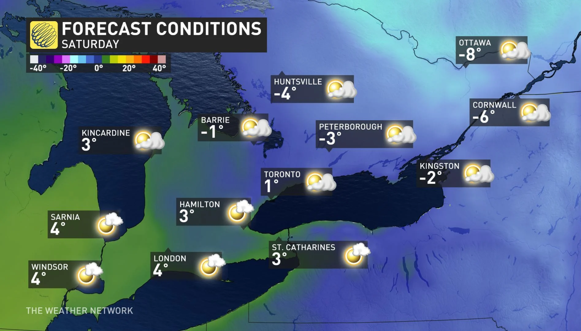
SATURDAY AND SUNDAY -- MILDER PATTERN LOCKS IN, HOPES FOR A WHITE CHRISTMAS FADE
By Saturday, temperatures will recover to near seasonal values, with daytime highs continuing to climb into the mid to upper single digits early next week ahead of Christmas.
"Temperatures will rise well above freezing for both Monday and Christmas Eve, and this will melt away any hope for a white Christmas for most of our region," says Gillham. "However, the lake-effect snow belts north of Toronto should be able to hold onto enough snow to stay white through Christmas, but areas with less than 10 cm of snow on the ground at the start of the weekend will likely be green by Christmas."
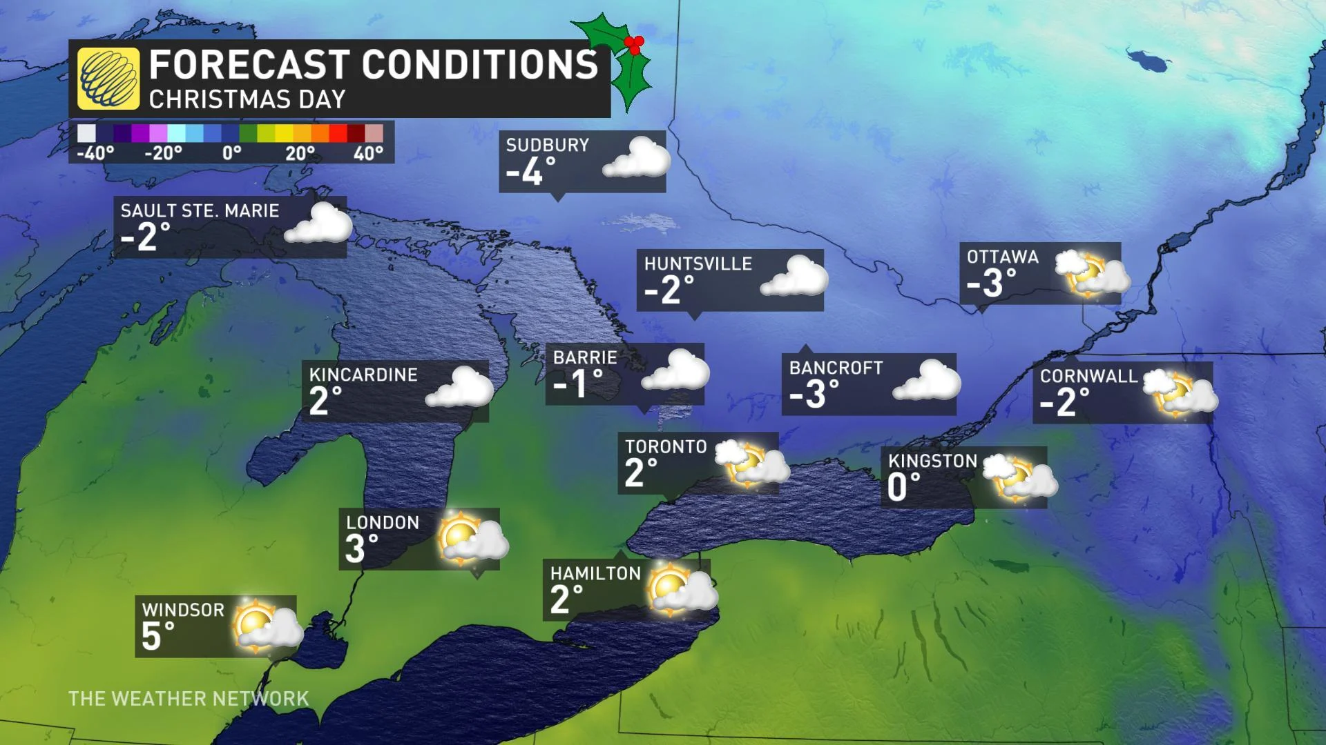
The mild bonus: These warmer temperatures will provide ideal travel conditions, with Christmas day looking to be mild and dry across the region.


