Severe storm threat hits NW Ontario Tuesday, risk of large hail and winds

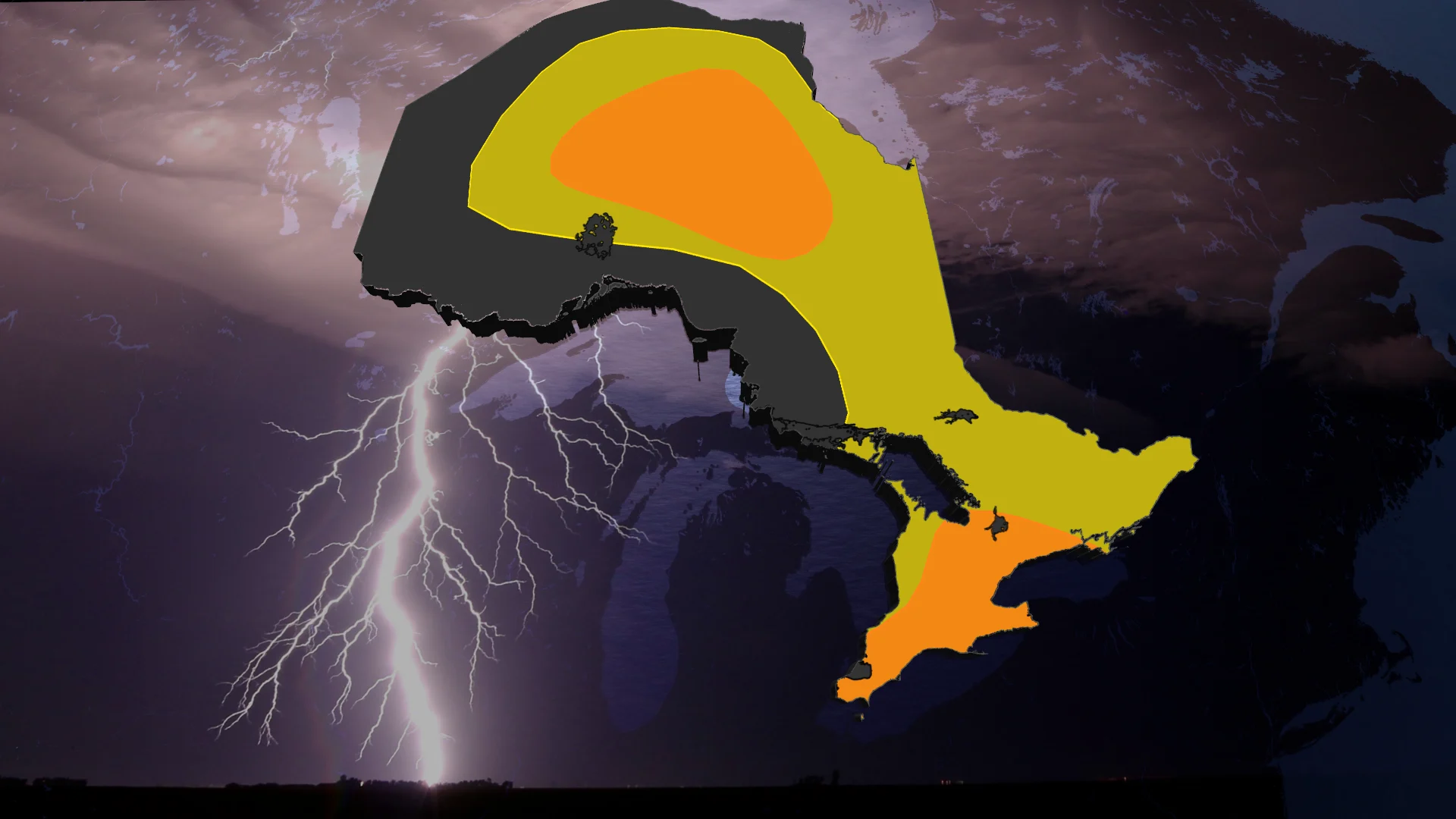
A multi-day severe thunderstorm threat covers Ontario as we kick off September, with the greatest risk areas spanning parts of the northwest on Tuesday
A low pressure system in northwestern Ontario on Tuesday could generate severe thunderstorms, with risks including large hail, heavy rain, and strong winds capable of causing tree damage.
DON'T MISS: Summer lingers as warmth wins out across Canada in September
Be sure to stay alert to the changing conditions, and check for any weather warnings in your area.
Tuesday: A conditional severe storm risk in southern Ontario, stronger storms in the north
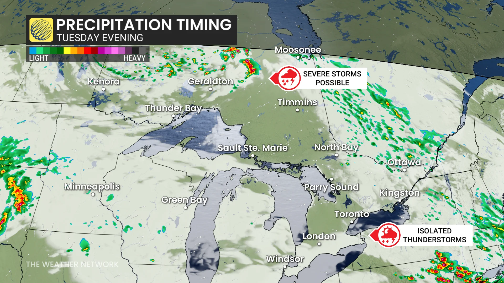
Tuesday’s weather includes isolated afternoon and evening thunderstorms developing from northwest flow aloft, particularly near Georgian Bay and Lake Huron.
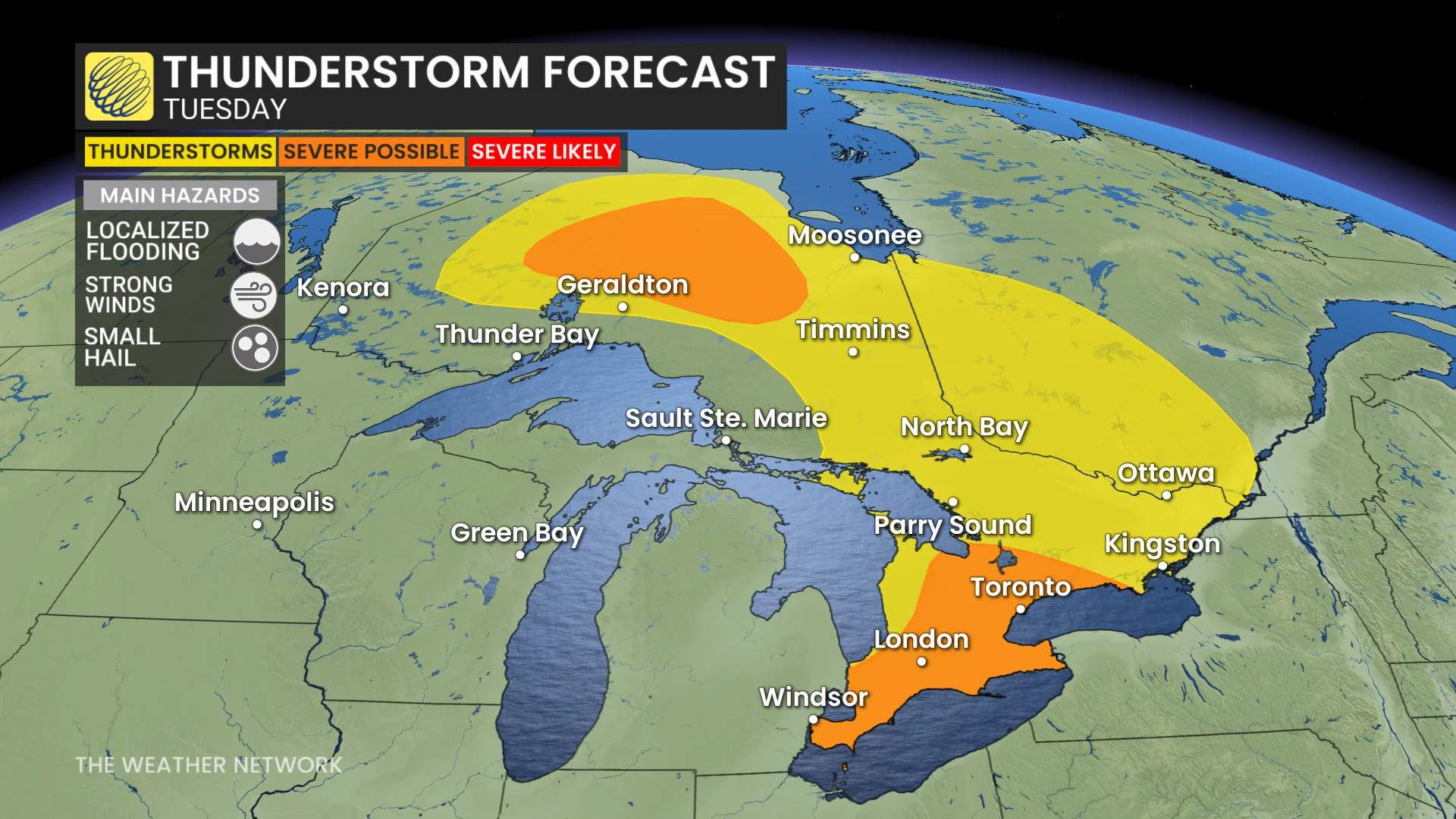
These may migrate towards the Greater Toronto Area (GTA) and Niagara. Severe storms are less likely, but could bring heavy rain in short bursts of 30-60 minutes.
Northern regions face higher risks, where large hail, strong winds, and localized heavy rain could occur.
Wednesday: Risk for stronger storms with a few isolated supercells
On Wednesday, a potent cold front from Michigan arrives, increasing severe weather potential across southern and eastern Ontario. Key risks include torrential downpours, damaging winds, large hail, and the possibility of isolated tornadoes.
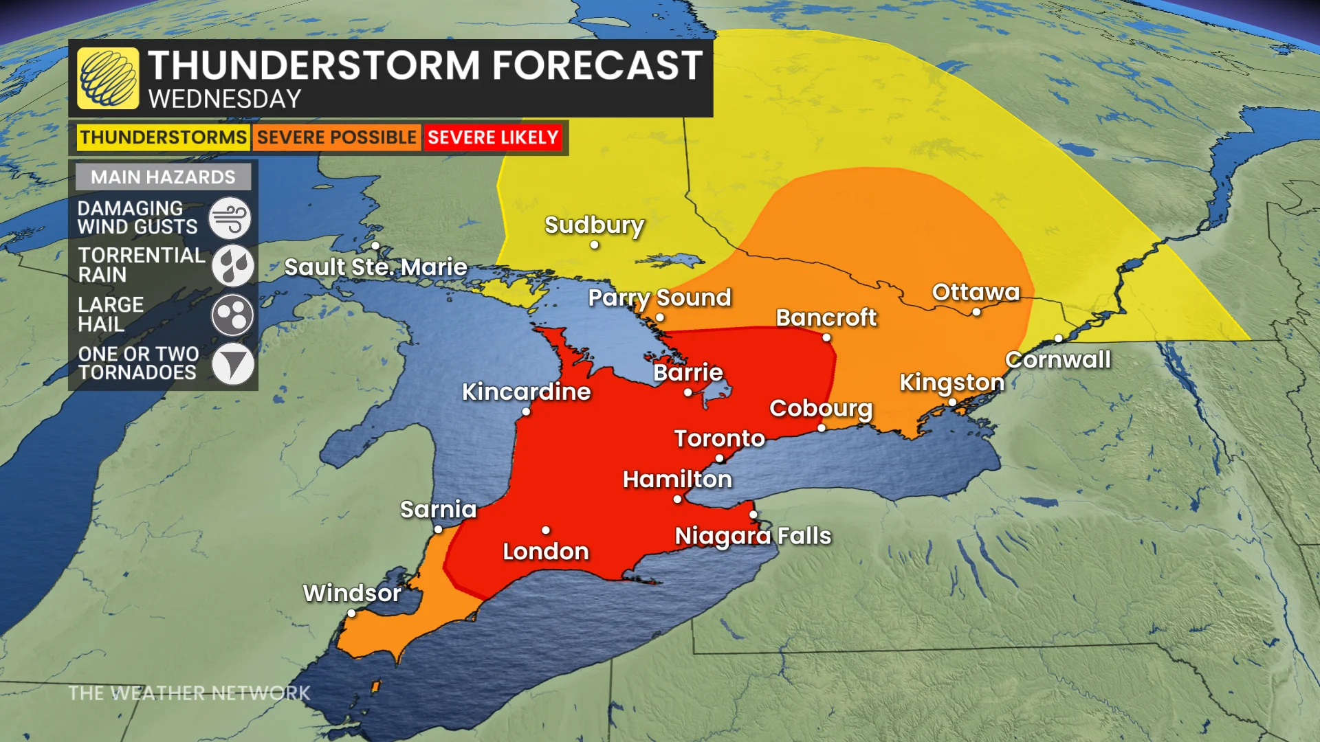
Morning rain may impact the GTA and Highway 401 corridor, with severe storms expected through the afternoon and evening.
The timing of Wednesday's storms remains uncertain. Storm activity is expected to develop across cottage country and into Quebec by early afternoon. Prefrontal rain could impact areas from the GTA to London earlier in the day.
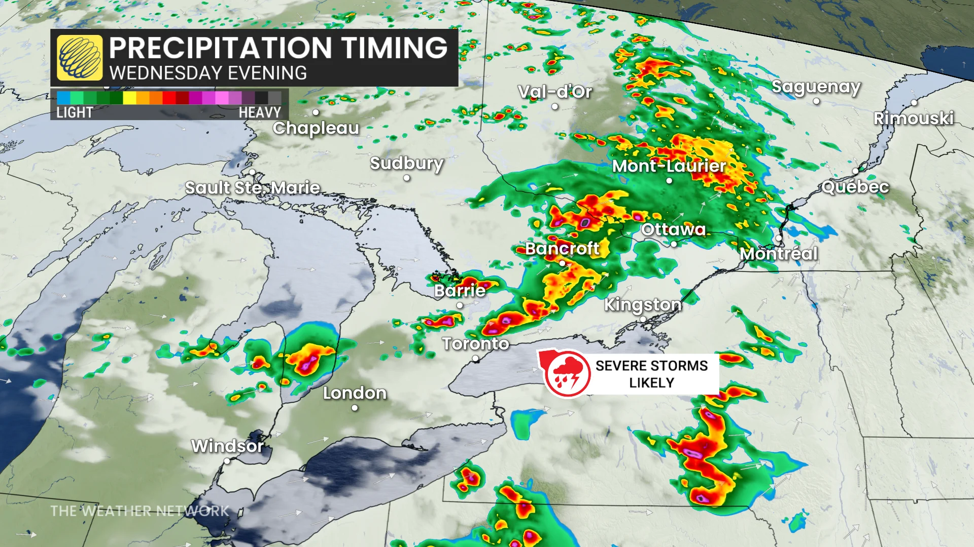
The main event—a cold front—could trigger severe thunderstorms, sweeping from Barrie into the GTA and eastern regions by late afternoon and evening.
Additional storms may linger near London around dinnertime.
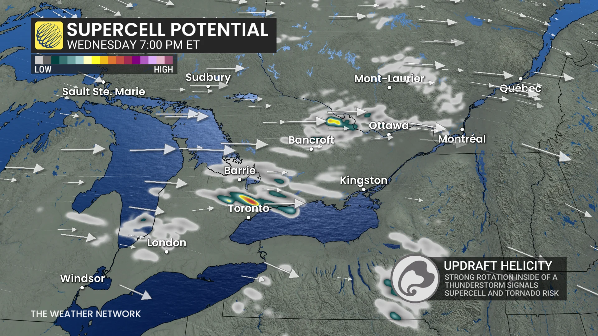
Conditions calm by Thursday as the cold front stabilizes the atmosphere, likely ending the daily storm threat.
Visit our Complete Guide to Fall 2026 for an in depth look at the Fall Forecast, tips to plan for it and much more!
Labour Day weekend: Calm start, stormy finish?
Dry and calm conditions are anticipated to kick off the long weekend, but showers and thunderstorms could develop by Sunday or Monday as humidity builds back into the region. Temperatures next week are forecast to remain near or above seasonal norms.
Stay tuned to The Weather Network for the latest forecast updates for Ontario.