Ontario could see its first 30 C of 2023 in April...how common is that?
This week is giving Ontario a decent sneak preview of the summer, with abundant sunshine and temperatures in the upper 20s, potentially hitting as high as 30°C in some spots on Thursday. That's pretty warm considering the calendar date will be April 13.
In a unique week of firsts for Ontario, it also saw its inaugural 20-degree reading of the year on Monday. As well, the Rogers Centre opened its rooftop on Wednesday, April 12, the earliest it has done so in the year. If the 30-degree mark is hit, it will also be the first in Canada in 2023.
RELATED: Canada’s brief summer sizzle to end with snow
We took a look at the frequency of temperatures reaching that coveted mark in Ontario during the month of April. It's not as rare as you may think it is.
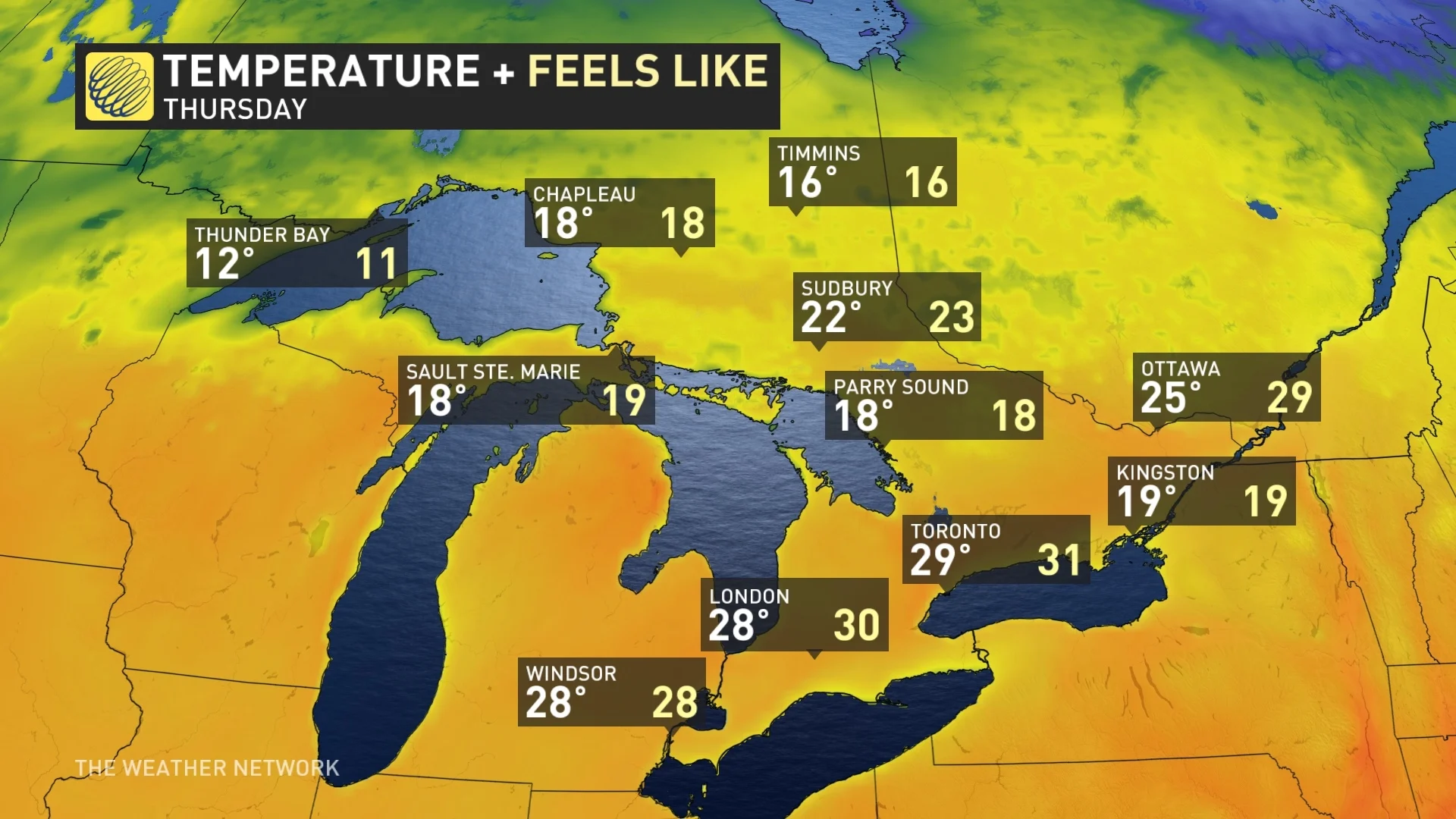
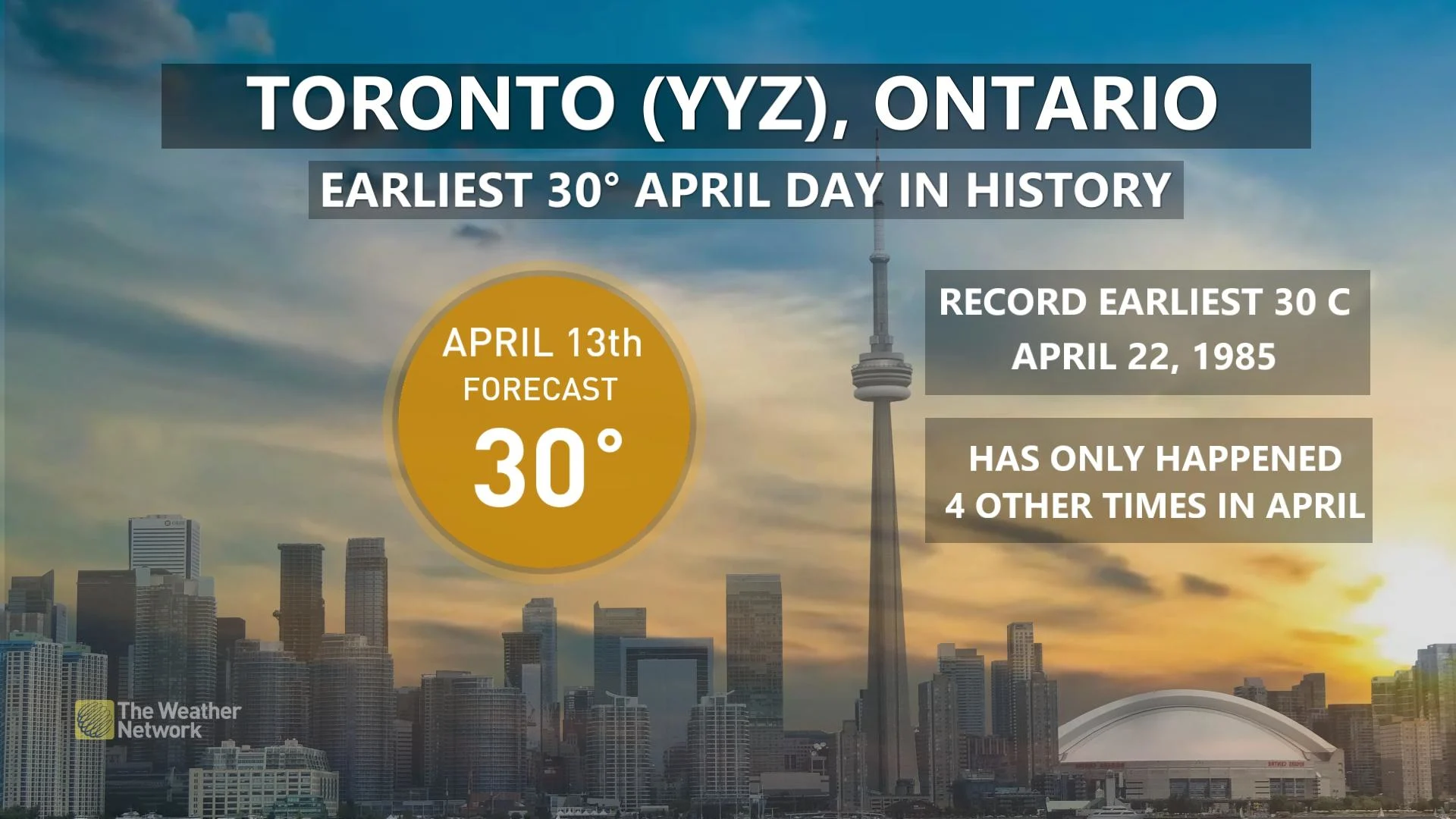
For example, Toronto's Pearson International Airport (YYZ) is forecast to see 30°C on Thursday, while the downtown area could see 29°C.
If the airport reaches 30°C on April 13, it will be its earliest on record, surpassing April 22, 1985 as the current date.
There has been four times the airport has reached 30°C in the month of April.
Even if we only reach 28°C or 29°C, it will still break a record as the earliest date in April the airport has seen a temperature that high.
Hamilton's John C. Munro Hamilton Airport (YHM) is forecast to be 29°C on Thursday. It has never reached 30°C in the month of April, so this will be a first for it should the warmth overachieve and reach that mark.
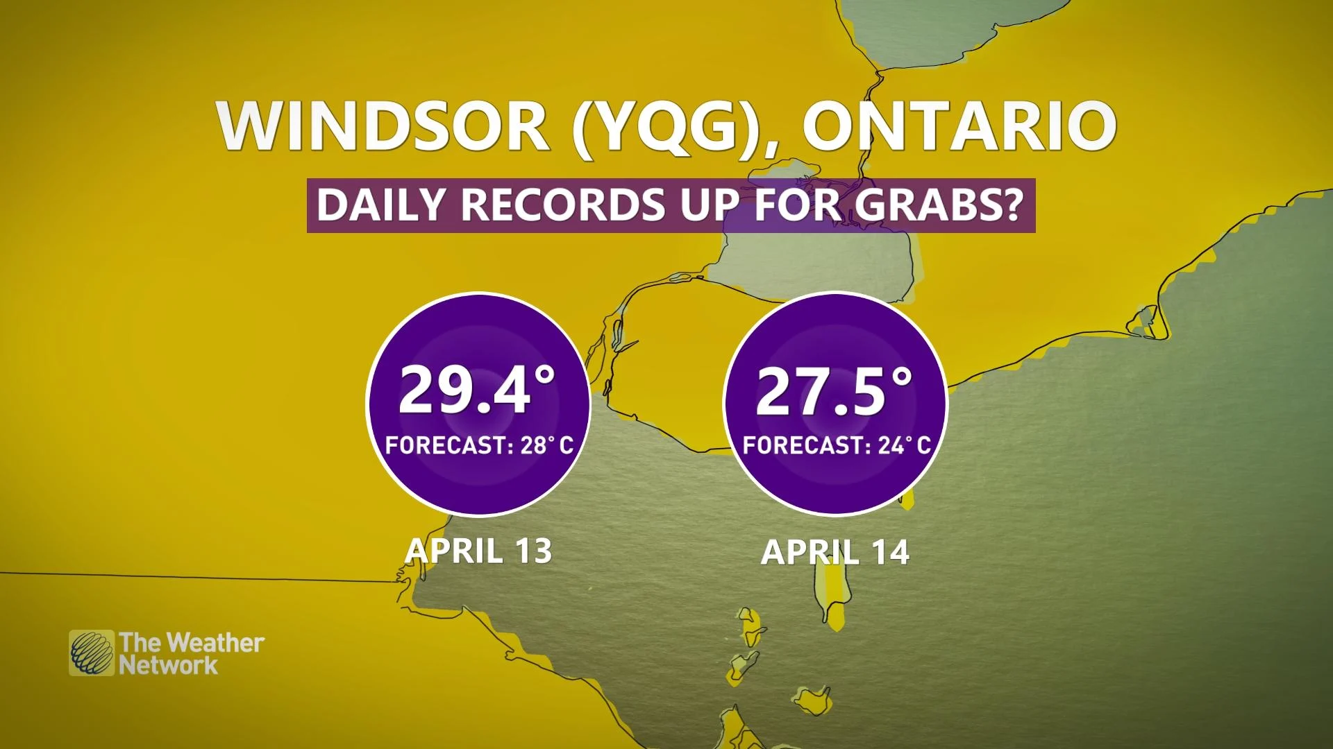
Although London and Windsor are less likely to hit 30°C, if there is a surprise, it would also be the earliest on record for them. Windsor has hit 30°C five times in April while London has seen it on three occasions.
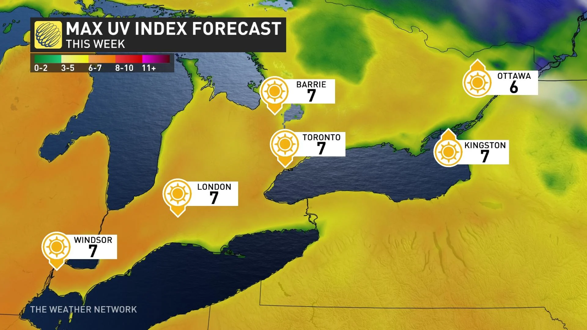
As a sidebar, for those planning on spending time outdoors Thursday, the UV index will be high (7), so put on sunscreen before heading out.
We can't forget about eastern Ontario. Ottawa is going to be mild with 25°C on Thursday. While it will won't break a daily record, it will still be warm.
Don't get used to the heat
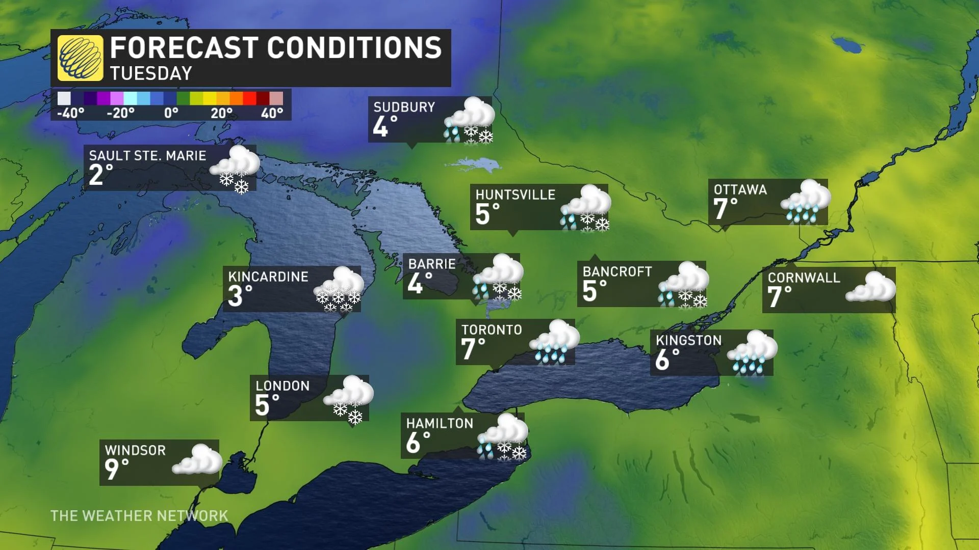
But don't get used to the warmth. Ontario will be in for a rude awakening come next week as reality sets in and brings spring back to more typical conditions for April.
A cold front is expected to track across southern Ontario on Sunday, possibly sparking a period of showers and thunderstorms.
A Colorado low will then slowly advance into Ontario into early next week, drawing down with it much colder air from the far north. As the cold air gets wrapped in around the low and sweeps into southern Ontario, rain will transition to mixing and straight snow late day Monday and into Tuesday.
Temperatures will fall quickly late day Monday, with daytime highs Tuesday expected to be in the low single digits.
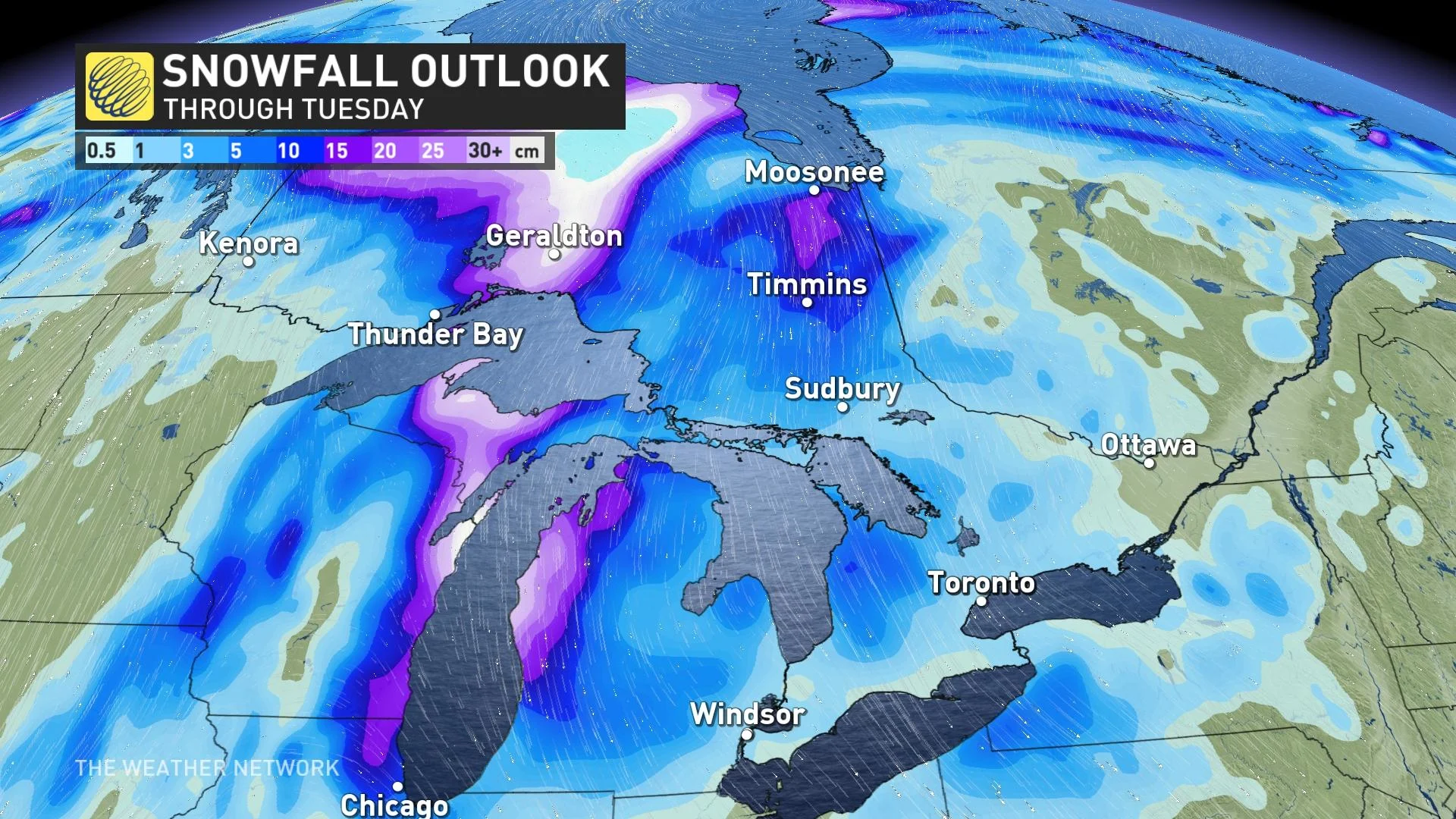
Snowfall amounts will be minimal to just flurries across the GTA and much of southern Ontario, however the snowbelts and communities along the shores of Lake Huron and Georgian Bay could see snow accumulations of several centimetres.
Temperatures will slowly rebound behind this shot of below seasonal air, but not to the extend of the summer-like weather we've seen this week.
With files from digital writers and meteorologists at The Weather Network.