Ontario: Warnings issued, ferocious storms with tornadoes possible

Another lightning show is possible on Friday with rounds of storms and a severe weather threat
Strong thunderstorms have begun their trek across southern Ontario as a cold front cuts through the province for Friday night. After both a tornado and a downburst were confirmed with Wednesday's severe weather, the work-week closes out with another round of ferocious weather thanks to an approaching Colorado low. Heavy rain, strong winds, and even the potential for additional tornadoes are all on the table for Friday, along with another impressive evening light show. We take a look at the timing for these rounds of storms, and when summer tries to fight with a slow warming trend, below.
WEATHER HIGHLIGHTS:
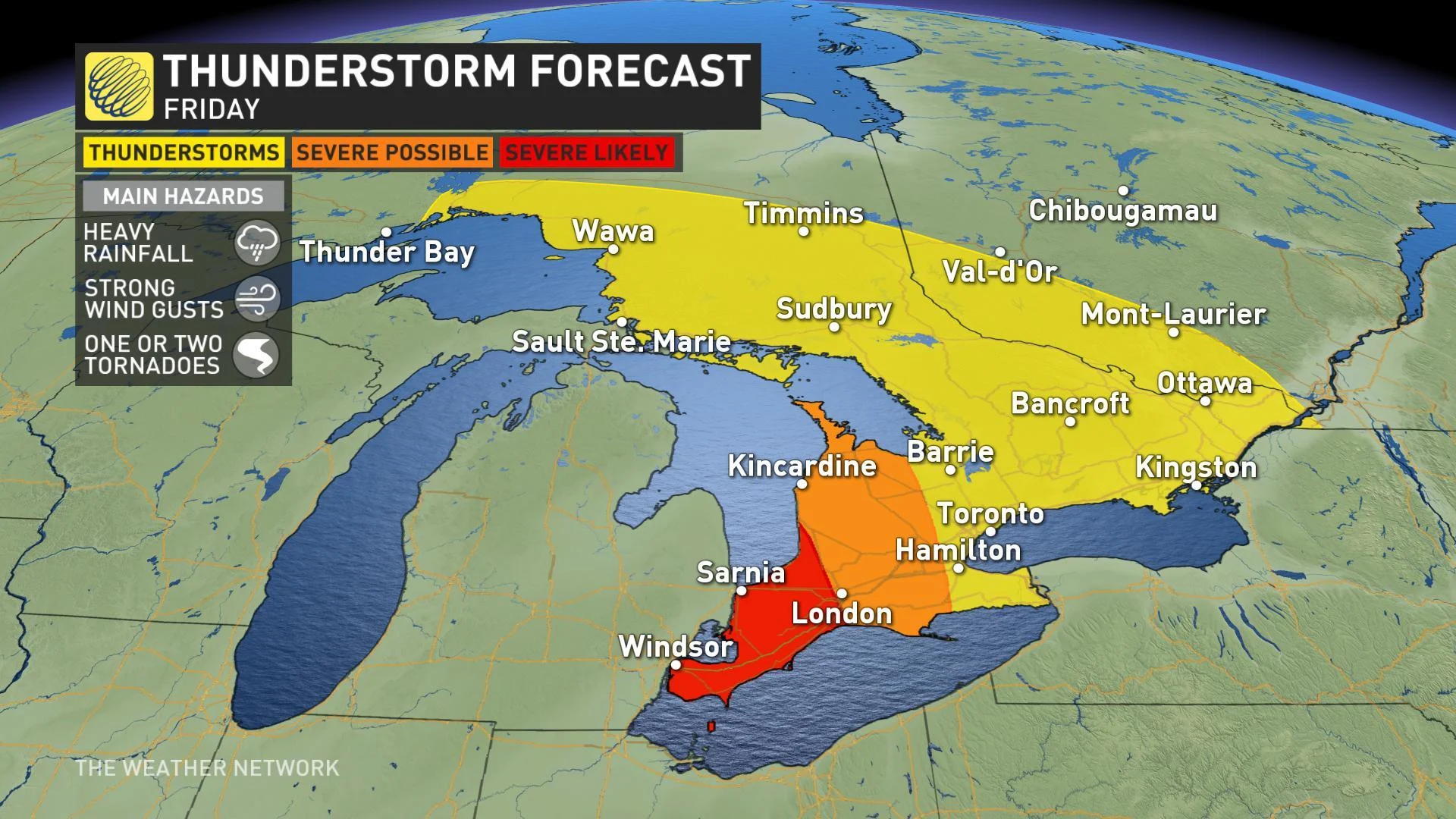
Approaching Colorado low drives thunderstorm threat through Friday evening
Widespread thunderstorms move through Friday, severe risk highest for southwest
Heavy rain, strong winds, isolated tornadoes possible
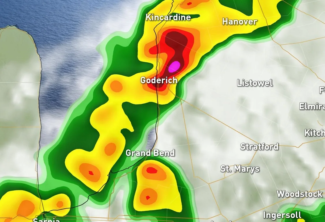
Severe thunderstorm watches in effect for southwestern Ontario
Stay on top of ALERTS in your area
RETURN OF STRONG STORMS LOOMS FOR FRIDAY
Skies cleared somewhat through Friday morning ahead of the front, which hasleft conditions primed for severe thunderstorms as the cold front itself approaches. This includes the risk for tornadoes across much of southwestern Ontario.
"The better instability remains in the Ohio Valley and Michigan, but we have a lot of dynamics associated along the cold front Friday evening, so we can't rule out some isolated severe thunderstorms in southwestern Ontario," says Weather Network meteorologist Tyler Hamilton.
Tornadic threat aside, these storms will produce heavy downpours and may generate flooding on roads and low-lying areas. Strong, gusty winds are also likely with some storm cells. Some damage to trees and structures was reported with the storms as they passed through Michigan Friday afternoon. Reports of damage are also filtering in from the Amherstburg area.
While the strongest storms are expected to stay in southwestern Ontario, most of the rest of the region will see at least some rain or overnight thunderstorms as the cold front moves through. The heaviest of the rain should have moved on by dawn on Saturday, though some spotty showers are likely to linger, especially over eastern Ontario.
SUMMER ATTEMPTS TO FIGHT BACK AGAIN
While Friday night's front will chip away at milder temperatures once again, summer isn't quite ready to exit southern Ontario.
Saturday will be a gorgeous late summer day as temperatures rise to the warm side of seasonal and abundant sunshine helps to heat things up further. That sun will give way to the risk for passing showers through Sunday with temperatures highly dependent on the amount of cloud cover through the afternoon.
"Next week will feature abundant sunshine with temperatures near to above seasonal through the week," says Weather Network meteorologist Dr. Doug Gillham. "During the middle of next week, warmer weather will be spreading into Ontario, but our warm-up will be rather slow due to an east wind off of Lake Ontario."
Still, many parts of the region can expect several days with temperatures in the low to mid-20s.
TORNADO CONFIRMED AFTER WEDNESDAY'S STORMS
A brief return to the hot and sticky July-like weather provided the fuel for severe thunderstorms to blossom across parts of southern Ontario Wednesday evening with power outages and treacherous travel reported at times throughout the night. On Thursday, Environment Canada confirmed a tornado near the Petrolia area after significant damage was reported across the southwest.