Ontario buried under epic snow totals as lake-effect setup takes over

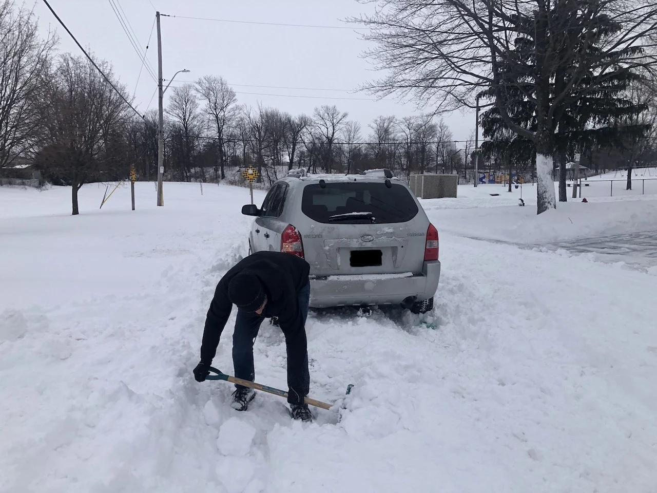
Parts of southern Ontario are digging out after one of the most impactful winter storms in recent years powered through the region Sunday night and Monday. The storm shut down everything from businesses and schools to highways and an airport. The end result was some areas shovelling out anywhere from 30-50+ cm of snow amid blizzard and winter storm warnings. More on how much snow fell and what's still to come for Monday overnight, Tuesday and beyond, below.
PHOTOS: WINTER STORM WALLOPS ONTARIO, QUEBEC, DRIVERS SHOVEL ON THE SIDE OF THE HIGHWAY
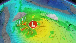
A potent low-pressure system that developed stateside and tracked south of the Great Lakes brought major snowfall and dangerous travel to much of Ontario on Monday.
Here are some current snowfall totals (Sunday night to Monday) as of Monday evening.
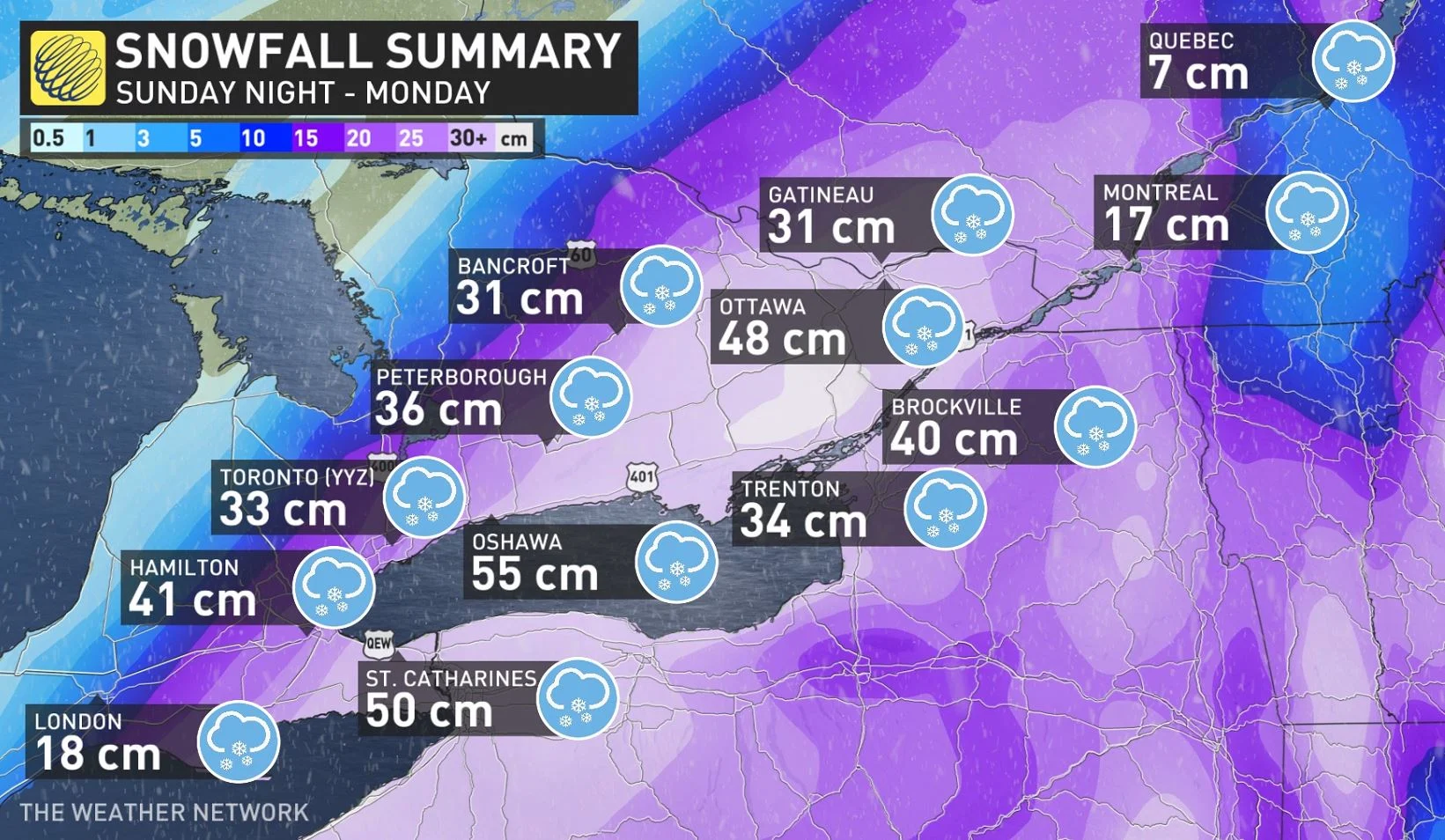
The Niagara and Hamilton regions, as well as eastern Ontario, took the brunt of the heaviest accumulations, as was forecast. Oshawa has picked up 55 cm, with 52 cm for Whitby and Niagara Escarpment, 50 cm in St. Catharines, 48 cm in Ottawa, 43 cm in Oakville, 41 cm in Hamilton, 40 cm in Brockville, 33 cm in Toronto, and 36 cm in Peterborough, among some of the highest totals.
Also of note is Ottawa airport's total of 48 cm claims its second snowiest one-day snowfall event since records began in 1938.
Monday started out with widespread school bus cancellations, with several schools opting to also close and cancel classes for the day. Others, however, including the Toronto District School Board, chose to remain online.
WATCH | FIRST RESPONDERS STRANDED FOR HOURS AS WINTER STORM BLASTS TORONTO
Toronto police officials temporarily shut down the Don Valley Parkway and Gardiner Expressway, with other road closures reported in the Greater Toronto Area reported, as well. The Ontario Provincial Police, meanwhile, reported dozens of collisions throughout the Greater Toronto Area (GTA), with vehicles spinning out, losing control and getting caught in the snowbanks or ending up in the ditch amid the slick conditions.
There are also reports of motorists becoming trapped on Highway 401, some having been stuck on the roadway since the morning.
In addition to vehicle impacts, Pearson International Airport (CYYZ) shut down in the mid-afternoon until 6:30 p.m., due to a lack of taxiway routes and gates.
DON’T MISS: Why those wild weather maps you see on social media are probably bogus
As well, the City of Toronto declared a special "major snow storm condition" to ensure its crews can remove snow on streets left by the winter storm on Monday.
The setup may be cancelled sooner than 72 hours or it may be extended longer than that depending on how much snow needs to be removed. At this time, the city anticipates it will likely be extended.
WHAT'S AHEAD: SNOW SQUALLS SET UP IN BEHIND STORM, FOLLOWED BY CLIPPER
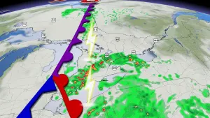
Looking ahead, the heaviest snowfall has wound down and the lingering effects have pushed out of eastern Ontario as the system departed the province. The winds will subside Monday overnight.
Behind the system, however, weak lake-effect snow has set up across the traditional snowbelt regions, and will linger into Tuesday morning. Snow squall warnings are in effect for areas near Lake Huron, which missed out on the winter storm. Snowfall amounts of 10+cm is expected for areas southeast of Lake Huron, north of Goderich, with 5-10 cm further inland.
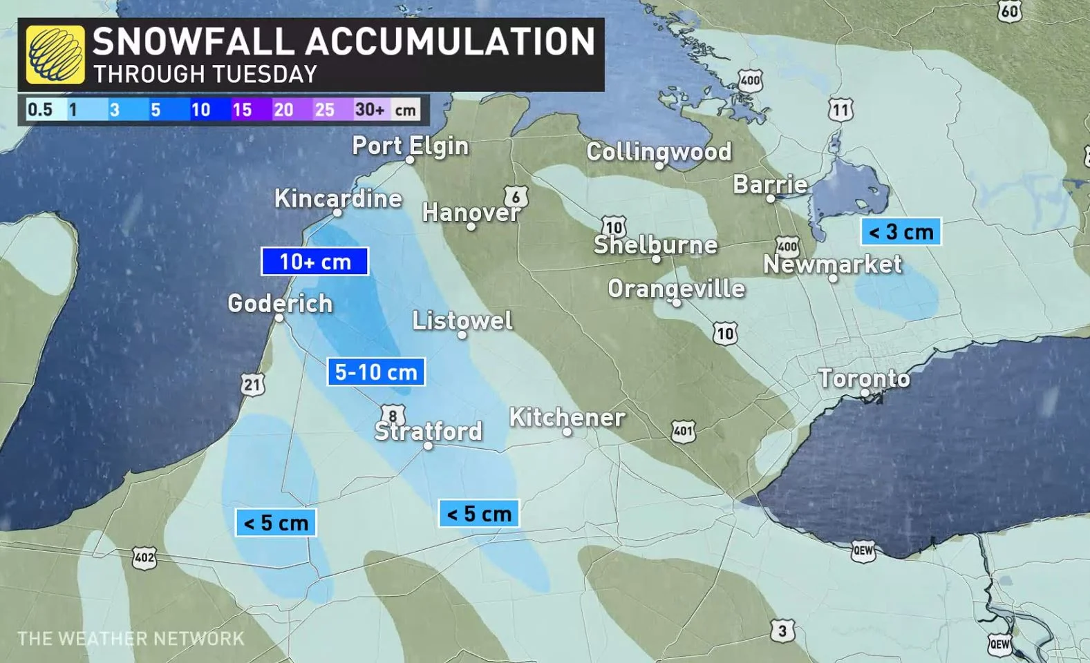
Beyond, a clipper system will track into southern Ontario Tuesday night and will bring a few centimetres of snow into Wednesday. Areas along the lakeshores may see some mixing, with less than 3 cm of snow anticipated for the GTA down to London. Meanwhile, some of the snowbelt regions may see 5-10 cm.
The rest of next week looks rather wintry with temperatures staying near seasonal or on the cold side of seasonal.
However, another shot of Arctic air is expected for Thursday and Friday. This wintry pattern is expected to continue through the final week of January with a couple more blasts of frigid weather to come.
OPP OFFICER SHOWS TRANSPORT TRUCKS STRANDED AMID BLIZZARD CONDITIONS
Stay tuned to The Weather Network for the latest forecast for Ontario.