Ontario bracing for more rounds of snow, frigid air on the way
The active pattern responsible for this week’s snowstorm will continue straight through the weekend
Folks who love the cold and snow are in for a real treat with Ontario’s forecast into next week.
Fresh off the snowstorm that blanketed the region into the day Thursday, we’re looking at several more opportunities for snow moving into southern Ontario as cold Arctic air surges into the region.
DON’T MISS: What is wind chill and why does it 'feel' so miserable?
More snow arrives Friday
Thursday saw widespread snowfall totals ranging from 20-25+ cm throughout the Greater Toronto and Hamilton Area, prompting school and road closures throughout the area.
Don’t put away the snow brushes just yet.

A weak system from the Prairies moving in on Friday will produce additional widespread snow through the late afternoon and evening hours.
While accumulations will be rather light, on the order of 3-5 cm, wind gusts of 40-50 km/h will lead to blowing snow. Drivers should use caution and prepare for reduced visibility at times.
Temperatures get colder, conditions get snowier
A stubborn upper-level trough will provide persistent cold air and instability over the Great Lakes heading into this weekend.

Localized bursts of lake-effect snow are in the forecast for the Niagara Peninsula and Georgian Bay shores, setting up late Saturday and lasting through the day on Sunday.
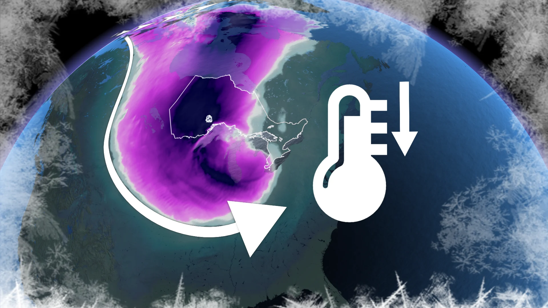
A lobe of the polar vortex over Hudson Bay will deliver the coldest air of the season to kick off next week. Toronto may see its coldest daytime high since 2019, with wind chill values in the -25 to -30 range.

In addition to the cold conditions, we’ll see another clipper arrive on Monday to bring a fresh round of widespread snow across southern Ontario. Communities in the traditional snowbelts will see lake-effect snow build on Tuesday behind this system.
Stay with The Weather Network for all the latest on conditions across Ontario.