Ontario: The sun will return after a dreary, wet Sunday, but chilly air remains

The heaviest showers will remain to the south, but Sunday will be far less pleasant than Saturday.
While Sunday won't be a washout, it will be dreary, cool and wet as showers continue in the south. Amounts will be quite limited because of the position of the U.S. system, but it won't be a pleasant day. Monday will see an improvement, but temperatures will remain below seasonal as there is little warmth in the forecast for the rest of the month. Details, timing, below.
WEATHER HIGHLIGHTS:
Showers continue Sunday, temperatures remain cool
Fair skies return Monday
Chilly temperatures to continue into May
Stayed informed of the weather ALERTS in your area
SUNDAY: DREARY, COOL WITH SHOWERS TAPERING OFF GRADUALLY
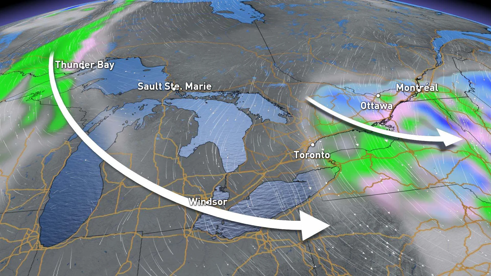
Sunday's showers will continue through the day but will very light in nature, as the U.S. system responsible for them is passing further south of the Great Lakes than initially believed.
Areas north of Toronto will escape the rain altogether, and the GTA itself will only see very light showers, with under 2 mm forecasted. The heaviest rain will remain confined to the Niagara region, where another 5 is expected Sunday. Areas along the shores of Lake Erie towards Windsor will only receive about 5 mm.

For most of the south, the rain will gradually ease off through the day with the edge of precipitation remaining along the lakeshore areas in the GTA and Niagara into the evening.
However, parts of eastern Ontario could see a rain-snow mix into Monday morning. A raw, northeast wind will keep temperatures below seasonal, with daytime highs in the low double digits for most areas.
MONDAY: FAIR SKIES, BELOW SEASONAL TEMPERATURES CONTINUE
Fair conditions will return to the south Monday, with a mix of sun and cloud. Temperatures will be slightly warmer temperatures for some, but still below seasonal for this time of the year.
Another stateside system passing south of the province will brush the southwest with light rain Monday night, but the GTA will escape its effects. The next widespread system looks to impact southern Ontario by mid-week.
LOOK AHEAD: COOL TREND CONTINUES WITH BRIEF GLIMPSE OF WARMER WEATHER
Fair and cool conditions will continue early next week, with a large system expected to track into the Great Lakes region later Wednesday through Thursday, bringing periods of rain as we conclude the month of April.
The good news, albeit temporary, is there will be a couple days of warmer weather for next weekend with near seasonal temperatures.
"Unfortunately, the warmup looks to be rather temporary. Cooler than seasonal temperatures are expected to dominate through May 10, but it won't be nearly as cold as the past two weeks," says Weather Network meteorologist Dr. Doug Gillham.
Check back for updates as we continue to monitor the forecast.