Two historic events paint a question mark over Canada’s November

Warmer temperatures will dominate Canada throughout November, but several major factors could throw a wrench in the pattern
An average November across Canada is no picnic as autumn begins to fade against winter’s steady advances.
But this month won’t follow the typical script.
Several historic events may throw a wrench in the pattern, including an unprecedented breakdown in the polar vortex and an intense El Niño flexing its influence.
DON’T MISS: Canada's polar vortex wild card is waking up much earlier than expected
Powerful El Niño continues to dominate
We’re in the midst of an unprecedented El Niño right now.
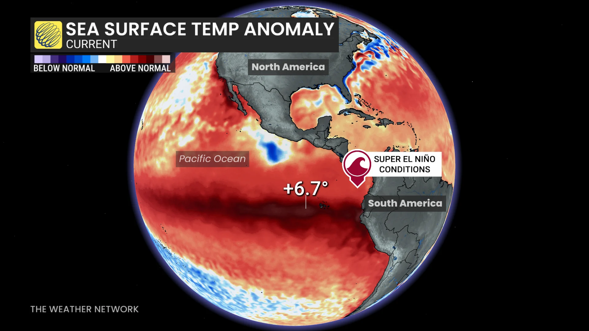
Sea surface temperature anomalies running about as high as they’ve ever been observed in key regions of the eastern Pacific Ocean.
These historically warm waters are significantly influencing weather patterns across North America.
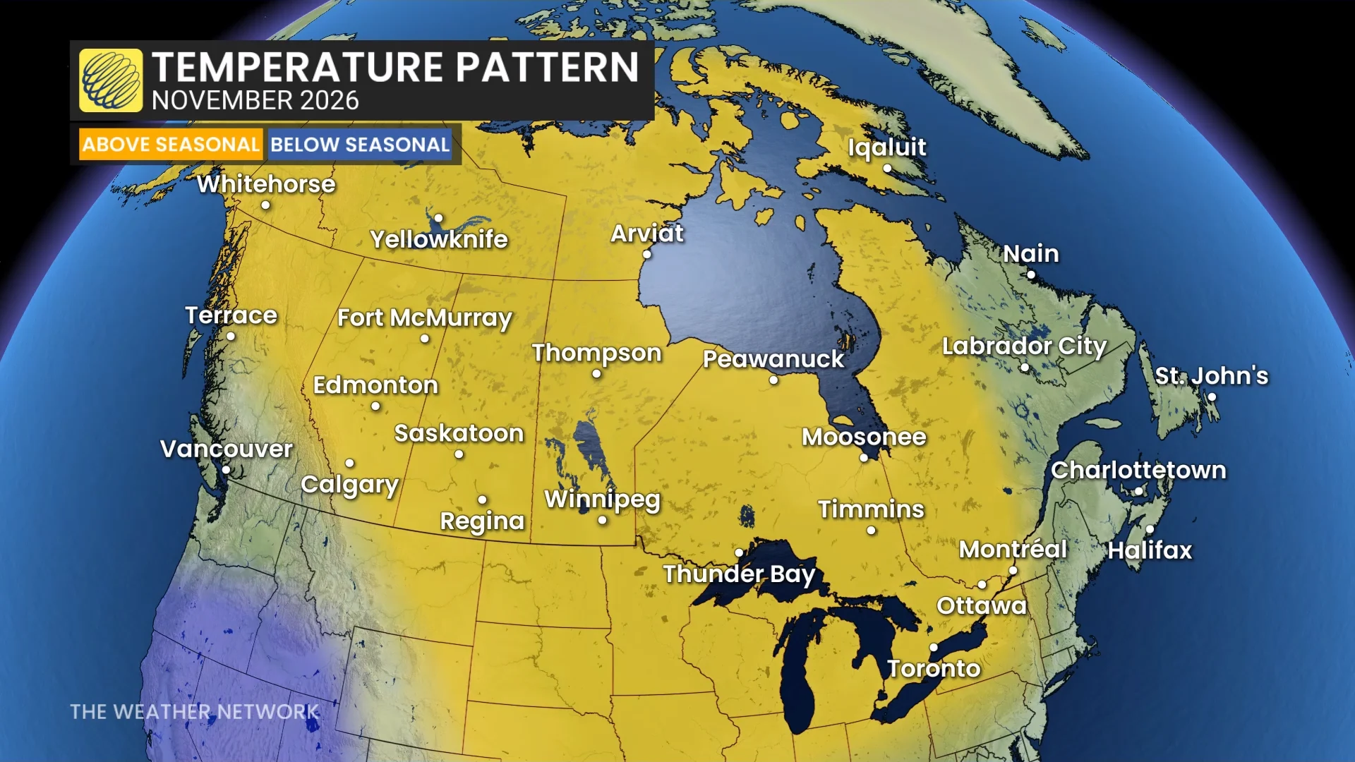
We saw above-seasonal conditions across most of Canada during October as a whole, with the warmest conditions parked over the centre of the country.
Temperatures will continue to run warmer-than-normal for a majority of the country throughout November, although near-seasonal conditions are expected in Atlantic Canada and southern British Columbia.
RELATED: Canada's Winter Sneak Peek: El Niño puts record warmth in play
One potential hiccup in the pattern will originate thousands of kilometres across the Pacific Ocean.
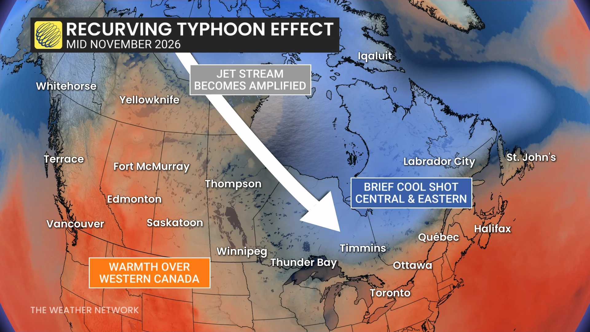
Recurving typhoons can disrupt the pattern by disrupting the jet stream, allowing warmth to build over Western Canada while folks back east deal with a brief dose of colder air.
Watching a historic polar vortex breakdown
Forecasters are also closely monitoring an unprecedented breakdown in the polar vortex across the far northern latitudes, which is occurring three weeks earlier in the season than ever recorded in the past.
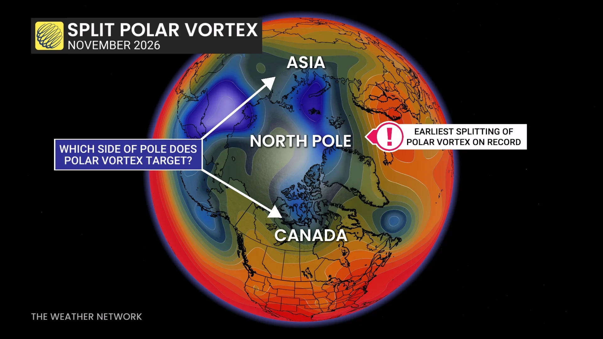
The polar vortex is a wind circulation that acts like a moat, keeping the season’s coldest air locked near the poles. Frigid air can spill southward when this wind circulation breaks down.
Where the heart of the cold air travels after the polar vortex breaks down remains an open question. Canada could very well bear the brunt of this event--but it could just as easily slide toward Siberia instead. This will become clearer later in November.
A November reality check
November has a reputation for unpleasant weather across Canada as the warmth of autumn gives way to more frequent tastes of early winter weather.
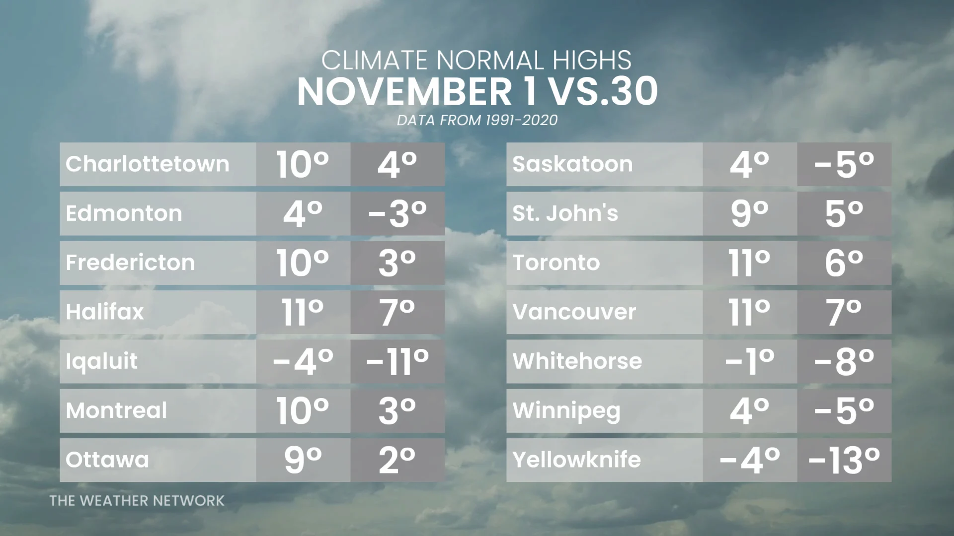
Average daytime high temperatures quickly fall between the beginning and end of November. Most communities away from the coasts are on track for a 5-7°C drop in average highs between Nov. 1 and Nov. 30.
Keep this decline in mind when above-seasonal temperatures are in the forecast. A warmer-than-normal day in November is still chilly enough to require a jacket across most of Canada.