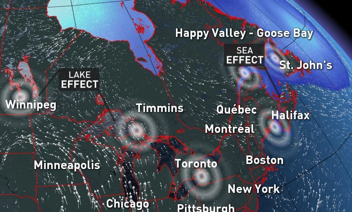
The world's lake-effect snow hot spots might surprise you
Thanks to our unique geography and plentiful coastline, lake-effect snow is a winter fact of life for many Canadians. Whether it's 5-cm-per-hour snowfall rates off of Lake Huron, streamers from the Gulf of St Lawrence, or Strait of Georgia squalls on Vancouver Island, Canada has a lot to offer when it comes to lake- and sea-powered snow.
While we do have an ample supply of the key ingredients -- cold air moving over large bodies of warm water -- Canada isn't the only place on the globe that fits the bill. And some of the spots that share in the shovelling might surprise you.
QUICK REFRESHER: HOW DOES LAKE-EFFECT SNOW HAPPEN?
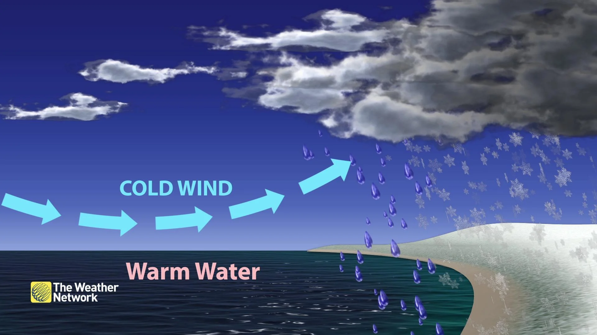
As the name suggests, you need a body of water -- though it doesn't technically have to be a lake. Some of the most significant "lake-effect" accumulations around the world are actually the product of seas. The key is an open body of water that stays relatively warm compared to the air that passes above it. To crank up the lake-effect snow machine, you need a temperature difference of about 13ºC between the water and air.
You also need the winds aligned with a significant fetch; that is, passing over a lot of open water. That's also why you don't see lake-effect around smaller lakes and ponds, and why the effect dwindles as a lake ices over.
SEE ALSO: How the Great Lakes contribute to dangerous wintry weather
The topography of the shore plays a role, too. A hilly or mountainous shoreline will help wring moisture out of the air after it passes over the water, giving rise to higher snowfall amounts.
THE LAKE-EFFECT SNOWBELT GOES GLOBAL
This finicky combination gives rise to a sort of 'global snow belt' of regions around the world, running along through the Great Lakes, Mediterranean, Black Sea and through northern Japan, between about 40 and 40 degrees north latitude.
That's not to say it doesn't happen outside of this range, but this is a lake-and-sea-effect 'sweet spot,' where mild late fall and early winter sea surface temperatures collide with frosty northern air. And that leaves a lot of places you might never have thought of as lake-effect hot spots around the world.
ISTANBUL, TURKEY
Istanbul sits on a peninsula between two major bodies of water, the Black Sea and the Sea of Marmara. Both of these are capable of churning out sea-effect snow when cold air descends from Siberia in the fall and winter and icy winds blow across water with surface temperatures in the low teens. One sea-effect storm here in 2005 dropped 50 cm of snow on the city in an event that lasted several days.
ATHENS, GREECE
Greece is subject to the same treatment from the Aegean Sea, sometimes getting a double-helping from Siberian air masses that first traverse the Black Sea and Sea of Marmara, then pick up additional moisture from the Aegean before dumping it all on the eastern side of the country.
Heavy sea-fueled snowfall in 2008 cut off access to 150 villages and dropped up to 40 cm on Athens.
CENTRAL JAPAN
Siberian air travelling the other direction is the driving force behind sea-effect snow from the Sea of Japan. While much of the northern half of the country sees some snow off of the sea, potent streamers butting up against the mountains in Nagano and Nigata prefectures in central Honshu join forces to produce some colossal snow totals each winter.
Sources: Research Gate | BBC |