20-40 cm and 60-100 km/h winds: East Coast faces intense nor'easter
A powerful nor'easter will hit Atlantic Canada through Wednesday with heavy snow, rain, and strong winds, likely causing travel issues, power outages, and school closures
Batten down the hatches, Atlantic Canada.
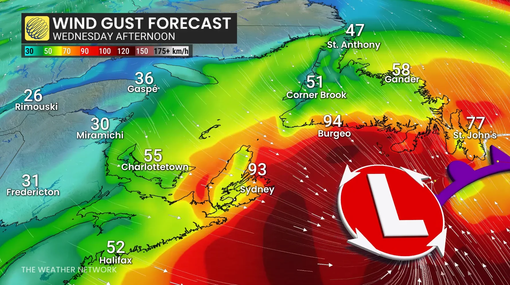
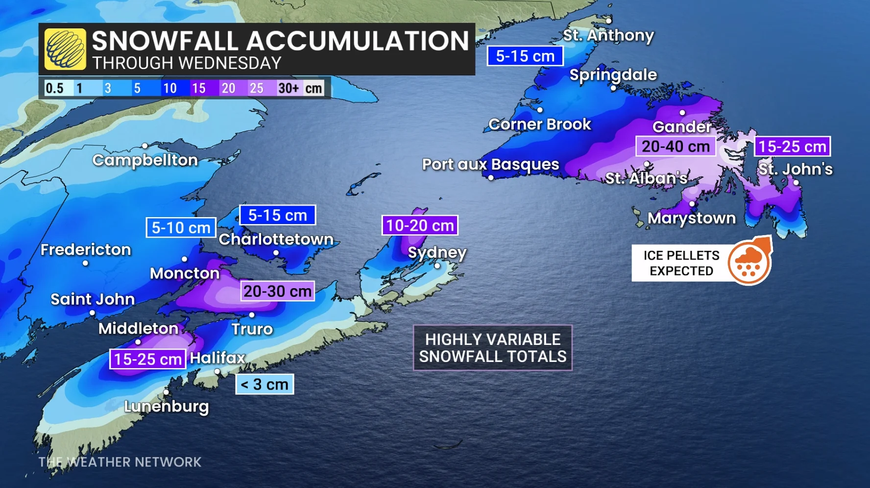
The region is beginning to feel the impacts of an intense nor'easter, which will continue to bring powerful wind gusts (60-100 km/h), heavy snowfall (20-40 cm) and copious rainfall for some areas through the day on Wednesday. Widespread warnings are in effect.
DON'T MISS: New colour-coded Canadian weather alerts have now launched. Here's what they mean if you see them
Expect challenging travel with snow-covered roads and walkways. Utility outages and disruptions to transit and ferry schedules are also possible. Subsequent rain and snowmelt could lead to water pooling on roads and localized flooding in low-lying areas.
Rain, heavy snow, and strong winds set to impact the Maritimes
Forecasters say the conditions necessary for a sharply deepening storm are all present: A strong jet stream, plenty of cold air and unusually warm ocean temperatures to fuel its formation.
Snow began in the Maritimes on Tuesday evening as the low moved along Nova Scotia's south coast overnight. Conditions will continue to worsen into Wednesday morning, with stronger winds and more precipitation.
Southern Nova Scotia is expected to receive the most rain, with 30-50 mm forecast, and wind gusts of 50-80 km/h. Forecasters warn about ponding and pooling on roads.
Cold air will remain in place farther north, including Saint John, Moncton, Charlottetown, the Annapolis Highlands and the Cobequid Mountains. These areas could receive 10-20 centimetres of snow, along with gusts of 50-70 km/h.
Commuters should expect difficult conditions Wednesday morning, with possible delays or closures on the Confederation Bridge.
LOOK: Eco-friendly tips for keeping a healthy pet and planet
Colchester and Cumberland counties are forecast to see 20-30 cm of snow locally, with highly variable totals across Cape Breton, and other regions of Nova Scotia.
WATCH: Heavy snow, ice pellets and 90 km/h winds target Newfoundland
Wednesday will be Newfoundland's turn, with snow and strong winds spreading across the island in the morning and intensifying by the afternoon. Snowfall rates could reach 3-5 centimetres an hour, with coastal winds gusting to 80-100 km/h. Inland winds could reach 60-80 km/h.
The combination of heavy snow and strong winds may cause whiteout or near-blizzard conditions, slick roads and the possibility of road, school and business closures.

There is also the possibility of localized power outages.
The forecast for southeastern Newfoundland remains somewhat uncertain. The Avalon and Burin peninsulas may see snow turn to ice pellets or rain as the low moves south of the region later Wednesday, potentially affecting snowfall totals.
MUST SEE: A winter storm's track can make or break your forecast
The heaviest snow is forecast for central portions of the province, stretching into western sections of the Avalon Peninsula.
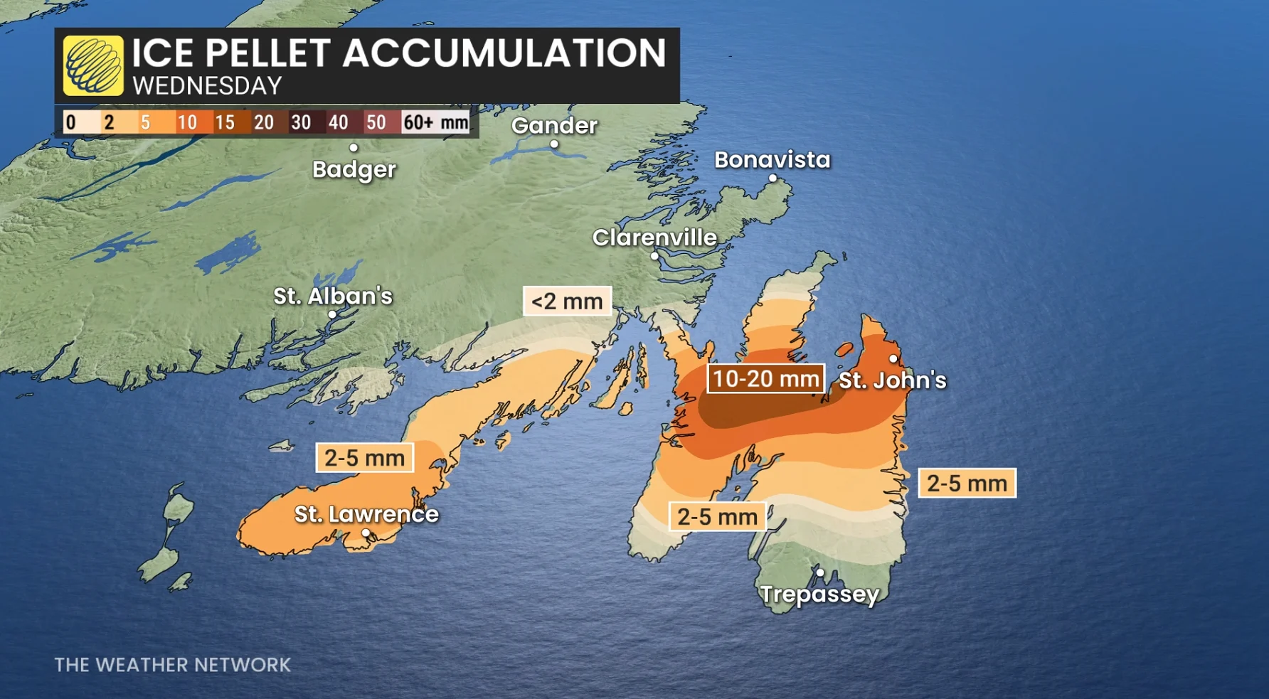
Snowfall totals of 20-40 cm is forecast for east-central Newfoundland, with 15-25 cm of snow for parts of the Avalon. Ice pellets will also impact snow totals if icy conditions persist longer than expected for areas like St. John’s.
Heavy snow, ice pellets and mixing are forecast to target the Avalon on Wednesday morning and afternoon.
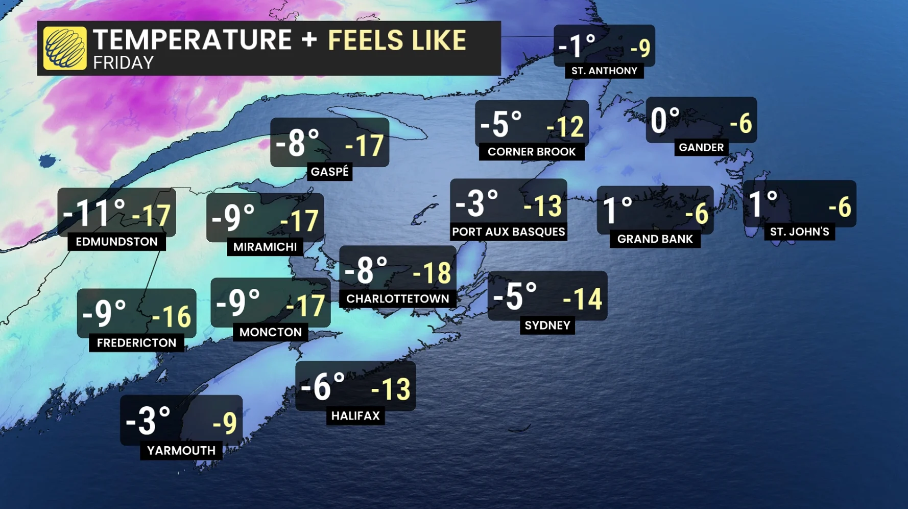
Conditions are anticipated to improve Wednesday night, but cold Arctic air will stay behind the system. On Thursday, wind chill values in some parts of New Brunswick could reach -10 to -20.
Stay with The Weather Network for the latest across Atlantic Canada.