Rainfall, winter storm warnings issued across parts of B.C.

Heavy rain will soak southern British Columbia this week and high-elevation snow will lead to travel issues in the mountain passes.
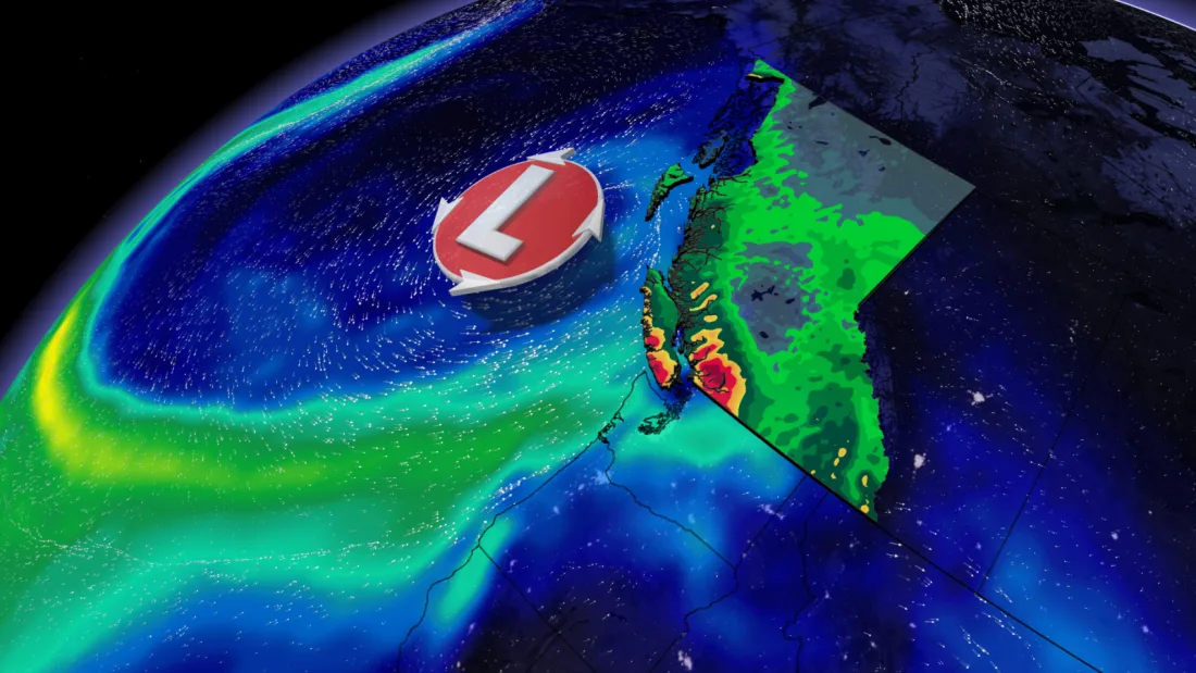
Atmospheric moisture is spreading over the South Coast and causing a rise in temperatures with a surge of precipitation. Although February has been a dry month for British Columbia, some cities, such as Vancouver, may actually end up with near-normal rainfall totals for the month.
A potent atmospheric river that moved into the region on Sunday is set to bring days of soggy weather. The highest totals will fall over the Lower Mainland and Vancouver Island, where over 100 mm of rain is possible through Monday. Across the Lower Mainland, most of the rain will fall east of Vancouver, but the city itself can expect to see 75-100 mm.

“Heavy downpours can cause flash floods and water pooling on roads,” states Environment Canada and Climate Change’s (ECCC) rainfall warning for the Fraser Valley. Although there will be breaks in between, the rain and snow are expected to continue into Wednesday morning before winding down in the afternoon.
Wind gusts could reach 70 km/h along the coastline as another system pushes ashore before subsiding on Monday morning.
SIGNIFICANT MOUNTAIN SNOWS WILL LIKELY COMPLICATE TRAVEL
Low freezing levels will make this a much more interesting pattern for ski resorts and mountain passes. Freezing levels will generally hover around the 1,000-1,500 metre range.
Accumulating snow will blanket the province’s major mountain passes, likely leading to major travel disruptions through Monday. Special weather statements and snowfall warnings are in place as the weather in the mountains can change suddenly, resulting in hazardous driving conditions.

"Be prepared to adjust your driving with changing road conditions. Rapidly accumulating snow will make travel difficult. Visibility may be suddenly reduced at times in heavy snow," ECCC says in the statement.
Through Monday, accumulations of 10-30 cm of snowfall are peppered across the mountain passes. Some regions, such as Highway 3 - Paulson Summit to Kootenay Pass, could see between 40-50 cm.
The soggy pattern continues through the middle of next week as additional systems will track into the South Coast. A drier pattern is expected for the second week of March.
Stay tuned to The Weather Network for the latest on conditions across British Columbia.