Active storm track to give Atlantic Canada rain, snow and wintry cocktail
An unsettled week lies ahead for Atlantic Canada, including a potent storm developing stateside that could have significant, wintry impacts
Even though spring is around the corner, Atlantic Canada will be getting plenty of wintry weather before the start of it.
This week is a prime example, with multiple systems bringing in a mixed bag of precipitation over the coming days.
SPRING 2024: Get an in-depth look at the Spring Forecast, tips to plan for it, and much more!
It will culminate with a potential mid- and late-week storm that could have travel and power disruptions as a result of the possible implications, including a prolonged period of freezing rain and ice pellets, along with heavy snowfall.
What to expect with the first system Tuesday and what we know so far about the successive low to come.
Tuesday overnight sees the initial round of rain
After starting the week with mild temperatures and abundant sunshine, rain will push back into the Maritimes on Tuesday night, picking up Wednesday morning across Newfoundland.
The heaviest rain will fall in northern Nova Scotia and southern New Brunswick during the overnight hours on Tuesday, with 5-20 mm forecast.

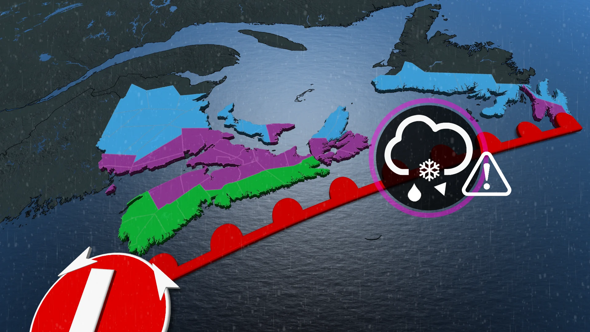
Bigger system brings threat of extended period of wintry mix, from Wednesday night through Friday
The next, and more impactful, system is forecast to develop along the U.S. Southeast on Wednesday night, tracking south of Atlantic Canada.
Milder temperatures will be in place as the precipitation starts across the Maritimes, though with the potential for some snow to fall on the northern edge of the system.
Through Thursday, colder temperatures will then shift south, with most of the rain transitioning to snow across parts of New Brunswick.

When the transition occurs, there's also an elevated chance for prolonged, wintry cocktail of ice pellets and freezing rain. These conditions are possible along southern New Brunswick and P.E.I., extending into northern parts of Nova Scotia. It could last through Thursday.
Temperatures will remain slightly cooler in Newfoundland with this system, which will mean the precipitation will begin as snow, with a chance of mixed precipitation along the southern Avalon or Burin peninsulas.
"Confidence is lower on the exact location of the mixed precipitation, but the setup is favourable for it. Forecasters will continue to calculate how efficient the ice accretion is with this setup, so be sure to check back," said Rachel Modestino, a meteorologist with The Weather Network.

Areas seeing several hours of mixed precipitation are likely to icy and slippery conditions, leading to hazardous travel. Localized power outages are also likely.
Between 10-15+ cm of snow is possible for the hardest-hit areas of the Maritimes through Friday, while areas in Newfoundland, which see the snow longer, could end up picking 15-25 cm.
As the system departs, precipitation will change to snow for all by Friday.
An active pattern is expected into next week, with more snow and icy conditions likely with colder air staying locked in place.
Be sure to check back for the latest weather updates across Atlantic Canada.