Another round of rain targets B.C.'s extremely vulnerable flood areas
B.C. is bracing for another round of heavy rain Wednesday. It could cause further flooding and avalanches, and potentially landslides, too, as alerts remain in place
After a brief reprieve from the unrelenting rainfall, B.C. is preparing for its next round, which should be weaker than previous events in recent days, but is keeping communities on high alert for more flooding.
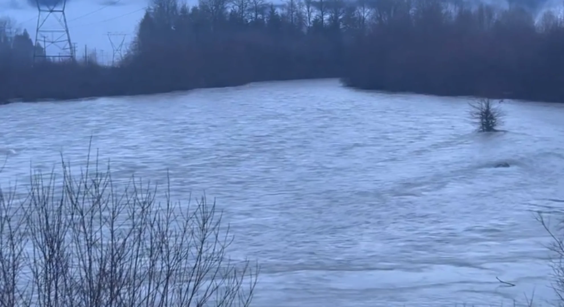
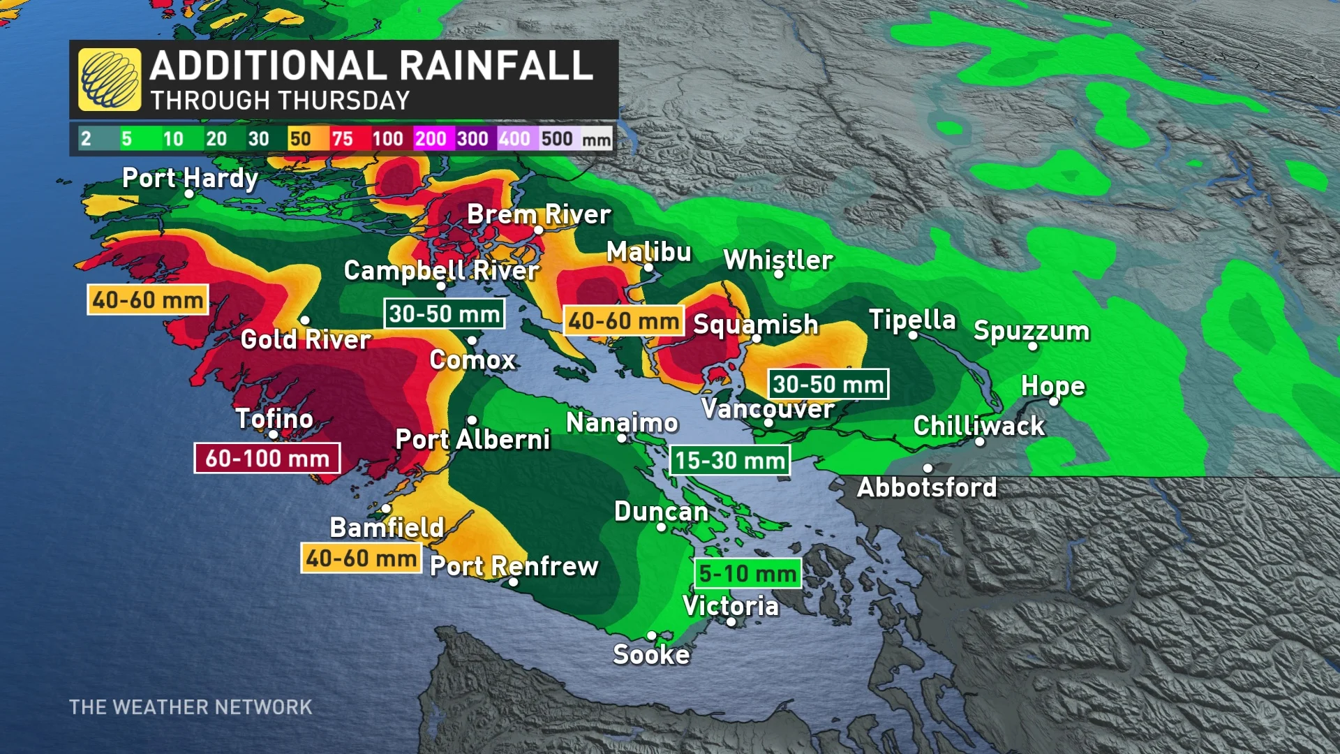
Widespread flood watches, warnings and high streamflow advisories from the B.C. River Forecast Centre are in effect across southwestern B.C., with another bout of rain set to impact the province's South Coast through Thursday.
RELATED: Snowmobiler killed in avalanche in northeastern B.C.: Avalanche Canada
Special weather statements also remain in effect, outlining the set of potential hazards with this next system. Among them are enhanced responses in river systems and the potential for flooding, water pooling on roads, risk of landslides, potential for falling tree branches and power outages due to strong winds and saturated soil, and possible travel delays.
As a result, an evacuation order was issued on Tuesday in Pemberton for six properties on Airport Road affected by flooding.
As well, an avalanche occurred Saturday in the Hasler riding area, as well, killing a snowmobiler. It was B.C.'s first reported avalanche fatality of the season.
Wednesday and beyond: Another round of rain moves in
Another round of soggy weather will impact very similar areas through Wednesday.

This round looks weaker and more disorganized, but not by much. Similar hazards will be felt since the ground and alpines are so unstable from the constant bombardment of moisture.
As wet conditions continue to plague the region, there continues to be the risk of localized flooding, avalanches from unstable snowpack, and the risk of mudslides from unstable earth.
Heavy rain moves in Wednesday, with scattered precipitation continuing on Thursday. The coastal mountains of Vancouver Island will once again record the heaviest amount of precipitation, on top of the 480 mm of rain already recorded from Friday to Tuesday at the Effingham station in the mountains east of Tofino.
WATCH: Animal shelter evacuated as B.C. community declares state of emergency due to flooding
Freezing levels will begin to drop as February kicks off a pattern shift back to winter.
DON’T MISS: El Niño is hanging strong—but a big change is on the way
High freezing levels are concerning. This deep reserve of mild, tropical air is bad news for ski resorts along the North Shore and Vancouver Island, where freezing levels will jump higher than 2500 m through the middle of the week.

Combined rainfall and snowmelt will lead to a flooding risk around the mountains, as well as creating an unstable snowpack that will enhance the potential for avalanches in the backcountry, to considerable levels in many areas, along with mudslides.
Widespread flood watches, warnings and high streamflow advisories are in effect across southwestern B.C.
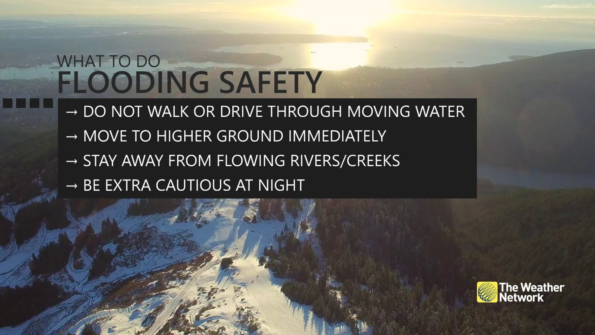
Remain mindful of the risk for flooding around vulnerable low-lying areas, and avoid driving across flooded roadways if you come across high water. It’s impossible to tell how deep the water is until it’s too late, and the road may have been washed out beneath the water.
With strong overnight southeasterly winds, Abbotsford has recorded a new all-time high temperature for January after reaching 18.2°C on Monday. Warm temperatures persist, but will cool back down by the weekend following one more push of heavy rain.
Drier, and more seasonal conditions will follow into the weekend.
A much drier pattern will linger through early February. Cooler-than-normal temperatures are expected in early February, but then a milder pattern is expected towards mid-month, once again.