Next messy system aims to hit Atlantic Canada with more wintry weather
The fling with wintry weather is not over for Atlantic Canada this week as a new low will bring in another round of snow and rain for parts of the region
An unsettled Monday was just a sign of things to come for Atlantic Canada this week.
The next event be smaller in scale and will move through quicker than the previous low, but significant snowfall is anticipated to return to northern and central New Brunswick by Tuesday evening.
DON'T MISS: Get to know the hidden gems across Canada
While the news of more wintry or rainy weather will come as a disappointment for many East Coasters, conditions on the Saint John River in New Brunswick aren’t a concern right now, luckily.
Be sure to monitor local weather alerts and check highway conditions before heading out to start the week.
More snow and rain on the way, with eyes on the Saint John River levels
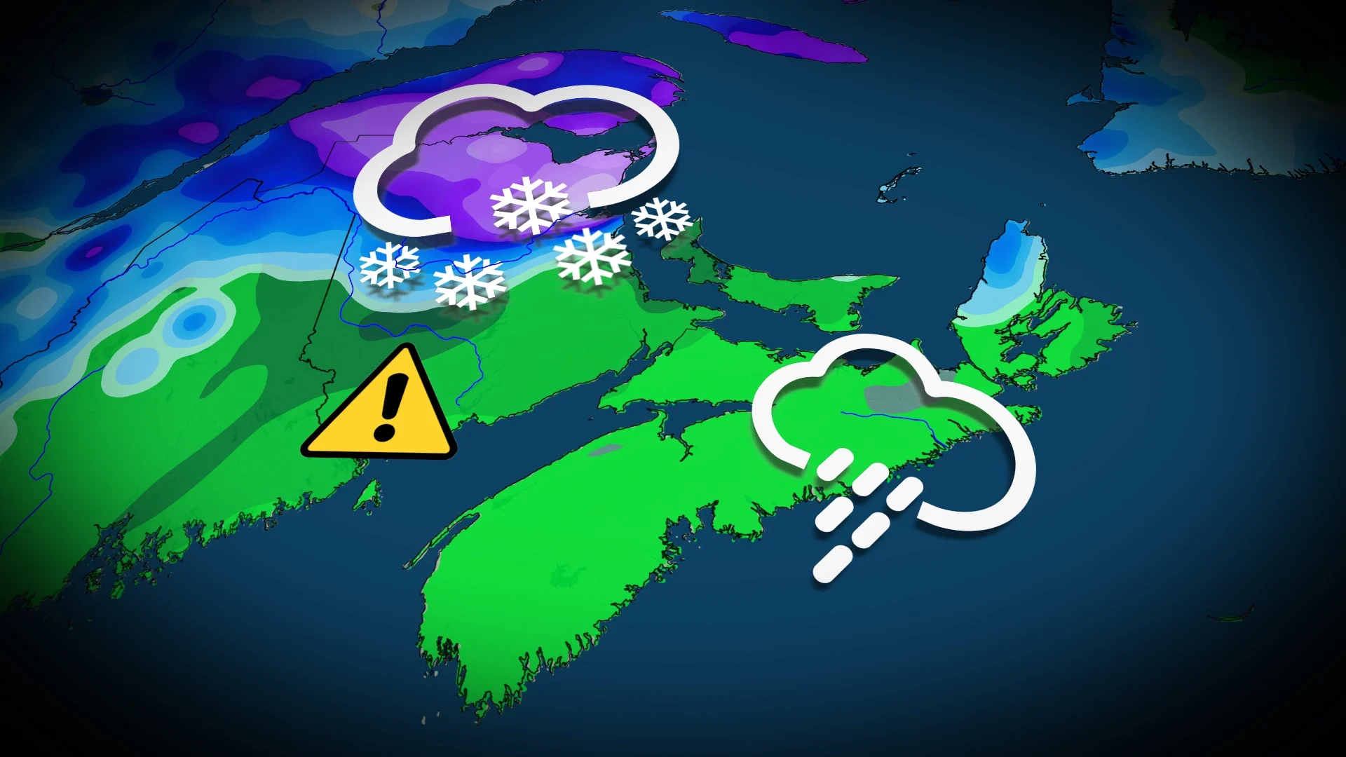
Another storm will quickly return to the region Tuesday, with colder weather accompanying it. The low will be smaller and faster, however, and will quickly move through Atlantic Canada.

Forecasters will be watching for significant snowfall to return to northern and central New Brunswick by Tuesday evening, and lasting through Wednesday. Heavy snowfall rates pick up Tuesday overnight before easing Wednesday afternoon.
SEE ALSO: A major polar vortex disruption is influencing Canada’s weather
Snowfall amounts of 10-25 cm are possible for areas surrounding Grand Falls, Campbellton and Miramichi, N.B.

Meanwhile, rain is expected in Fredericton and areas south, extending into P.E.I. and Nova Scotia. 10-25 mm of rain is expected in the southern and western parts of New Brunswick, in the heart of the Saint John River watershed.
Fortunately, the risk of flooding this year is low. With the upcoming rain, there is the chance for water levels to rise a bit, but most areas are in the clear with only the Gagetown monitoring station showing an advisory currently.

However, the water levels could creep up high enough to prompt a watch to be issued later this week. Other areas will inch close to the advisory level.
Northern sections of the Saint John River aren’t in the clear, yet, however, as there is still the risk of ice jams since ice is still present and there is still snow on the ground to melt, with more to come.
WATCH: The polar vortex is back, what does it mean for April?
Stay with The Weather Network for more forecast updates across the Maritimes.
