Nova Scotia in the path for a powerful winter storm, 30 cm possible for some

Major winter storm will slam Nova Scotia Thursday, with Halifax in line for 10-20+ cm of snow through Friday.
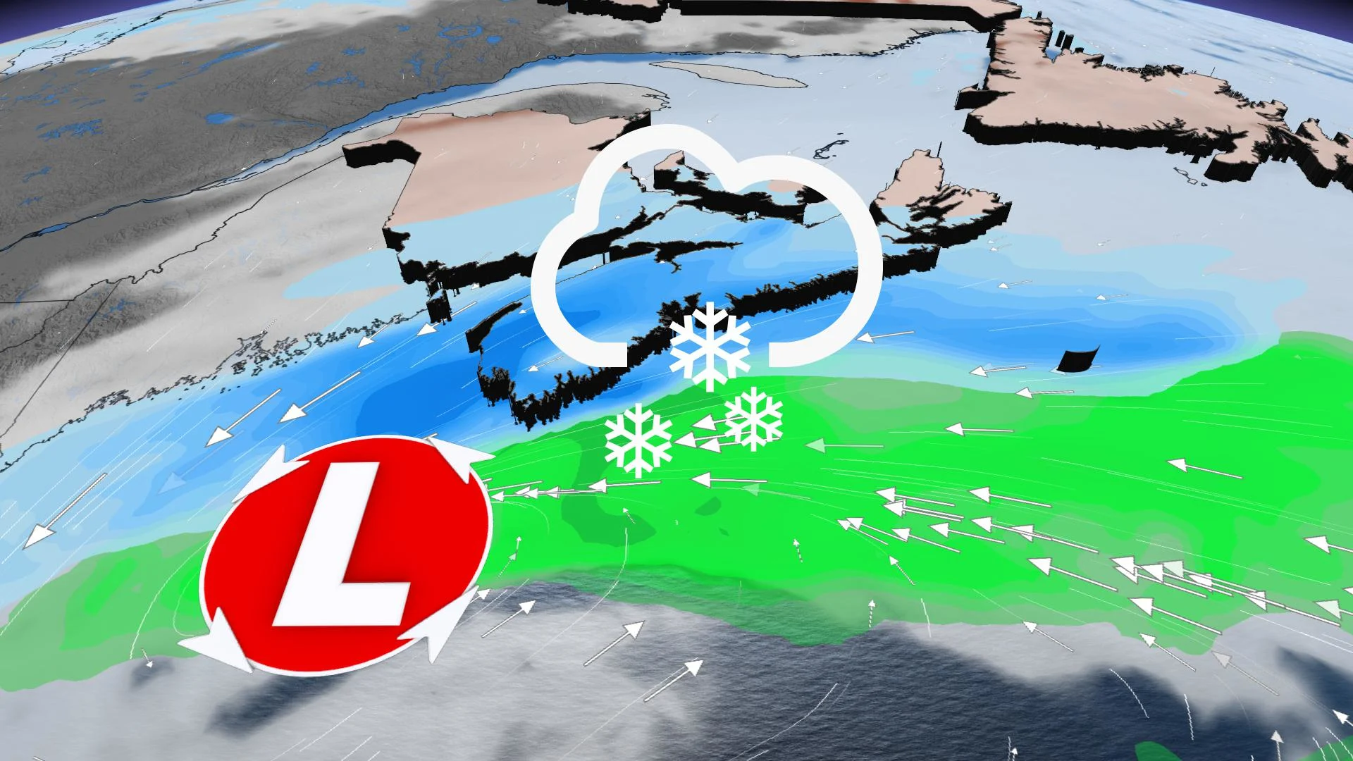
A powerful winter storm is bearing down on Nova Scotia, with snowfall amounts up to 30 cm possible for the western parts of the province, and hefty amounts for Halifax as well. The snow begins in the morning in Yarmouth, but the heaviest amounts reach Halifax by the afternoon and evening, and strong winds may make for blowing snow conditions and even more difficult travel. A closer look, below.
WEATHER HIGHLIGHTS:
Nor'easter pushes heavy snow into southern Nova Scotia Thursday, 15-30 cm forecast in some areas
Heaviest snow for western Nova Scotia, negligible amounts for New Brunswick
Stiff winds make for blowing snow
THURSDAY: NOVA SCOTIA BEARS THE BRUNT OF NEXT POTENT EAST COAST STORM
Unlike recent systems, the bulk of the snow will be targeted at Nova Scotia. The snow starts moving into the province's western tip in the morning hours, beginning around 8 a.m. for Yarmouth and gradually drifting to cover the majority of the province through the day.
By the late afternoon and early evening, the heaviest snowfall will reach Halifax and the surrounding areas, likely affecting the commute home.
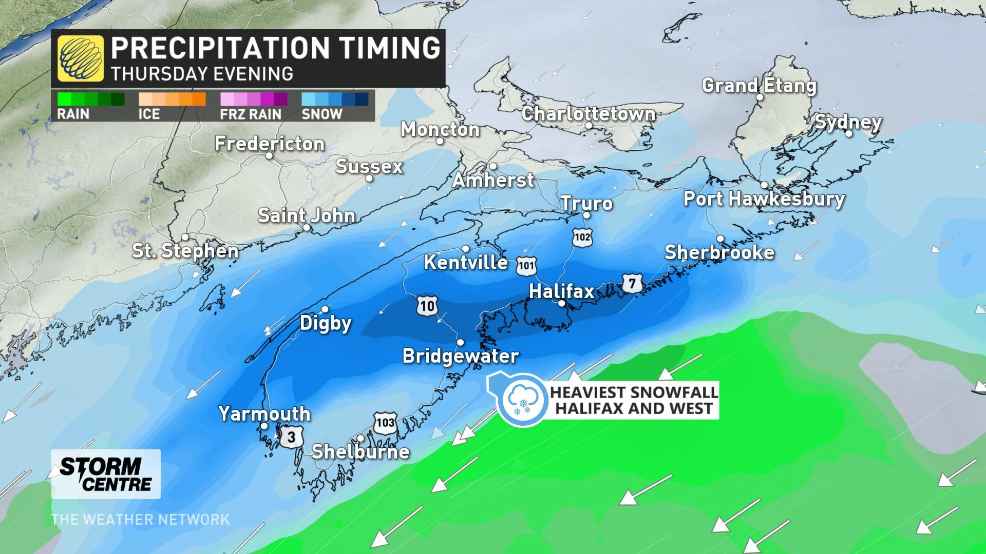
The snow will exit the province altogether overnight, and looks to remain as an all-snow event.
Western Nova Scotia up to Halifax will bear the brunt of the system, with some 15-20 cm possible for the capital, and as much as 30 cm for Yarmouth. Amounts drop off considerably east of those areas.
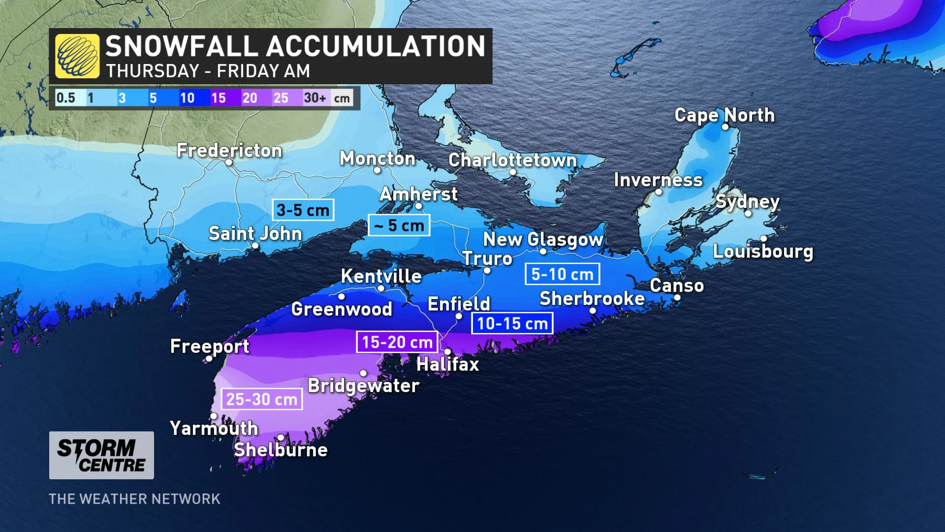
Southern New Brunswick's totals will be negligible, as will Prince Edward Island's.
Northeasterly winds will also be strong, intensifying in the afternoon and evening hours, with gusts of 40-70 km/h along coastal areas, making for periods of blowing snow.
BEYOND: FRIDAY FLURRIES, COLDER WEEKEND
The system looks to exit the region overnight, having minimal impact on Newfoundland, and leaving behind a few flurries here and there Friday, leading into a fair and cold weekend.
Beyond, the next week looks unsettled and milder, according to Weather Network meteorologist Dr. Doug Gillham.
"Well above-seasonal temperatures are expected for Christmas Eve and Christmas Day, with the potential for a significant storm to track across the region during Christmas and Boxing Day," Gillham says.
Be sure to check back for the latest updates on the active weather in your area.