Severe weather opportunity resumes on the Prairies with eastward shift
Folks in parts of Alberta and Saskatchewan will need to keep a close eye on the skies as thunderstorms will be possible once again, with the latter facing a chance of some cells reaching severe criteria
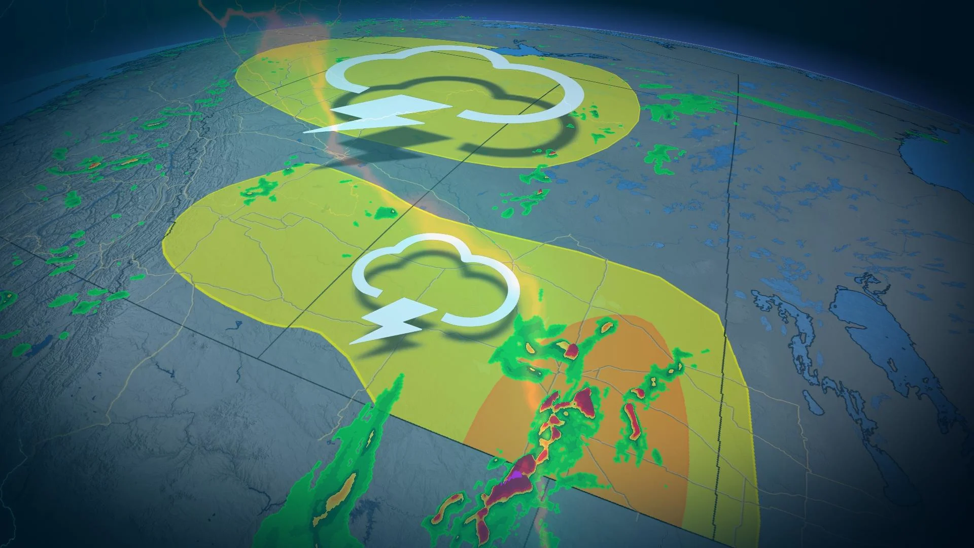
The Prairies are in the middle of a pattern favourable for thunderstorm development this week, particularly in Alberta and Saskatchewan.
Wednesday will see that threat shift east, with the focus of the strongest storm potential in southern Saskatchewan. So, those in the region will need to be prepared for severe weather in the afternoon and evening. Large hail, potent wind gusts and heavy downpours will be the main hazards where severe storms form.
MUST SEE: How severe weather alerts are issued, and potentially save lives
As well, there will be the risk of funnel clouds with thunderstorm development in parts of Alberta. So, it will be important to keep an eye on any watches and warnings that are issued, as conditions can change quickly when severe weather hits.
A brief shot of cooler temperatures will infiltrate the region by the end of the week, but the weekend will see a turnaround with warmth returning and having an extended stay into the the start of June.
Tuesday night and Wednesday: Thunderstorm risk moves eastwards
Thunderstorm activity will continue to rumble across southern Alberta throughout Tuesday, with gusty winds, large hail and frequent lighting being the highest risk factors.
By pre-dawn Wednesday, storm activity has decreased with some lingering storms across western Saskatchewan. The frontal system that will be the trigger for Wednesday.

The risk for severe storms shifts east into Saskatchewan as the risk for thunderstorms continues in Alberta thanks to a a swirling, upper trough across the province.
A storm will develop in south-central Saskatchewan, quickly developing into a cluster of storms. That initial period is where the greatest chance of severe weather will be, near the Regina and Estevan area.
Potential for funnel clouds across central Alberta with an upper trough among cold air aloft. These funnels typically develop during rapidly growing clouds. Fort McMurray, Alta., will be one of the communities that has a risk of funnel clouds.

There is still some uncertainty with the timing of the front, which could change the location of the severe risk.
The position of the surface front could change where the development of severe thunderstorms occurs.
Strong wind gusts and large hail are possible early on with the storms that develop, followed by a rain risk that will later emerge.

By Thursday, the risk of thunderstorms shifts east into Manitoba.
Rainy pattern for northern areas of the Prairies
A couple of low pressure systems will merge and impact northern areas of the Prairies mid-week, continuing through the weekend with widespread, substantial rain totals likely. That will include the more vulnerable areas, which desperately need the rain amid drought conditions.
A drier pattern is expected across southern areas during early June, but northern should continue to see some much-needed rain.
Be sure to check back on the latest forecast information across the Prairies this week