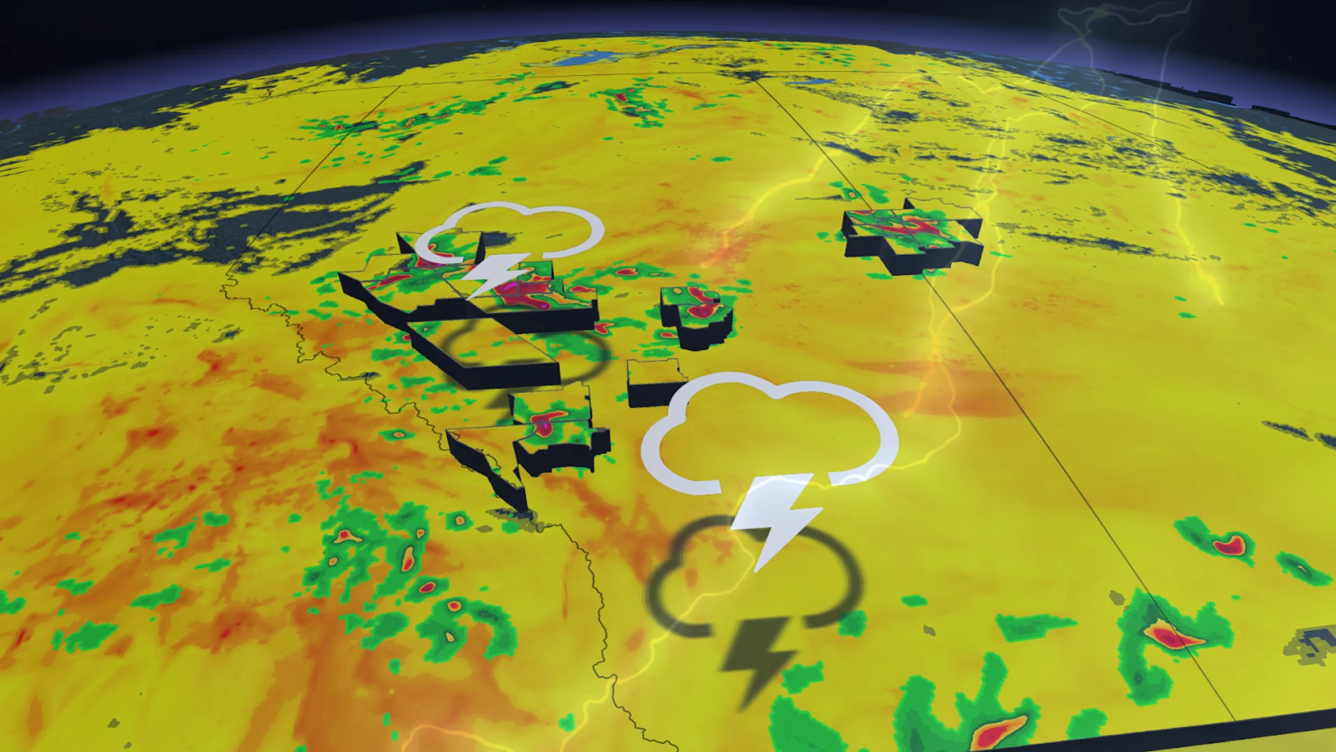
Multi-day, severe storm threat marks weekend in Alberta, Saskatchewan

Parts of the Prairies may see a weekend of active weather, with a multi-day risk of severe storms that could bring large hail, heavy rainfall and strong winds.
The threat for severe weather returns to Alberta and Saskatchewan this weekend after a brief reprieve to end the week.
The risk of severe thunderstorms will exist in parts of northern Alberta through Saturday, with the potential shifting east into parts of Saskatchewan through the overnight period. The threat will return to similar regions on Sunday.
Stay alert for rapidly changing conditions in your area, and be sure to keep up with the latest watches and warnings as you go about your day.
DON'T MISS: Summer of severe weather: Alberta a 'hot spot' for this year's biggest storms
Severe storms, significant rain possible in Alberta, Saskatchewan
A low-pressure system developing over central Alberta on Saturday will spark the development of scattered thunderstorms through the afternoon and into the evening hours.
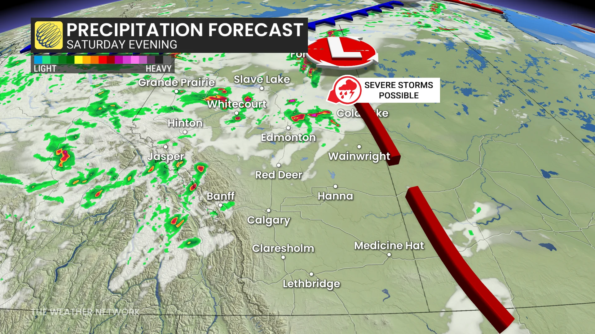
These storms will bubble up to the west of the low and move northeast through the day, a motion driven by the heat dome sitting stateside.
The main hazards will be large hail and heavy rainfall, with the threat transitioning over to damaging wind gusts as the thunderstorms organize into lines.
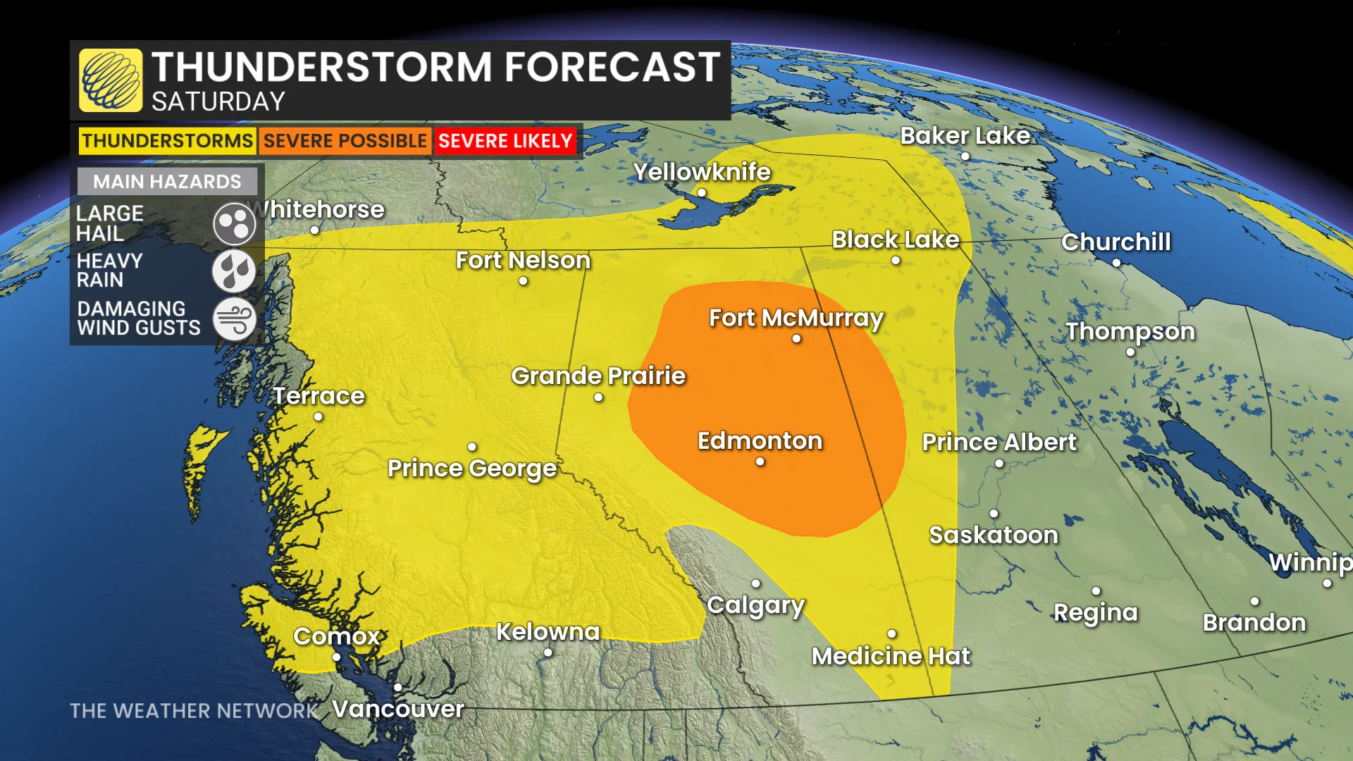
Localized flooding is also possible beneath some of the heavier storms, especially around Edmonton where we've already seen historic rains this summer.
Storm activity will continue into the overnight along the cold front north of Fort McMurray, eventually pushing east into Saskatchewan.
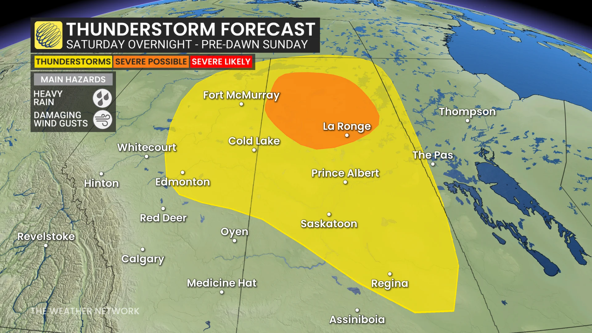
On Sunday, the low will stall over northern Saskatchewan from the early-morning hours to the afternoon period, bringing in another risk of severe thunderstorms.
The low will bring significant rain from Fort McMurray, Alta., to northeastern Saskatchewan--resulting in anywhere from 50 mm to 75+mm is through Sunday.
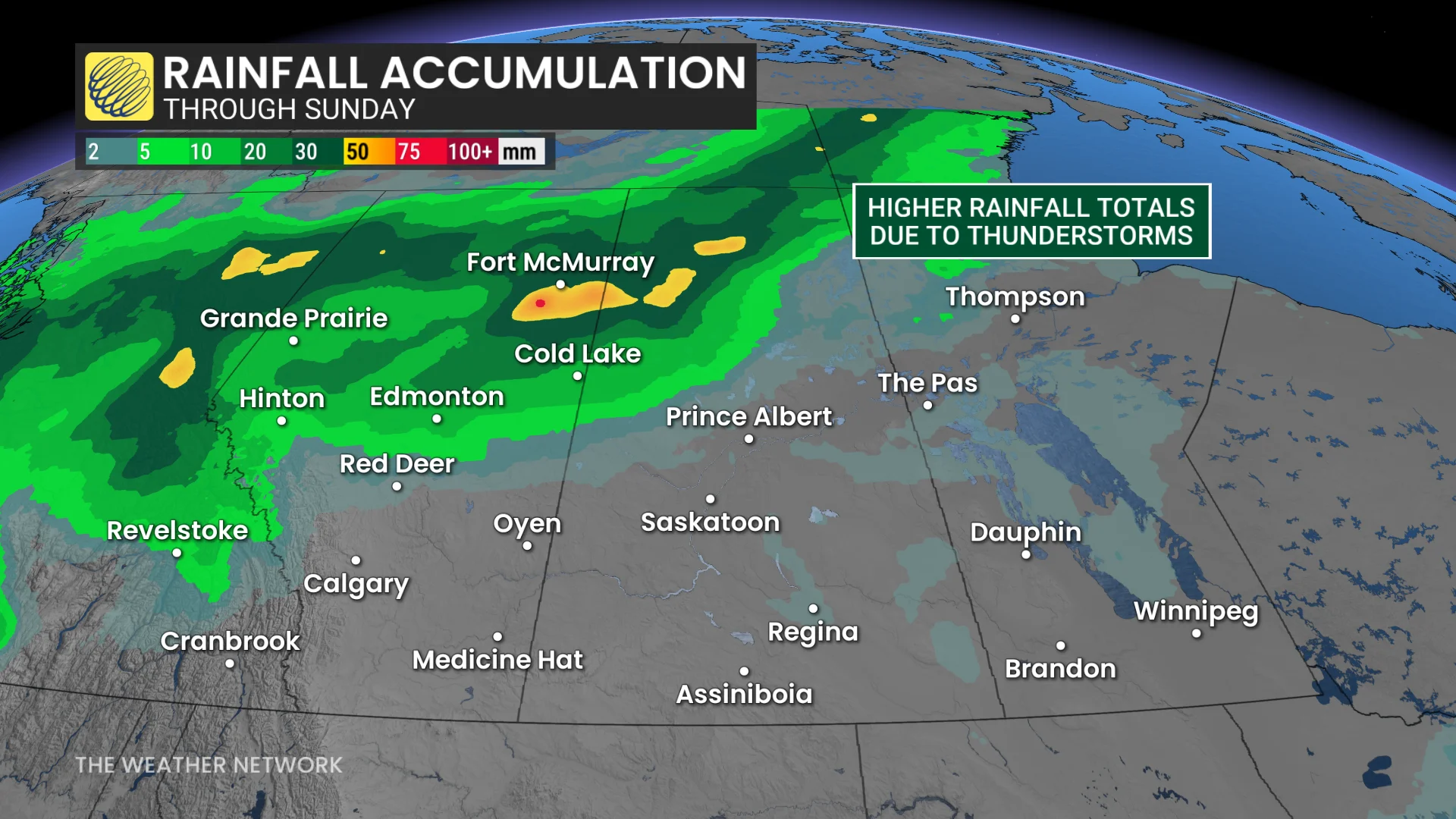
The significant amount of moisture on the northeastern Prairies will lead to higher rainfall totals.
High winds expected in southern Alberta on Saturday
Farther south, an inversion in the atmosphere will act as a cap that subdues thunderstorm development throughout much of southern Alberta.
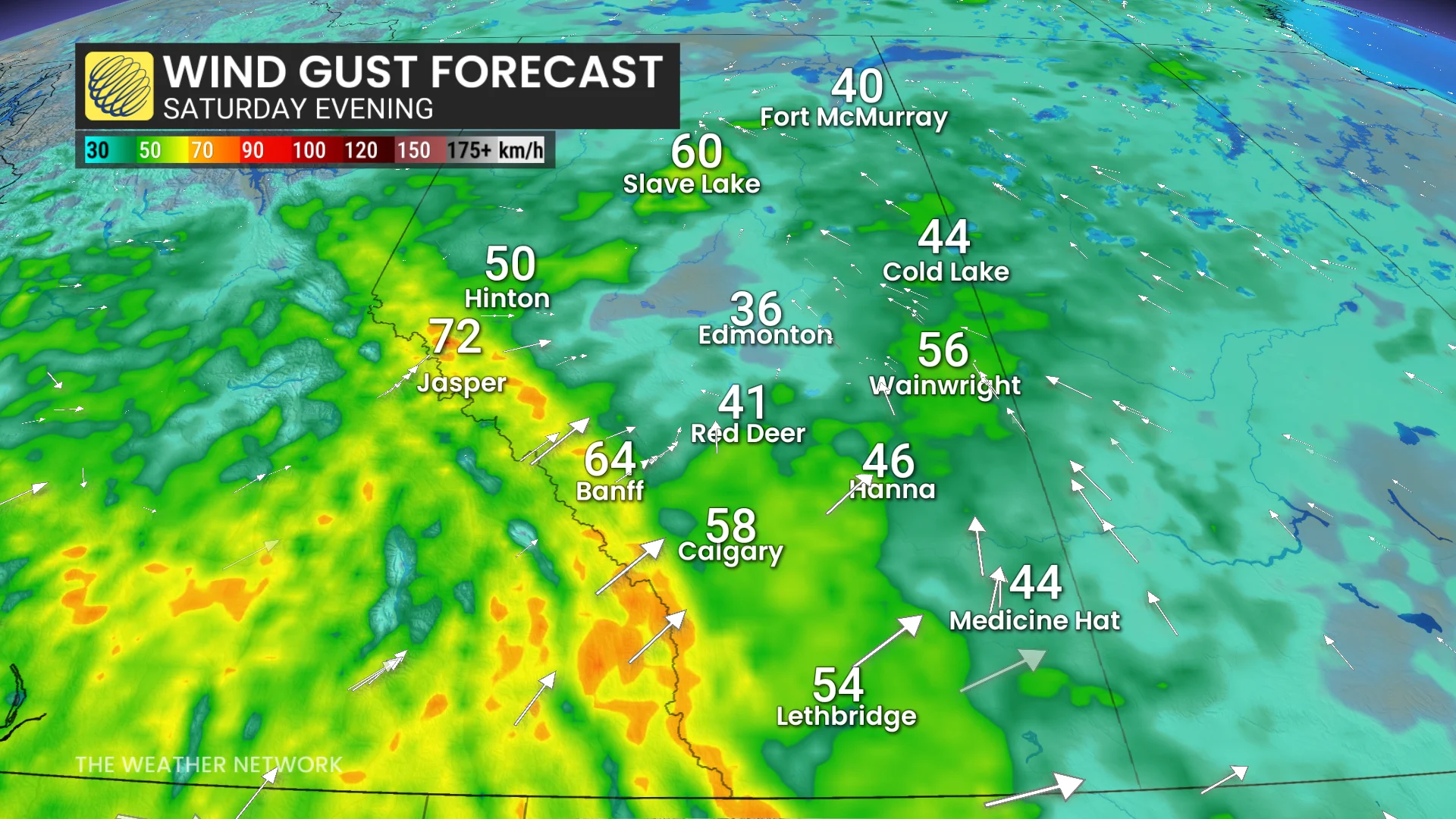
However, a strong air pressure gradient between a trough over B.C. and the stateside heat dome will generate strong, downsloping winds throughout much of the region.
Wind gusts up to 60-70 km/h are expected along the foothills and across southern Alberta. A secondary trough arriving Sunday will see winds shift around from the northwest, featuring even stronger gusts to 80-90 km/h through Sunday afternoon and into the evening.
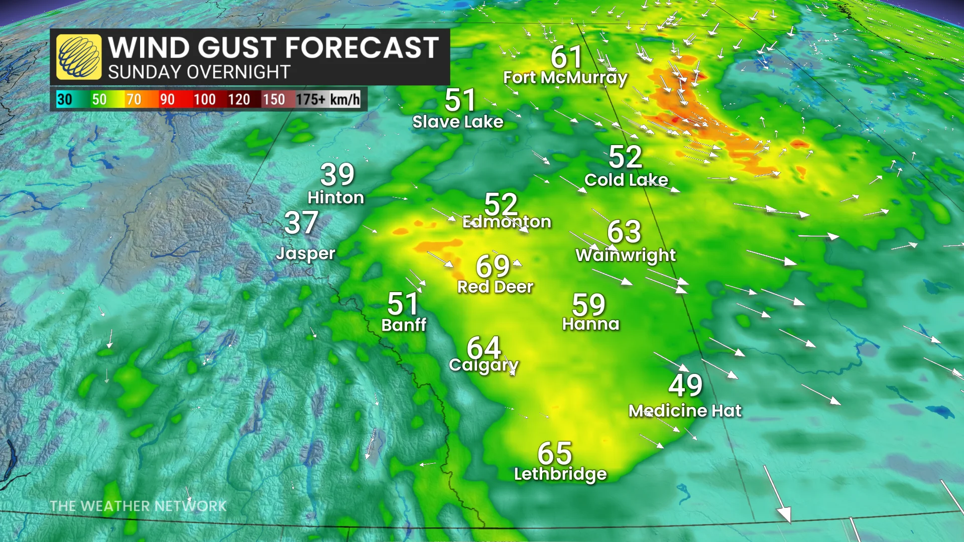
Additionally, the combination of relatively dry conditions, warm temperatures, and gusty winds will lead to an increased fire danger throughout southern Alberta this weekend.
Stay with The Weather Network for all the latest on conditions across Alberta.