Multi-day, messy event will spell trouble for East Coast travel and power
Atlantic Canada can't shake the winter weather, just yet, as a potent storm sets its sights on the region with a messy mix of rain, snow and howling wind gusts
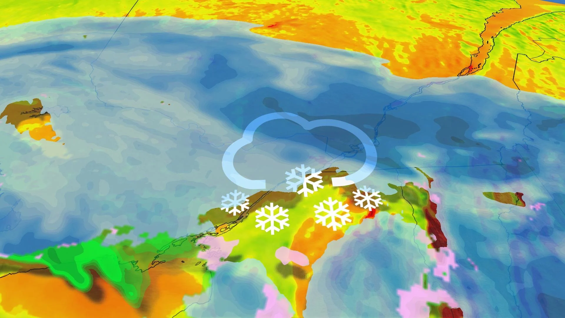
The Maritimes will be on the receiving end of a coastal storm that will pack quite a wallop as we get ready to enter the second half of the week.
The region will be dealing with plenty of wintry and spring weather, especially in New Brunswick and Nova Scotia. Snow, heavy rain and strong winds will be impactful.
DON'T MISS: Everything you need to know for April's spectacular and rare solar eclipse
Special weather statements are in place across the Maritimes, but snowfall warnings may be required as the storm draws closer. Travellers can expect slippery and poor road conditions, so modifying plans to avoid the worst of the impacts is recommended.
As well, blustery winds may cause power outages, so ensure your devices are charged.
Thursday and Friday: Snow, rain and strong winds will make for poor travel
A developing low-pressure system is expected to move into southwestern Nova Scotia Thursday morning, dumping heavy, wet snow over the region before lifting north into the rest of the Maritimes Thursday afternoon and evening.

As well, Nova Scotia’s southwestern coast and the Bay of Fundy will see a period of period of rainfall push in late Thursday.
This system will start off strong with heavy snowfall and increasingly blustery winds. Gusts could reach 70-80+ km/h throughout southwestern Nova Scotia before easing on Friday.
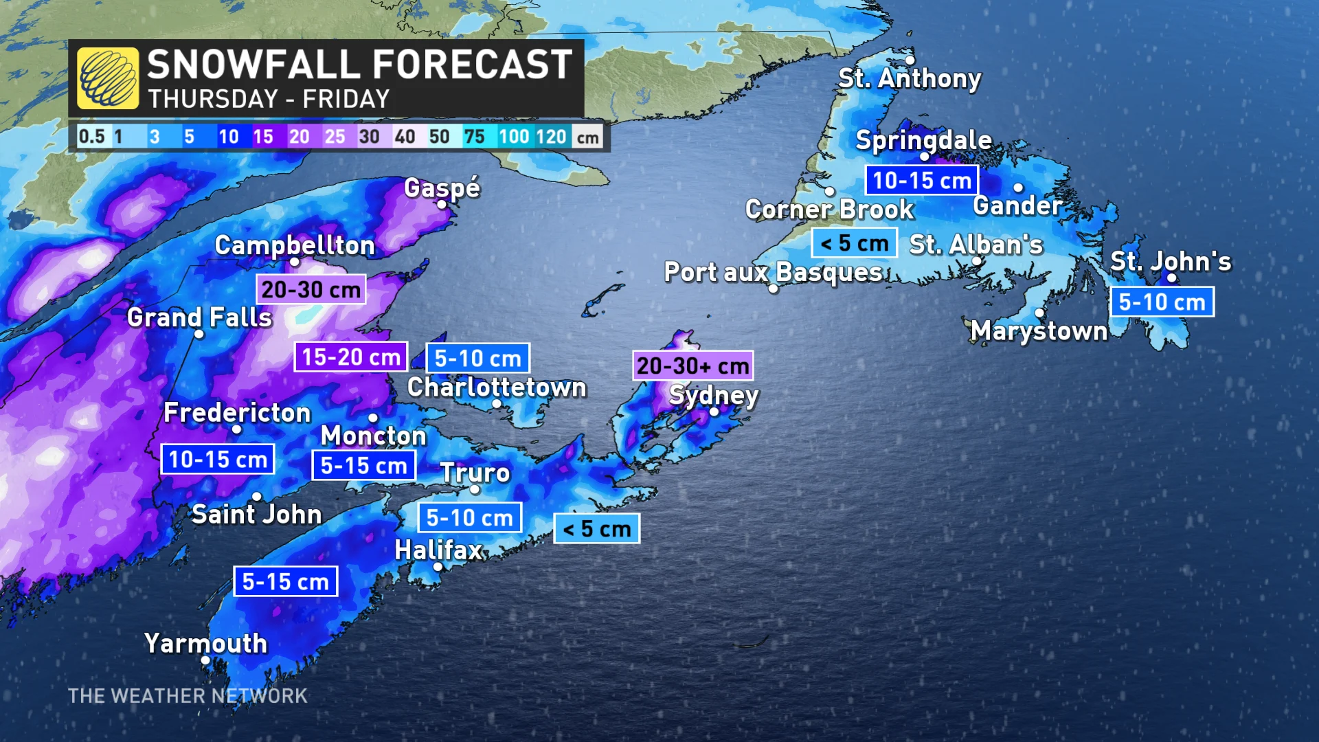
Folks living in areas of higher elevation can expect to see the most snow from this, as well as folks in northern New Brunswick.
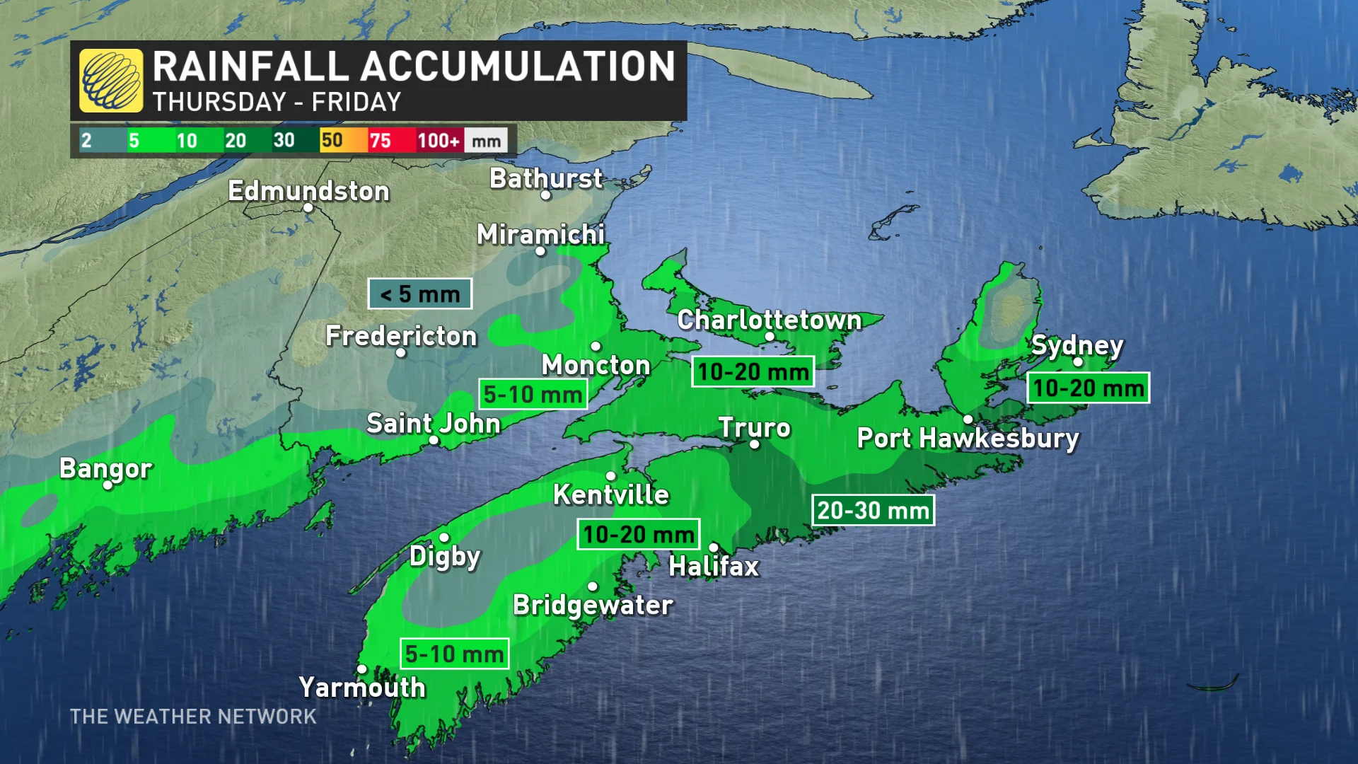
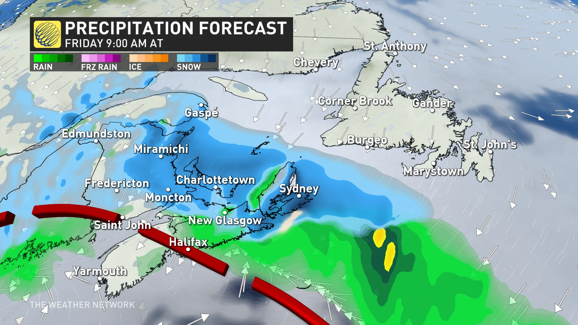
As the winds ease on Friday, a shifting storm track has the potential to let in some milder air and push some rain to Nova Scotia's south coast. Halifax will see rain while heavy snow persists in the eastern Maritimes.
Come Friday, also, snow will persist in P.E.I., New Brunswick, parts of Nova Scotia and southern Newfoundland, extending into Saturday as the system swirls and stalls over the region.
Total snowfall accumulations are still very uncertain at this time, however, due to the shifting storm track and milder air pushing in on Friday.
Folks can anticipate wintry travel conditions with this system on Thursday. Gusty winds and heavy snow will reduce visibility when driving, as well as make for some slick roads.
Due to the heavy nature of wet snow, localized power outages are possible as the weight of the snow and high winds puts pressure on power lines.
Conditions will remain chilly and unsettled behind this system as we head into the first weekend of April, with much warmer temperatures likely by the second weekend of the month.
Additional snowfall is coming through the weekend. Further totals are uncertain, but the snow will extend over most of New Brunswick, P.E.I. and southern Newfoundland.
Forecasters will continue to monitor conditions ahead of the total solar eclipse that’ll traverse the region on Monday, April 8.
Stay with The Weather Network for all the latest on conditions across Atlantic Canada.