Ripe recipe for severe weather in Ontario, Quebec means more storms possible
Wednesday will see a boosted severe weather threat in Ontario and Quebec, and it includes a tornado chance for parts of both provinces, so make sure you stay alert and weather-aware
Another day, another opportunity for severe weather arises in southern Ontario and Quebec on Wednesday.
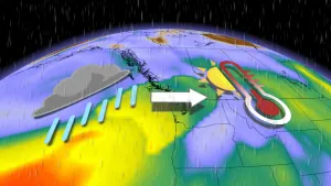
Arguably, Wednesday will feature the strongest thunderstorm risk ahead of and along a cold front that will be trailing a powerful low situated near Lake Superior.
DON’T MISS: Stuck in your car during a tornado? Here’s what you should do
The threat for severe weather on Wednesday will be raised, and will feature a tornado chance for central Ontario and along its border with Quebec. In addition, there could also be large hail, strong winds and heavy downpours.
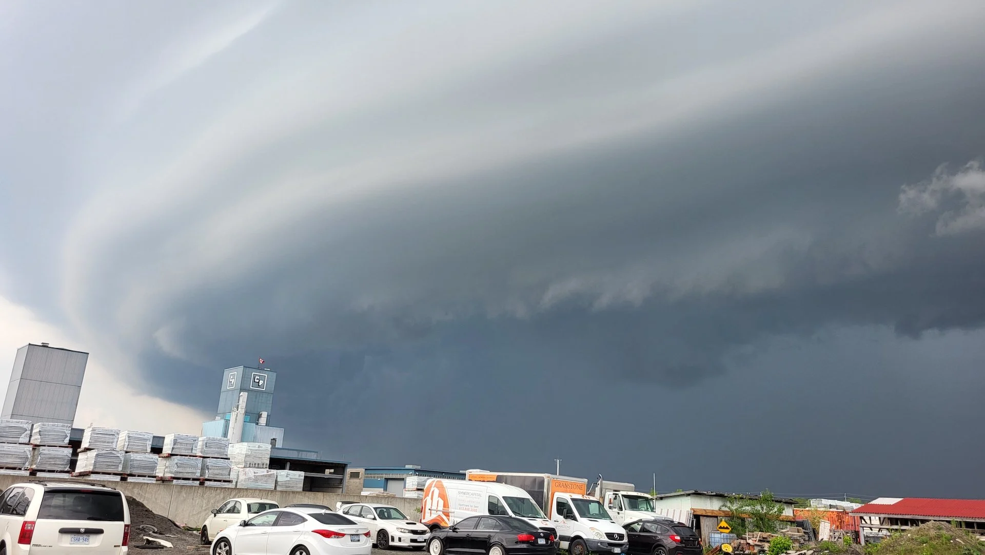
The renewed chance for severe storms comes after Tuesday's affair that yielded numerous warnings for parts of Ontario, along with stunning visuals of shelf clouds in the Ottawa region.
Stay close to safe shelter if you’re planning to spend time outdoors. If you’re close enough to hear thunder, you’re close enough to be struck by lightning.
Wednesday sees greater potential for severe storms
Temperatures in the upper 20s with high humidex values, in conjunction with a cold-front moving in from the states and low pressure over Lake Superior, will support the risk for severe thunderstorms across southern Ontario and Quebec on Wednesday.

MUST SEE: How severe weather alerts are issued, and potentially save lives
The timing of the cold front’s passage, as well as lingering storm activity from Tuesday, will dictate the severe thunderstorm potential across the region.
The main threats from these storms will be large hail up to toonie-sized, heavy rainfall, and strong wind gusts up to 100 km/h. Folks could be seeing these conditions last into the evening hours on Wednesday.

While it is low, a tornado chance also exists in central Ontario and along the Ontario and Quebec border, stretching from Temiskaming Shores, Ont., to Val-d’Or, Que.
There is a chance for storms to move through the Greater Toronto Area (GTA), but they will be more isolated and may contain strong wind gusts and heavy downpours.
There is a lot of uncertainty if any storms will develop in the GTA, but if they do, they will be strong. The location of the worst storms is dependent on the timing that the cold front moves through. A faster speed places the stronger storms closer to or in the eastern sections.

Rest assured, though, as forecasters are keeping a close eye on this risk throughout the day.
It’s always a good idea to have a safety plan in place for severe weather. Make sure you have a way to receive severe weather warnings the moment they’re issued, especially at night.

Temperatures and humidity levels will both tumble behind the cold front, allowing more seasonable air to spill over the region heading into the end of the week.
Thumbnail courtesy of Hussein D./X, taken in Ottawa, Ont.
Stay with The Weather Network for all the latest on your forecast across Ontario and Quebec.