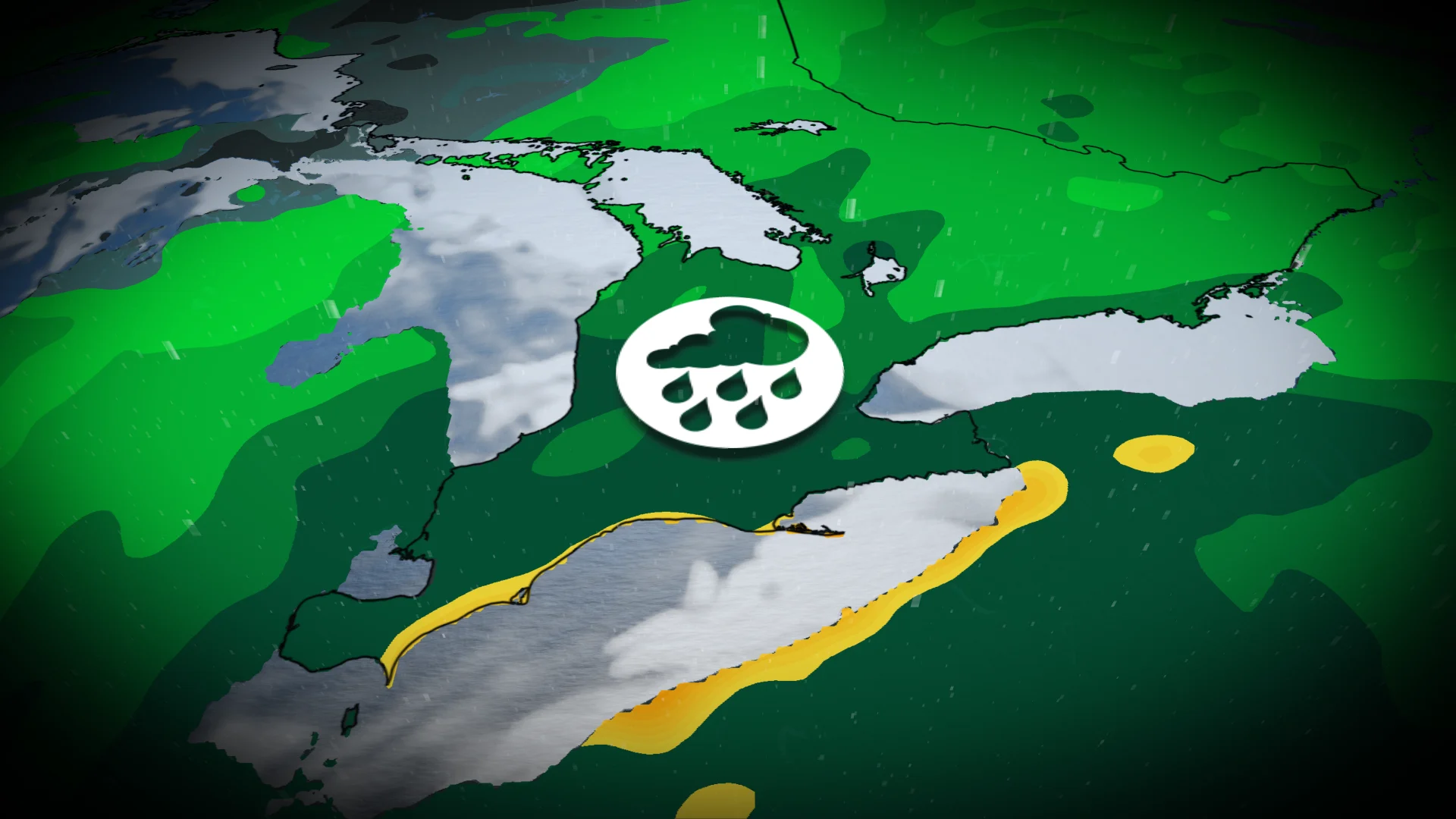
Muggy air, stormy skies continue to dampen Ontario into the weekend

Warm, humid, and unsettled conditions are expected in Ontario as we head into the weekend
A multi-day thunderstorm threat continues throughout Ontario heading into the weekend, with humidex values surpassing 30 before cooler, more seasonal air arrives next week.
Some forecast uncertainty remains, particularly with storm severity and locations impacted. Be sure to stay up-to-date on any changing conditions and weather alerts in your area.
RELATED: How to flood-proof your home, basements
Friday: Widespread rains dampen southern, northeastern Ontario
Widespread rainfall, at times heavy or even torrential, is possible through Friday early afternoon in areas including London, Hamilton, Niagara, and parts of the western Greater Toronto Area (GTA). This rain can exacerbate flood-related issues for areas still grappling with unprecedented floods from last week.
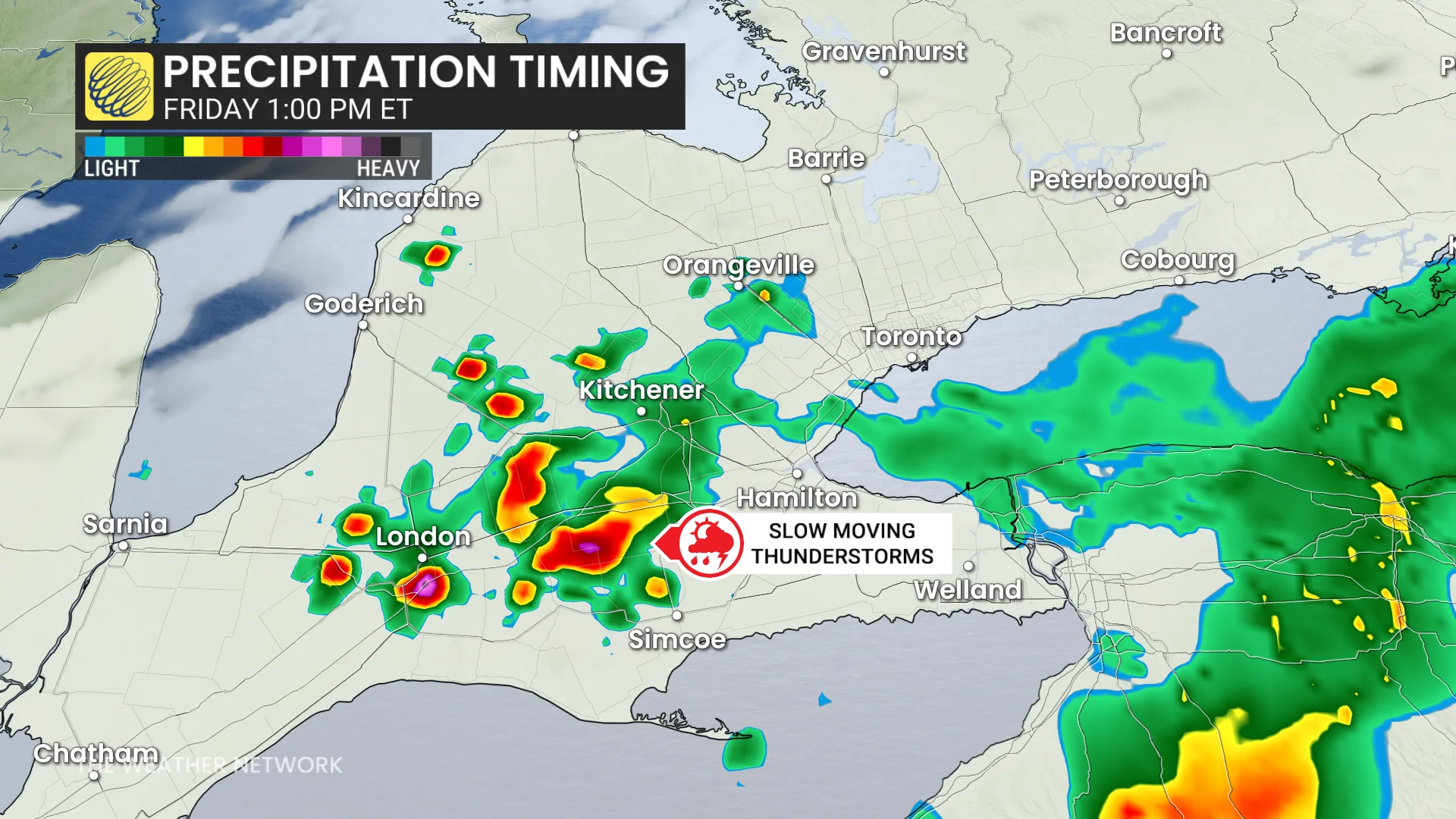
Thunderstorms were slow-moving early in the morning, dropping over 60 mm of rain over London by 10 a.m. ET.
While drier conditions may occur by early Friday evening for southern Ontario, a renewed risk of storms is possible later in the night for southwestern regions. These storms will be very scattered along lake breezes.
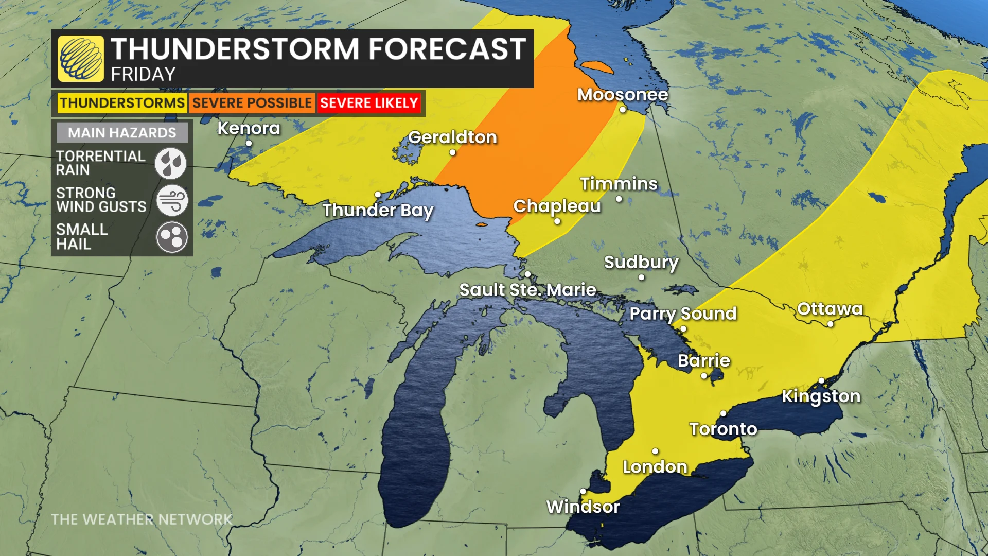
Meanwhile, a low-pressure system farther north will lead to a risk for severe storms in northeastern Ontario during the afternoon and evening hours. Strong wind gusts will be the primary concern here.
Saturday: Strong low with additional thunderstorm risk
Higher uncertainty exists surrounding Saturday's storm risk. Some heavy rain will track east through the GTA on Saturday morning. This area of precipitation may evolve into strong to severe thunderstorms as it approaches Kingston and Ottawa.
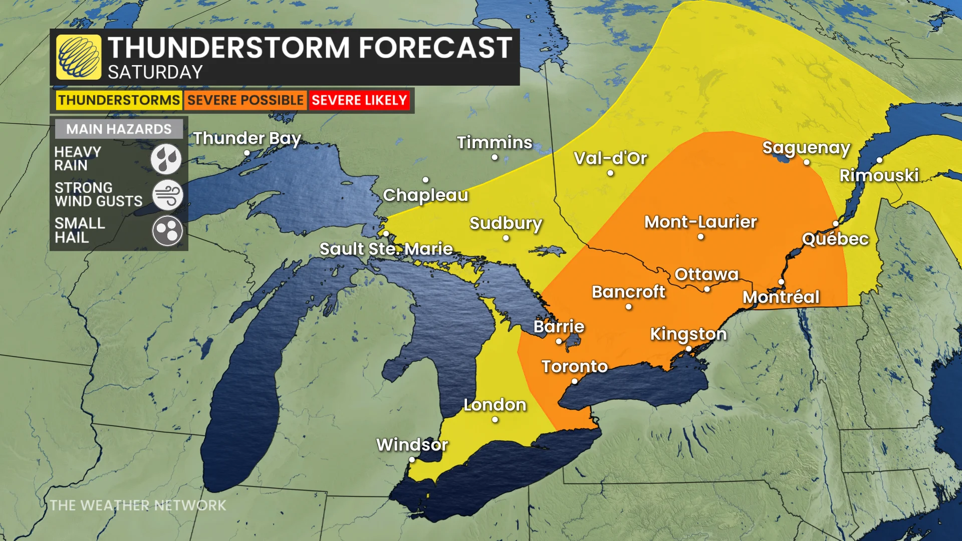
This system may carry upper-level wildfire smoke from British Columbia and Washington state, adding to the complexity of the forecast.
Stay tuned for updates as higher-than-average forecast uncertainty remains, particularly with storm severity and locations impacted.
WATCH: Three tips to protect against flooded basement damage
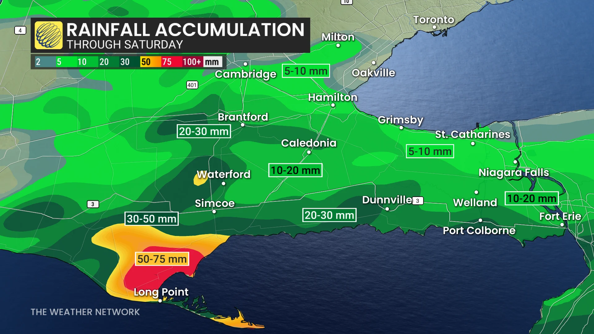
More rain comes to Niagara after damaging floods earlier in the week
Between July 27 and Aug. 3, the city of St. Catharines received over 250 mm of rainfall--and that was just from two storms! This caused widespread damage and flooding to thousands of homes, prompting the city to declare a state of emergency and seek provincial and federal aid.
For good reason, many locals have been on edge about what the next rainfall will bring.
Current forecast models are predicting the bulk of Friday and Saturday's rainfall will stay south near Lake Erie, but we could see some locally heavy showers spill north.
An August cooldown is coming
Next week will begin with near-seasonal temperatures before trending cooler by mid-to-late week. Below-seasonal temperatures are expected to persist through the weekend and into the third week of August.
DON'T MISS: Canada’s August outlook holds shifting heat and wildfire concerns
While a few rounds of showers and thunderstorms are likely, significant rainfall totals are not anticipated.
WATCH: Toronto's largest new park in a generation has been unveiled
Stay with The Weather Network for the latest updates on your weather in Ontario.