Much-needed rain coming to B.C. as pattern change on the horizon
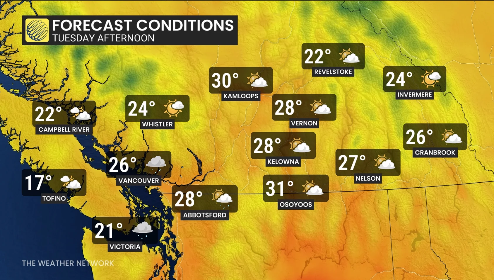
A significant pattern change is on the way for British Columbia, bringing an end to the warmer temperatures. The province can expect to see rain, the risk of thunderstorms, and the potential for snow at higher elevations this week
It’s been an exceptional dry streak across southern British Columbia over the past several weeks, with expanding drought conditions and higher fire danger risks.
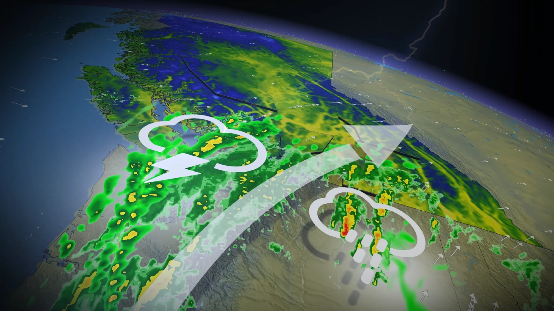
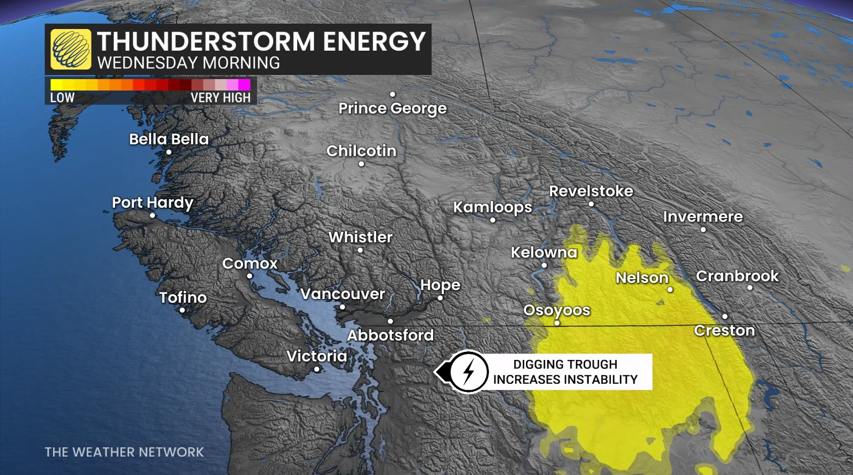
On Tuesday night, a trough approaches the coast, destabilizing the atmosphere and increasing the risk of a couple of scattered thunderstorms for the South Coast.
RELATED: Lawn-watering ban starts May 1 in Metro Vancouver, lasts through summer
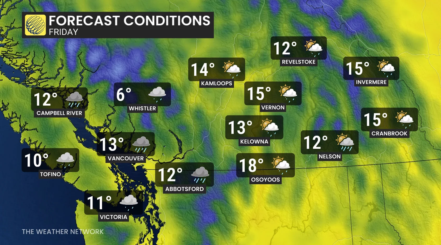
The good news is that an extended stretch of much cooler weather is likely starting Wednesday, along with showers and embedded thunderstorms.
Needed rain and thunderstorm threat this week amid warmth
By Wednesday afternoon, a pocket of below-seasonal temperatures develops in the southern Interior under a period of heavy showers and embedded thunderstorms.
By Thursday and Friday, the freezing level falls to below 2000 metres across the bulk of the south, meaning the province's high-elevation travel routes will be subjected to wet snow.
With a southerly flow and cooler air aloft, thunderstorm and shower chances increase as storms move up from Washington state later Tuesday evening.
The storm and shower motion will funnel much-needed moisture into B.C.’s parched Interior, with limited showers and less sustained rain for the South Coast.
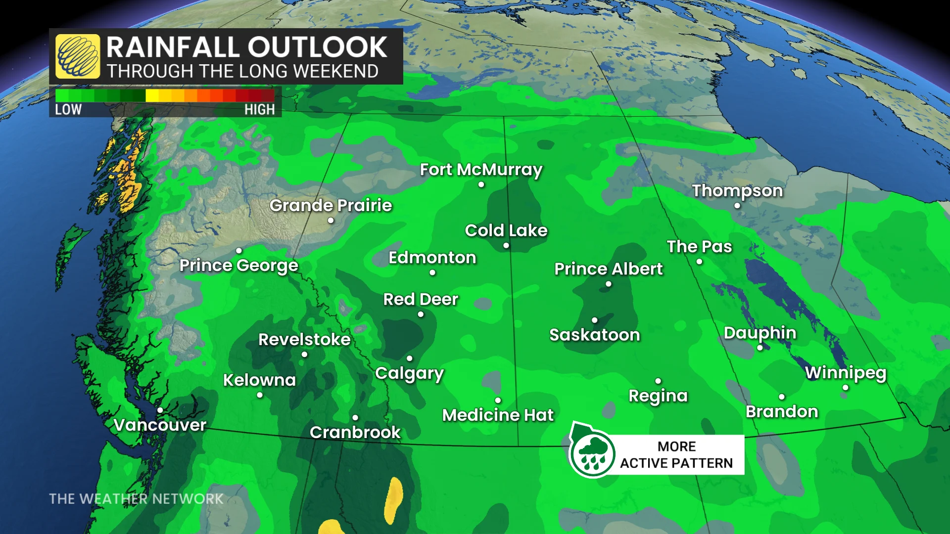
Totals of 10-20 mm of rainfall is expected for most of the Okanagan and southern Interior. It’s possible that Kamloops may see more precipitation over the next couple of days than it has received over the entire year to date.
Kamloops has seen 19.7 mm of precipitation through May 11, with a projected 10-20 mm of rainfall forecast from Wednesday to Thursday.
Long-range snow
Some of the higher, coastal mountain peaks will be subjected to more than 10 cm of snowfall before heading into the long weekend.
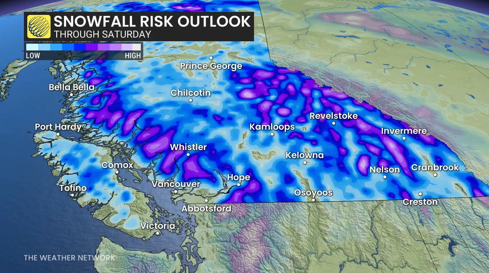
The Columbia and Rocky Mountains are forecast to accumulate some snowfall in a couple waves on Friday, and particularly into the weekend, so be aware for the potential for the forecast to shift during the coming days.
Cooler-than-seasonal temperatures will dominate through the long weekend and most of next week.
Widespread showers are likely on Saturday, especially for the Interior. Another system tracking onto the Central Coast could bring a threat for showers to the South Coast next Monday. A drier pattern is expected to return for late May.
Stay with The Weather Network for all the latest on conditions across British Columbia.