Rain and winds end the week in southern Ontario, with a looming frost threat
A rainy and mild end to the work week in southern Ontario, with improvements expected as we roll through the weekend, but a noticeable cooldown is on the way for Sunday
It won't be a pleasant end to the work week in southern Ontario, but there is some hope for a turnaround in time for the weekend for most areas.
The warmth we will see to conclude the week will come with a rainy and windy price Thursday, but it won't be a washout by any means. But, you will need to hold on to your hat if you're taking a stroll down by the lake.
RELATED: Canada's 2023 winter sneak peek - What El Niño means for our upcoming season
A secondary system that looked to be bringing more rainfall to the Great Lakes region this weekend may end up keeping a safe distance stateside, so no need to cancel those outdoor plans.
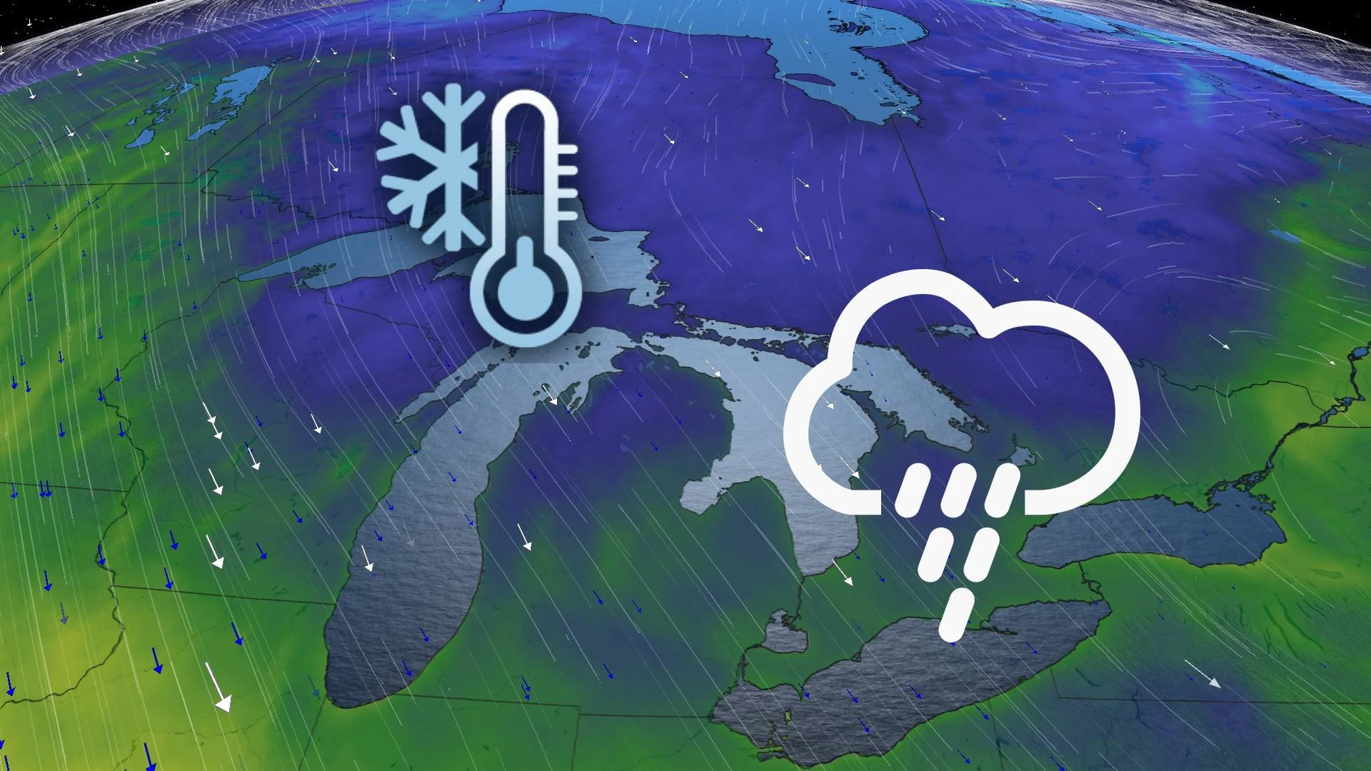
While we may luck out on escaping another round of rainfall, we won't avoid the looming cooldown come Sunday -- dropping to single-digit highs in many areas, with a widespread frost threat for Sunday night and Monday morning.
Thursday - Friday
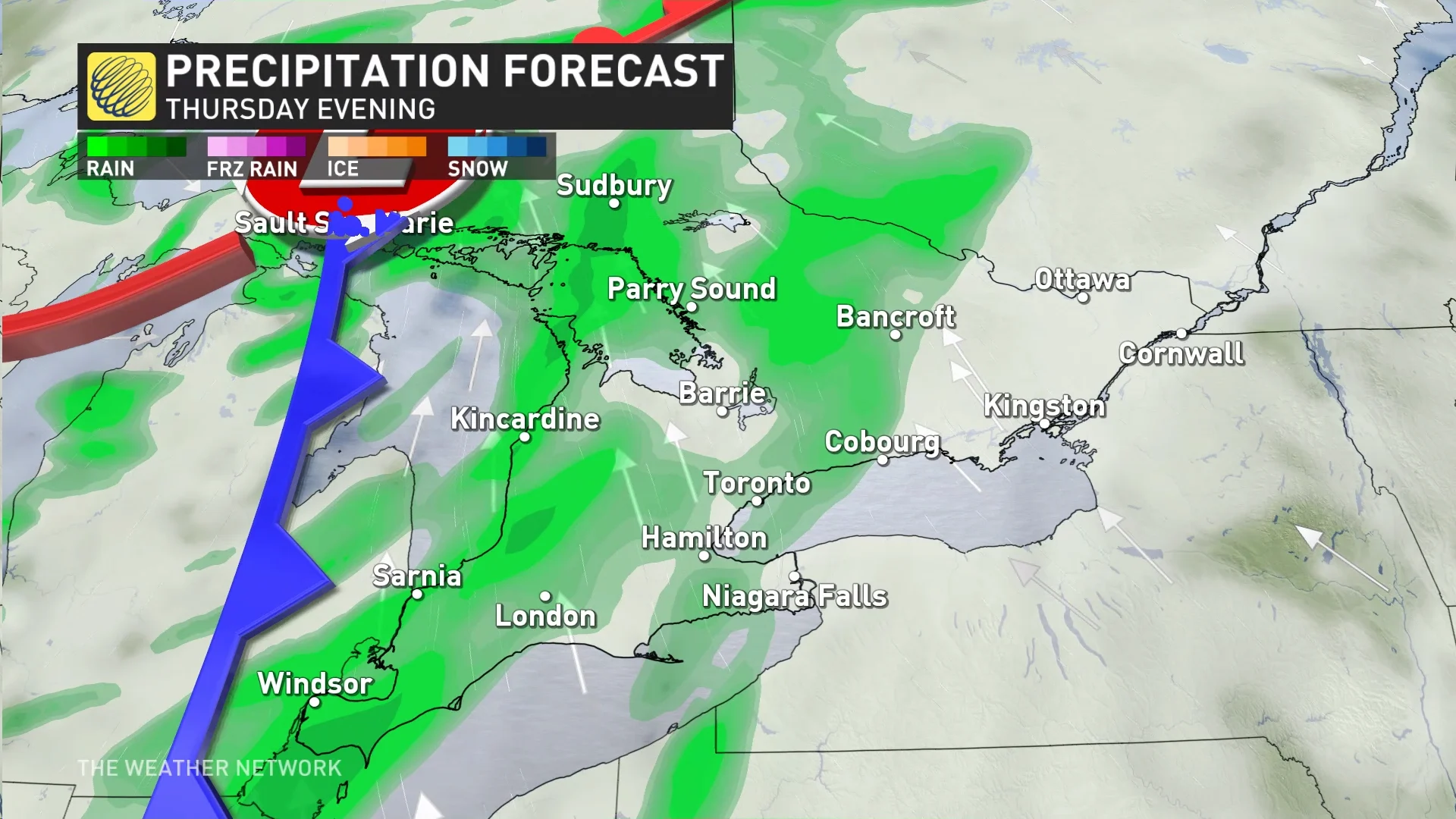
An Alberta clipper will track into southern Ontario for Thursday. The rain starts through the morning for southwestern areas before reaching the Greater Toronto Area (GTA) through the evening, lingering into Friday morning as it spreads the eastward.
SEE ALSO: How to trick you brain into feeling happy on this gloomy day
In addition to the rain, people will have to contend with the winds.
People can expect gusts between 30 and 50 km/h, with some lakeshore areas exceeding 50 km/h.

Saturday - Sunday
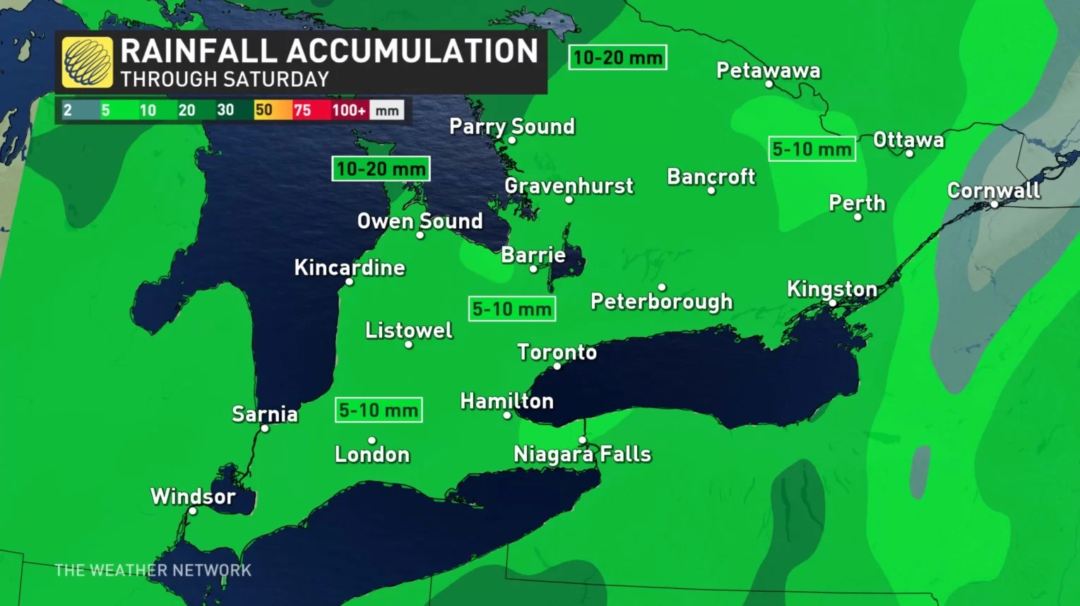
By Saturday, there will still be some lingering rain across eastern Ontario as a secondary clipper tracks towards the Great Lakes. At this point, however, the track of this system looks to remain stateside, with rain showers missing the southwest.
Despite being a few days away, there is still a chance for the track to change slightly. Regardless, cloud cover will linger on Sunday, with some sun poking through here and there.
Sunday will be a chilly one, with northwesterly winds funneling behind the clipper. We may reach only single digit highs, something Toronto has not recorded before since May 2 -- over four months ago. With the cooldown comes a widespread frost threat for Sunday night and into Monday morning.
A few days of warmer weather are forecast for the middle of or late next week, with temperatures reaching the mid-to-upper teens. Then, an active pattern is expected for the final days of October and into early November.
WATCH | Don’t let rainy, dreary days get you down; try this instead
Stay tuned to The Weather Network for the latest forecast updates in Ontario.