Rain, snow, ice creep into potentially intense weekend forecast in Ontario

As the forecast becomes clearer, the weekend looks to be a messy one for much of Ontario.
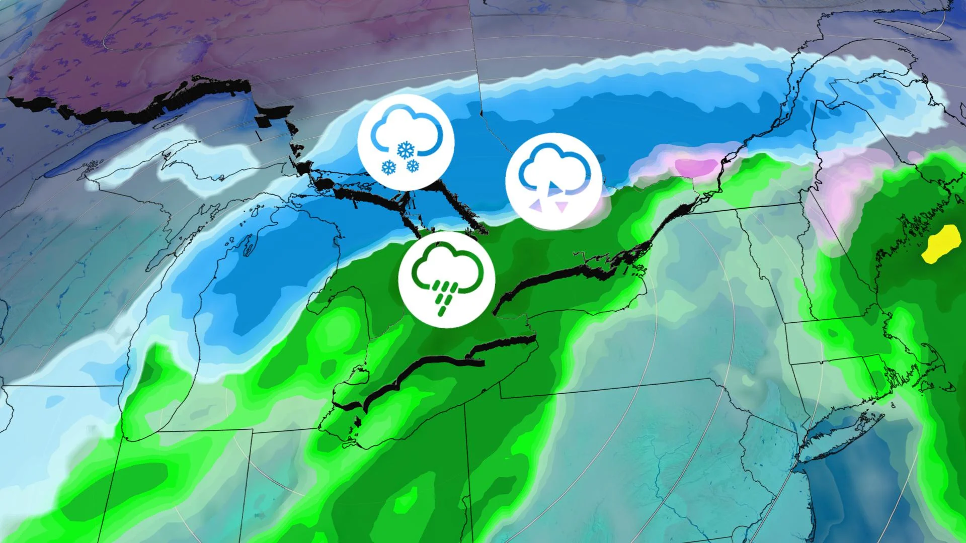
Though the effects of an incoming weekend system are not set in stone, forecasters do expect them to be messy, with heavy rain, snow and ice all potentially on the menu, varying depending on the storm's final track. At the moment, forecasters expect an extended period of snow for areas north of the GTA toward cottage country, with some ice mixed in, while much of the rest of the south may be in line for a steady, drenching rain for much of Saturday. More on the weekend storm set-up, plus a warmer pattern that takes us into Christmas, below.
WEATHER HIGHLIGHTS:
Temperatures remain mild across the south through Friday, snow in the north will have ended by the morning
Periods of snow, freezing rain and ice pellets threaten parts of Saturday, more significant impacts north of the GTA
General lack of cooler temperatures in the lead up to Christmas
Visit our Complete Guide to Winter 2021 for an in depth look at the Winter Forecast, Canada's ski season, and tips to plan for everything ahead!
WEEKEND: MESSY STORM SYSTEM THAT BRINGS RAIN, SNOW AND ICE
A low pressure system will develop over the southern U.S., intensifying as it tracks into southern Ontario on Saturday.
Widespread heavy rain and very mild temperatures are expected for southern Ontario, with the steadiest of it falling through the afternoon and evening hours.

Before the rain however, a period of snow or freezing rain threatens northern sections of the GTA from Orangeville to Barrie, with an extended period of snow and ice likely into northern cottage country as well.
The heaviest snow looks to target parts of the Nickel Belt, upper Ottawa Valley and then extending east to Quebec City, with the threat for widespread totals of 15-25++ cm in those regions. Snow totals, however, will be highly dependent on the storm track, which may shift as the event gets closer.

BEYOND: CONDITIONS LINGER INTO EARLY NEXT WEEK, NO REAL COOLDOWN AHEAD
Blustery and more seasonal conditions are expected behind this storm in southern Ontario, with gusty winds and lake-effect snow developing Sunday and continuing into early next week.
"Near seasonal temperatures are expected for most of next week," says Weather Network meteorologist Dr. Doug Gillham. "However, at this point, it looks like above seasonal temperatures could return to our region for the week leading up to Christmas."
According to Gillham, there are no extended periods of cold weather are in sight.
Be sure to check back for the latest weather in your area.


