Messy but nicely above seasonal Christmas for Quebec

Christmas in Quebec will feature rain, rather than snow, and crowned with potentially record-breaking warmth.
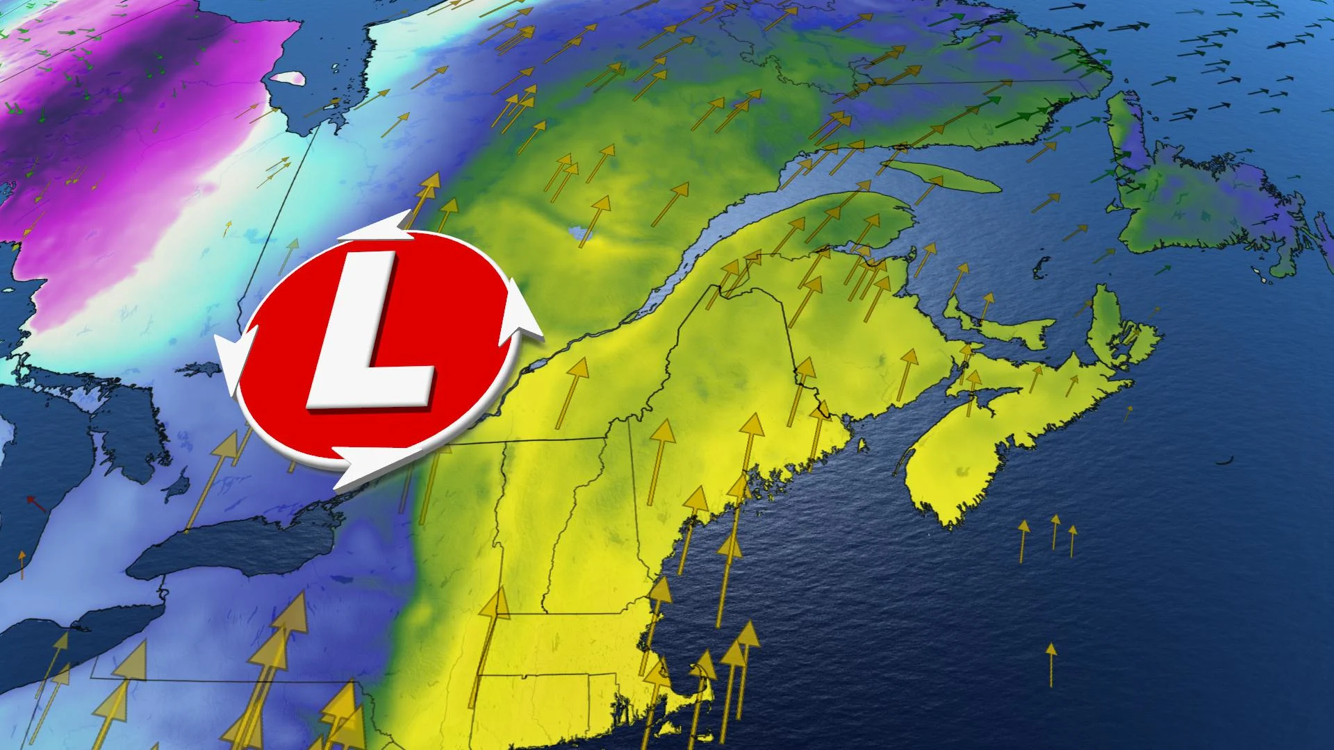
Christmas won't be too calm in southern Quebec, weatherwise, due to an incoming storm that will bring quite a bit of rain, though marked by southerly flow that will make for milder-than-seasonal temperatures as well. In all, some 20-50 mm of rain is expected, beginning Thursday, continuing overnight into Christmas morning, though falling temperatures will follow this system.
WEATHER HIGHLIGHTS
Rain spreads across Quebec Thursday afternoon through to Friday
Above-seasonal daytime highs Thursday and Friday
Brief shot of snow as temperatures drop later Friday
Dreaming of a snowy festive season? Click here to find out if your holiday wishes will come true!
WEDNESDAY TO THURSDAY: SCATTERED FLURRIES, THEN HEAVY RAIN STARTS
While Wednesday could see a sprinkling of scattered flurries or light snow here and there, it genuinely won't be anything remarkable compared to what's ahead for Thursday.
A low-pressure system will begin impacting the province Thursday, with rain beginning by the afternoon for many places, gradually intensifying into the overnight through to Friday morning.

In all, some 20-50 mm of rain will be possible by Friday morning, heaviest north of the St. Lawrence, though weather forecast models are still fine-tuning expected amounts.
Note that that will be largely rain, rather than snow, as a strong southerly flow will bring mild, above-zero temperatures alongside this storm, lasting into Friday.
FRIDAY: SHOT AT RECORD-BREAKING CHRISTMAS WARMTH
As for Friday, anyone hoping for even a slightly white Christmas will likely get the complete opposite, as that warmth sticks around for at least part of the day.
Cooler air will follow on the heels of this storm, but not before daytime highs that come very close to reaching record levels. That chill will reach Montreal sooner than Quebec City, giving the latter time to rise through the day, such that its forecast maximum of 9°C is a whisker above its current record for Christmas Day, a reading of 8.3°C set back in 1964.
Forecasters are also watching for a period of brief freezing rain to set up Friday as rain is expected to transition over to snow later in the day. This may impacts areas along the Ottawa Valley and through the Montreal area, as well.

Even more peculiar: Due to the atmospheric setup on Christmas morning, Quebec may actually be a few degrees warmer than parts of Florida, whose panhandle and northern edge will be flirting with the zero-degree mark, even as Quebec angles for a few broken records.

Beyond those daytime highs, however, dropping temperatures will change any remaining rain to a brief shot of snow. More concerning for Christmas drivers: Wet road surfaces may turn to ice, so travellers should be especially mindful.
Check back for updates as the system nears.