Mercury climbs with intensifying wind gusts in Alberta
The departing cold air in Alberta will open up the door for potent, downslope winds along the foothills, with gusts potentially exceeding 110 km/h in some areas that will help push the temperatures to well above the freezing mark
Powerful storms across B.C. will have a profound impact on the weather across Alberta for the next several days.
One of the effects will be intense wind gusts, which will also help temperatures soar above the freezing mark for much of southern Alberta, a sharp turnaround from the deep freeze we’ve experienced in recent days.
DON’T MISS: La Niña to continue into 2026, leaving thumbprint on winter weather
Wind gusts ranging from 60-110+ km/h are expected on Monday, depending on location, so expect difficult travel and the potential for localized power outages.
Gusty winds to persist into Monday
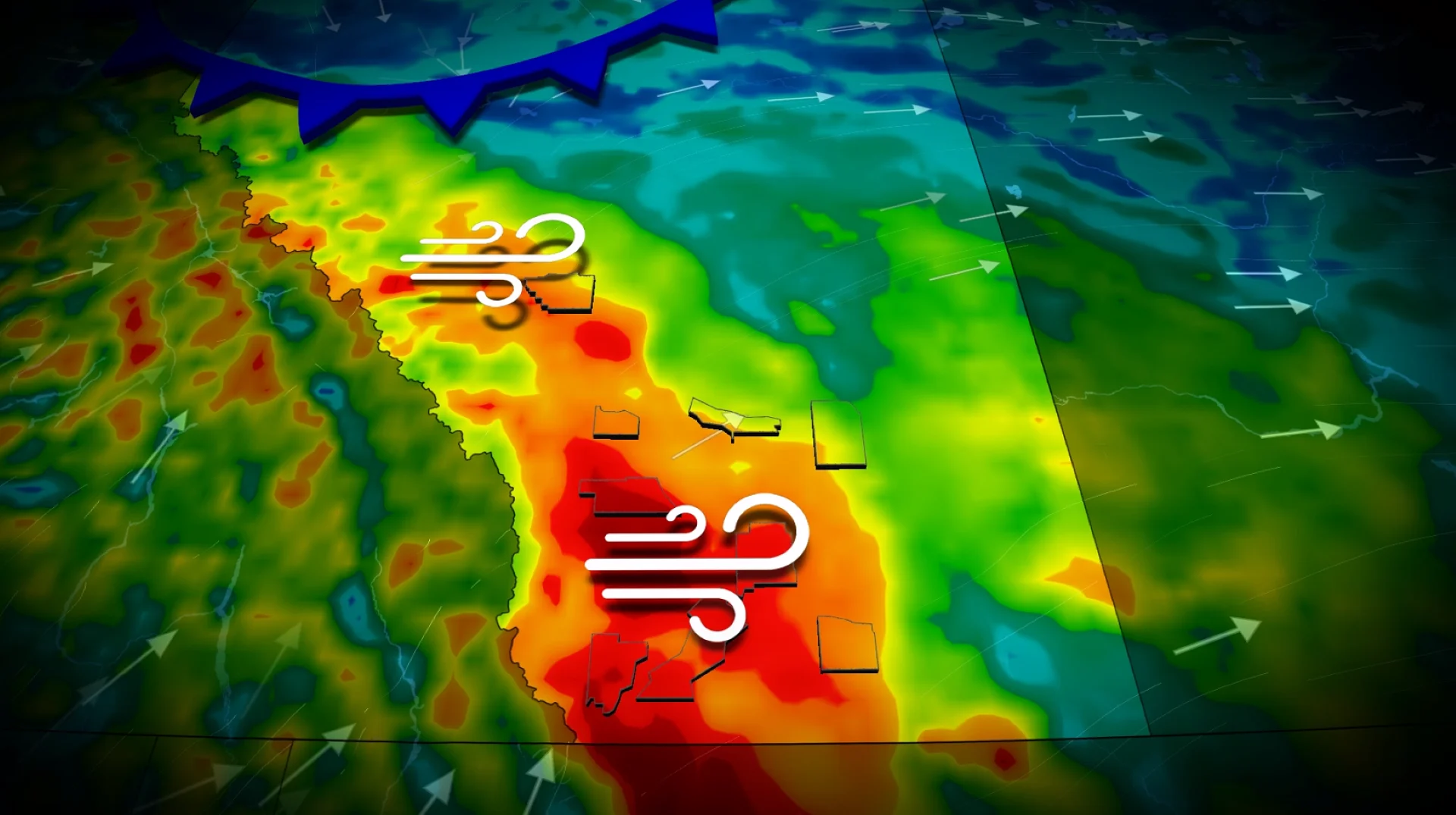
Gusty, westerly winds will ramp up into Sunday afternoon along the foothills, stretching from the Yellowhead Highway down to the international border as a trough develops.

The wind gusts along the Highway 22 corridor south of Longview could hover around the 90 km/h mark before subsiding in the evening
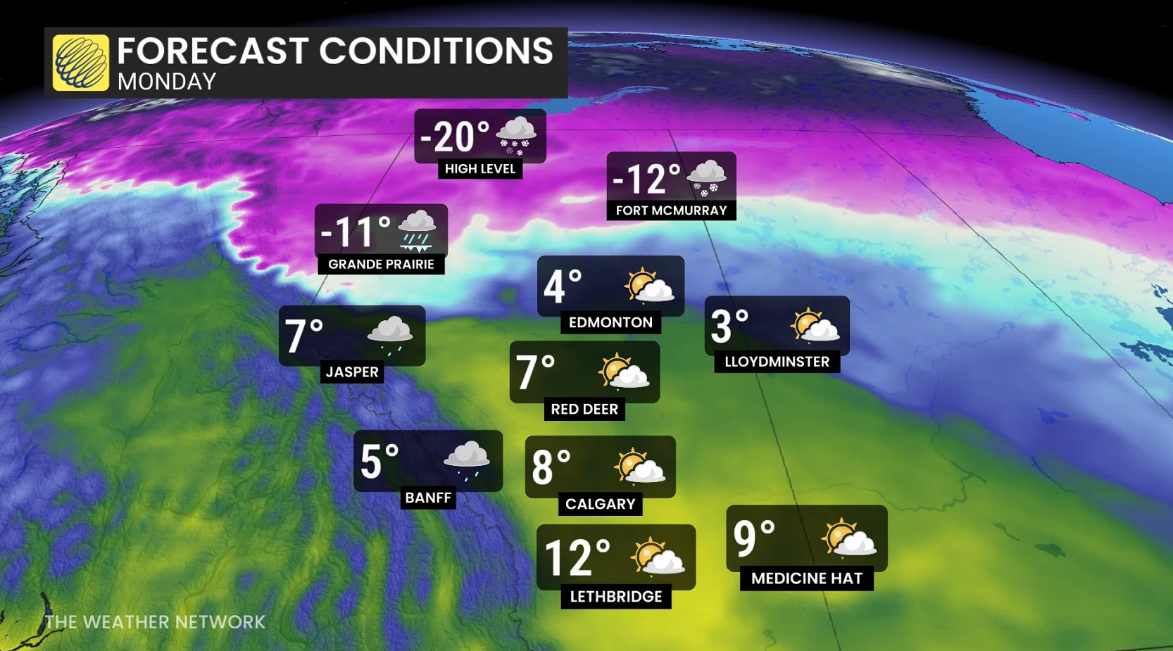
Sunday’s daytime highs will rise above the freezing mark throughout southern Alberta, with double-digit temperatures possible along and near Highway 3.
RELATED: Why living in Calgary can be tough on migraine sufferers
Monday looks to be the windiest day of the event as westerly winds ramp up along the foothills. We’ll see gusty winds expand toward the QE2 corridor into Monday evening ahead of a cold front surging in from the north.
Afternoon and evening wind gusts up to 60-80 km/h are possible along the QE2 into the evening ahead of a cold front that’ll surge in from the north. Extreme southwestern Alberta could see gusts exceed 110 km/h.
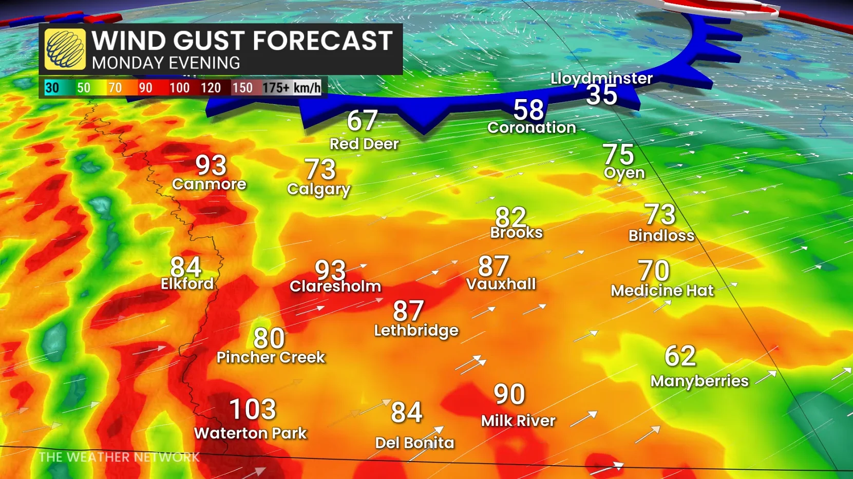
Winds will subside into the evening hours, but 60-80+ km/h gusts may extend east of the QE2 up to the Saskatchewan border as the low tracks eastward.
Daytime highs in the south will crest well above the freezing mark, potentially hitting double digits along the Highway 3 corridor. Even a temperature in the low teens can’t be ruled out across southwestern Alberta.
Stay with The Weather Network for the latest on conditions across Alberta.