
No joke: May winter storm threatens parts of northwestern Ontario
June may only be two weeks away, but wintry weather is still trying to keep its grasp on northwestern Ontario.
It's not really spring in Ontario unless there's at least one winter storm thrown into the mix, right?
As parts of northwestern Ontario grapple with wildfires and flood threats, a new hazard will move into parts of the region on Tuesday: ice and snow.
RELATED: Evacuation notice issued for Mine Centre in NW Ontario due to wildfire threats
We really do wish this were a joke so late in the season, but forecasters are looking at freezing air moving in behind a low-pressure system on Tuesday that is expected to bring a risk of ice pellets, freezing rain, and even wet snow near and along Lake Superior's shores.
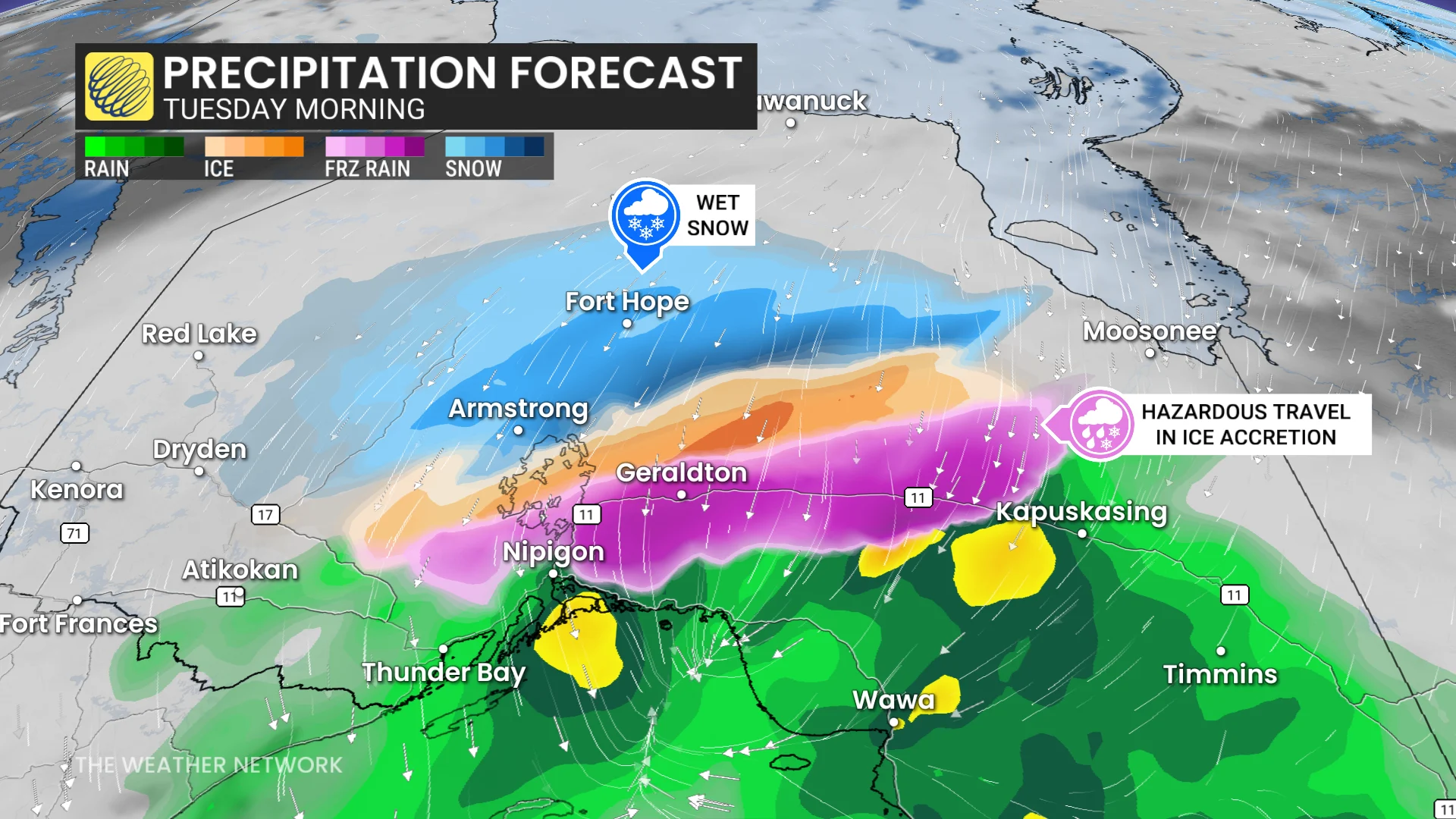
Communities likely impacted by the incoming wintry mix include:
Dryden
Nipigon
Geraldton
Marathon
Armstrong
Moosonee
Fort Hope
Current forecasts expect to see much of the freezing rain stay north of Thunder Bay, leaving the city in the rain sector for the entirety of the event. However, forecasters are closely watching the freezing line in case it suddenly shifts south over the area, pulling the wintry mix with it.
SEE ALSO: Why we see floods following fires: A tale of two extremes
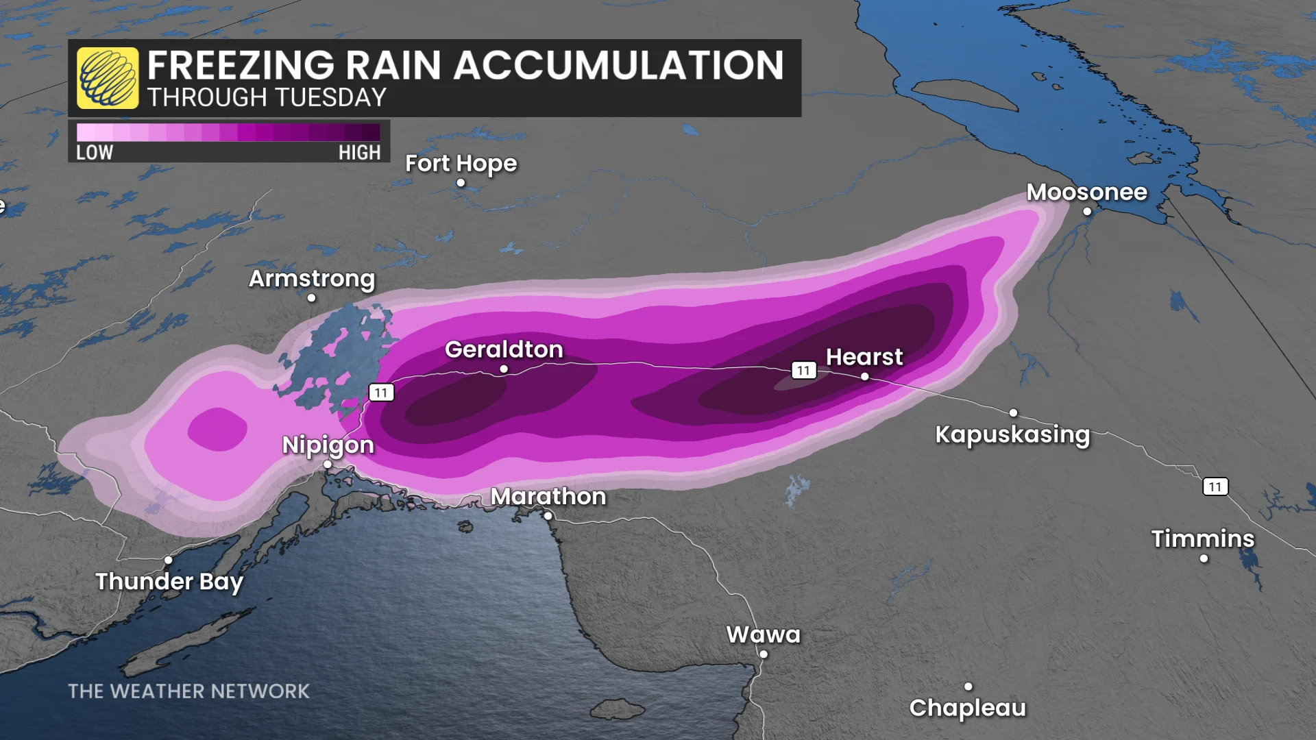
Folks travelling through the region should monitor road and highway conditions before heading out. Highway 11, in particular, could see heavy freezing rain accumulation through Tuesday morning, creating hazardous travel from Nipigon to Kapuskasing.
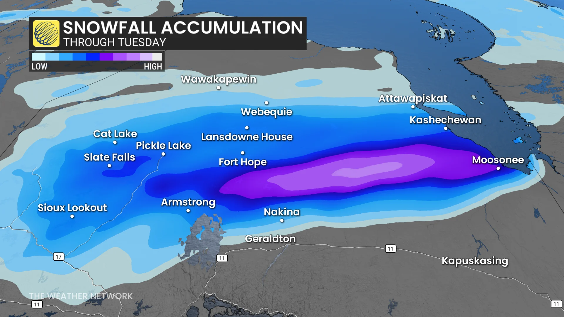
Further north, we'll see heavy, wet snow impact areas around Armstrong and Fort Hope. Exact accumulations are uncertain, though, and will depend on how much ice the area gets.
Stay with The Weather Network for more information and updates on your forecast across Ontario.