March kicks off with reminder that winter isn't done in Ontario, Quebec

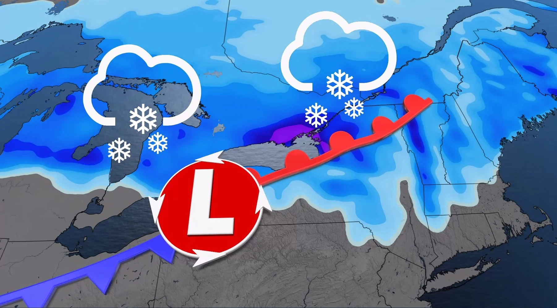
March 1 is the first day of meteorological spring, but winter isn't finished with southern Ontario and Quebec. This week will see multiple shots of snow push through from several systems, with accumulations adding up for some areas through Thursday.
The calendar may indicate the start of meteorological spring Tuesday, but winter is far from over in southern Ontario and Quebec. A wintry pattern is expected this week with cold temperatures to start and several systems clipping Ontario and Quebec with snow through Thursday. Some areas in Central Canada may see 10-20 cm of snow through the week. Expect some disruptions to some of the commutes during the periods of snowfall. More on the snow timing, accumulations and impacts, as well as a look at the messy weekend system, below.
MUST SEE: Pothole 101: Why February has been the worst month for roads
TUESDAY/WEDNESDAY: QUICK BURSTS OF SNOW WITH MULTIPLE SYSTEMS
A cold pattern will dominate most of Canada east of the Rockies for the start of this week, continuing across Central and Eastern Canada Tuesday.
Meanwhile, the first system will track across Ontario Monday overnight into Tuesday morning, bringing a quick couple of centimetres of snow to the Greater Toronto Area (GTA) and 2-5 cm expected north of the region towards Lake Huron and Georgian Bay.
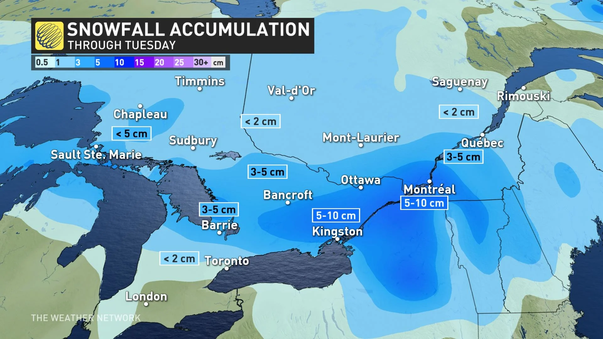
As the system progresses east, heavier snow is expected for eastern ontario including Ottawa and Cornwall, extending into southern Quebec. Snow is forecast through the day on Tuesday for Montreal and communities along the St. Lawrence River, including the Eastern Townships. 5-15 cm of snow is forecast for areas surrounding Montreal. Expect a slick evening drive Tuesday in the city.
The second system will move in Wednesday, bringing a second shot of snowfall to southern Ontario and southern Quebec. On Wednesday afternoon, southwestern Ontario could see the chance for mixing, freezing rain or rain as temperatures climb above the freezing mark in to the mid-single digits.
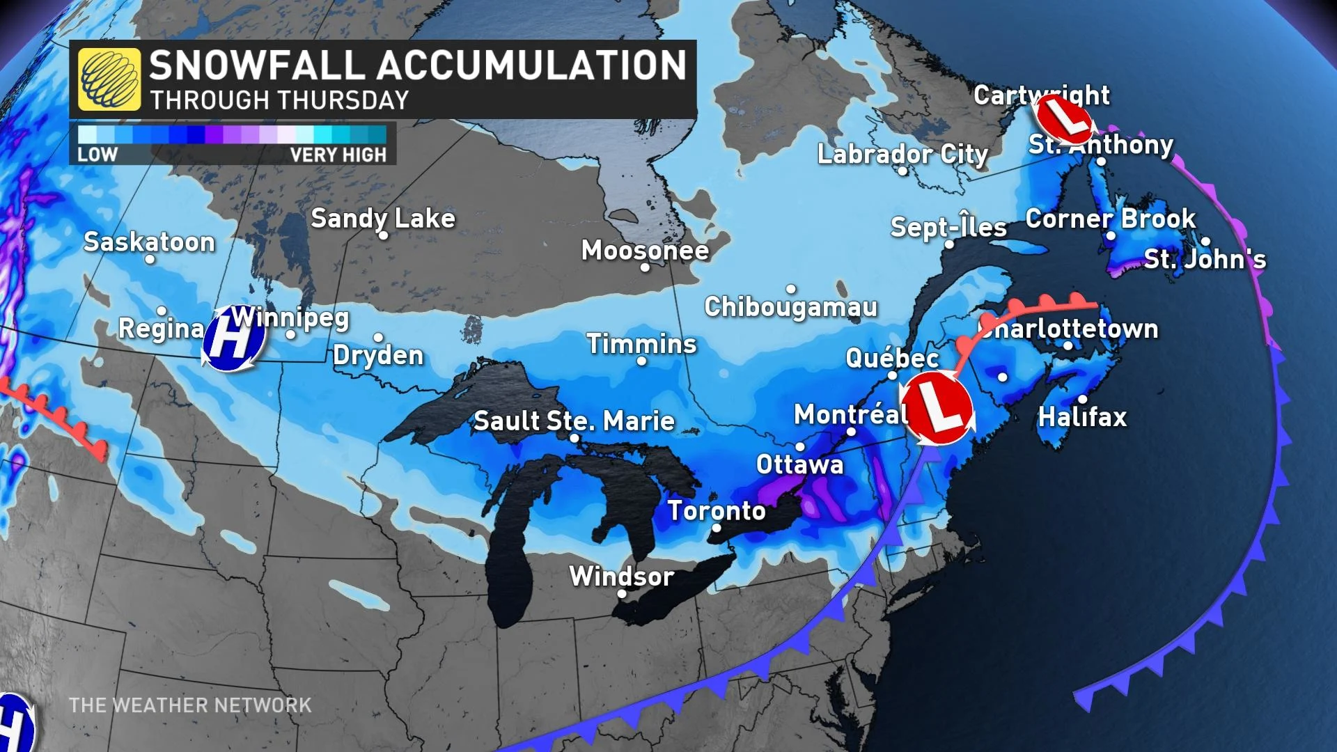
This system will bring a couple more centimetres of snow to the GTA, with 5-10 cm closer to the Huron and Georgian Bay shores.
LOOK AHEAD: POSSIBLE WARM-UP COMES WITH MESSY SYSTEM
Milder weather will attempt to move into southern Ontario and Quebec on the weekend.
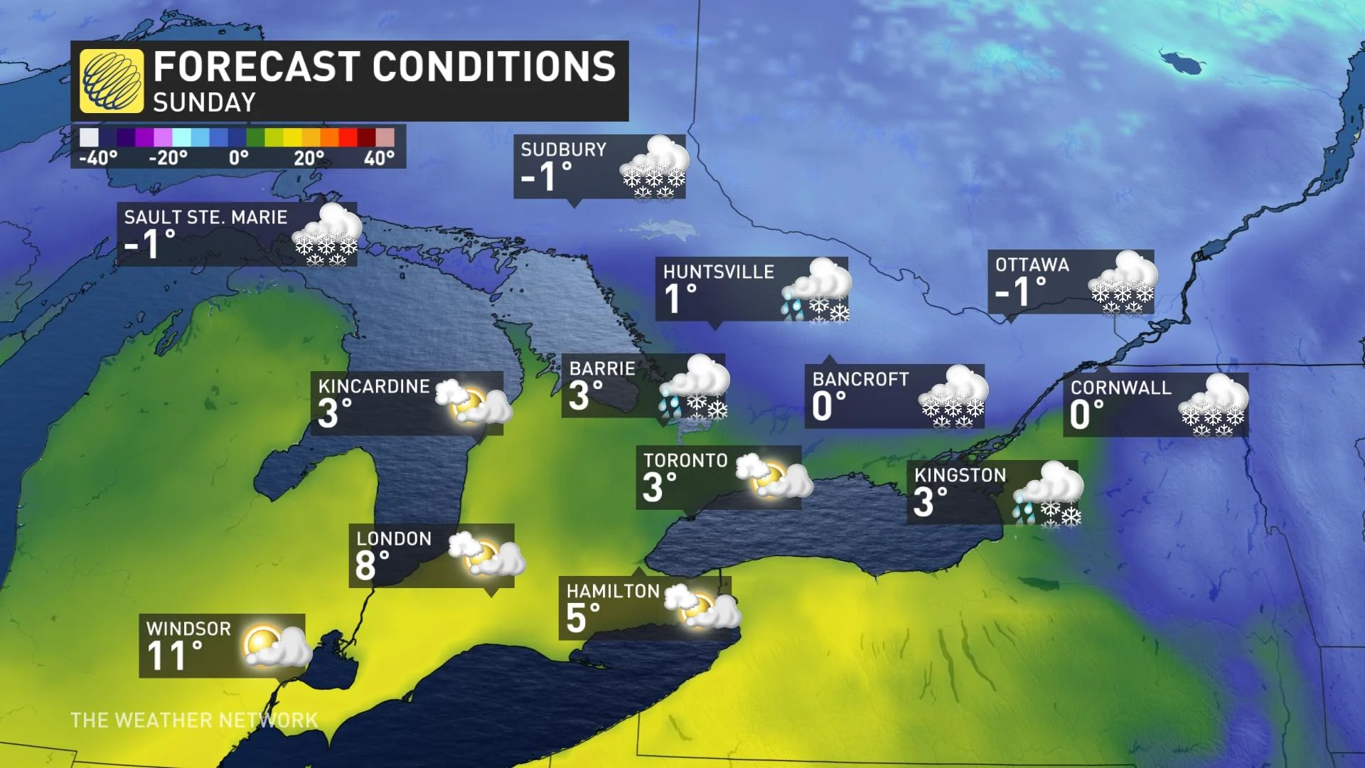
With that, a messy system expected for southern Ontario this weekend with periods of snow and freezing rain spreading into the region Saturday. At this point it looks like ice and snow will change to rain on Sunday with very mild air trying to push into parts of the area. Meanwhile, snow and ice could spread into eastern Ontario and southern Quebec on Sunday.
Forecasters are watching the potential for a rather stormy and possibly wintry pattern during the second and third week of March. An abundance of Arctic air will surge across Central Canada and attempt to press into the region while warm weather over the eastern U.S. also tries to surge north into the region.
Be sure to check back for the latest updates on the forecast in southern Ontario and southern Quebec.
Subscribe to 'This Day in Weather History': Apple Podcasts | Amazon Alexa | Google Assistant | Spotify | Google Podcasts | iHeartRadio | Overcast'