Marathon rainfall event winding down in Alberta after dropping 100+mm
A prolonged rainfall event will finally wrap up across Alberta on Tuesday, with totals creeping up towards, at or above 100 mm in multiple locales. However, the flood risk remains elevated in some areas
Alberta has been enduring a prolonged period of heavy rain but it looks like the end is finally in sight.
At least one locale has received at least 100 mm of rain, which exceeds the typical monthly rainfall totals for many in Alberta. But there is a good chance of more locations seeing totals reach or exceed 100 mm by the time the rain winds down on Tuesday.
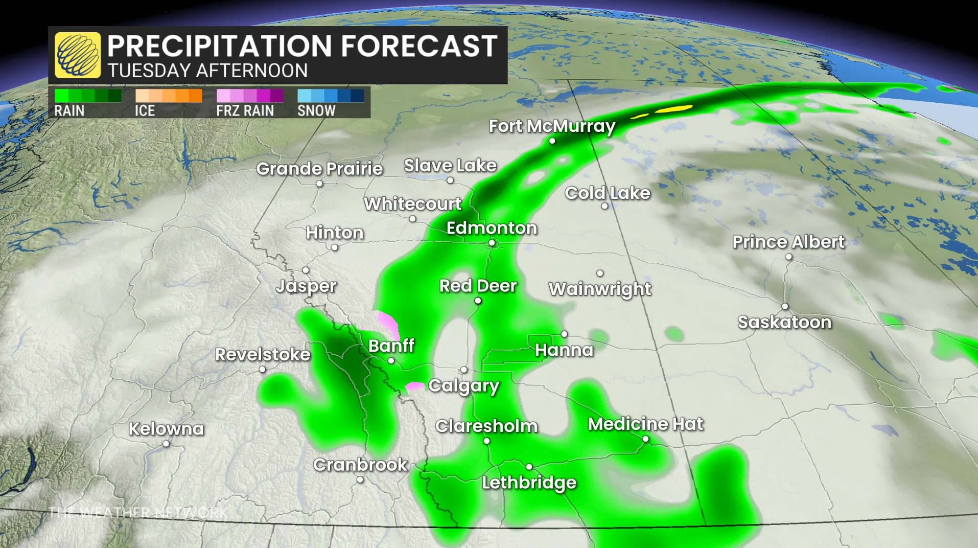
It looks the excessive rainfall will taper off on Tuesday, with just lingering showers continuing into Wednesday morning for eastern areas.
Excessive rainfall in Alberta will finally ease Tuesday
Rain will finally taper off across central and southern Alberta by Tuesday, though some showers may persist into Wednesday morning in eastern areas.
30-50 mm of additional rainfall is expected across central and southern Alberta, pushing some totals towards and above 100 mm.
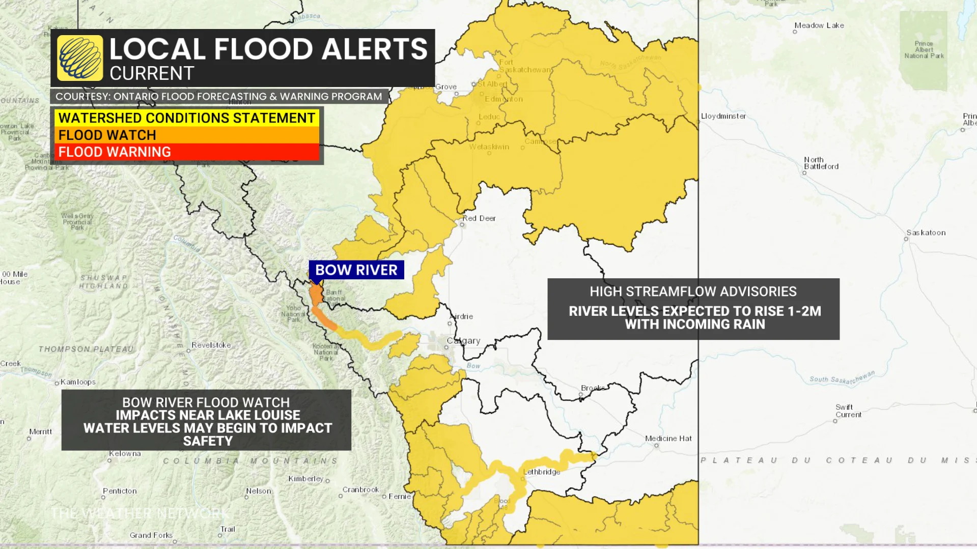
Only one flood watch remains in the province: Bow River near Lake Louise and Pipestone River near Lake Louise. Many high streamflow advisories are in effect across multiple basins.
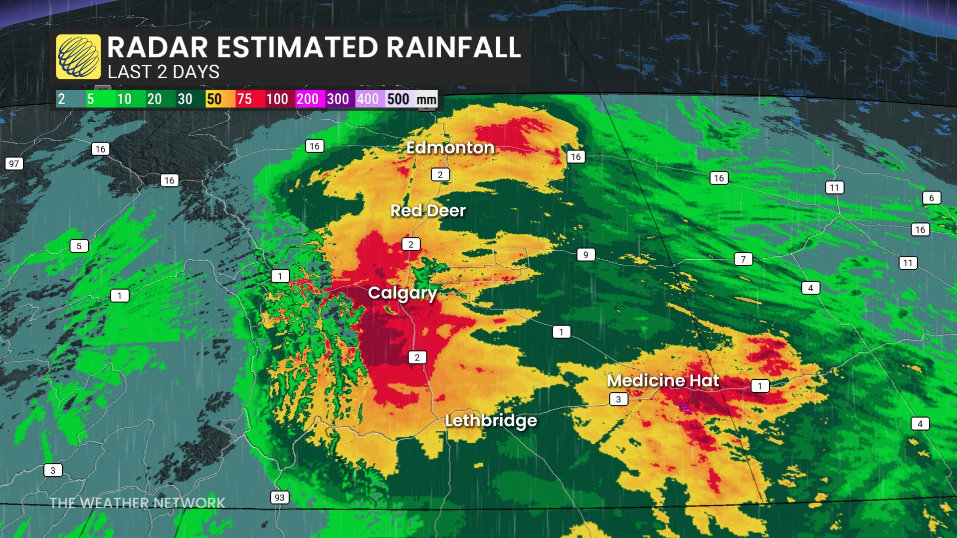
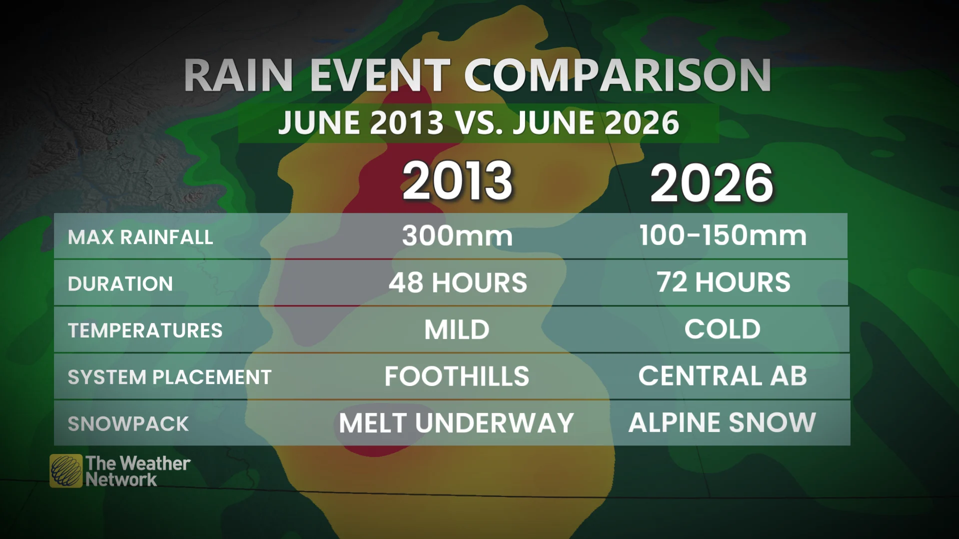
WATCH: Heavy rain continues to unfold across Alberta, how this event compares to 2013 floods
An active storm track has been responsible for delivering repeated rounds of heavy rainfall across Alberta. A rich reserve of moisture straight from the Gulf of Mexico fuelled the precipitation, allowing for excessive totals in many locations.
Alberta's 2026 Summer Forecast: Strong start, but with some concerns
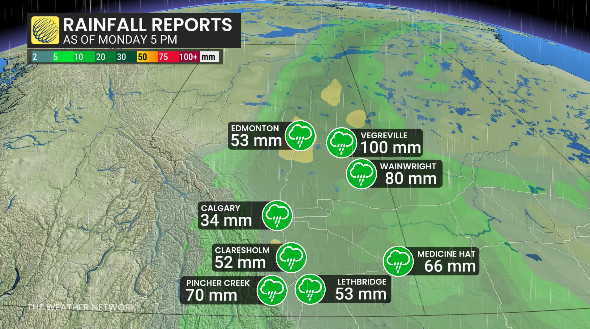
Rainfall totals so far:
Vegreville: 100 mm
Wainwright: 80 mm
Medicine Hat: 66 mm
Pincher Creek: 70 mm
Claresholm: 52 mm
Lethbridge: 53 mm
Edmonton: 53 mm
Calgary: 34 mm
For reference, Calgary averages 112 mm of rain in a typical June, while Edmonton and Medicine Hat normally pick up around 75 mm of precipitation through the month.
High-elevation snowfall was ongoing throughout Monday, with wet snow falling at mid-mountain levels in the Kananaskis Valley, with reports of up to 15 cm. Wet snow was reported as low at 1300 metres elevation in the Canmore region.
Mountain peaks were forecast to see 30-50 cm of fresh snowfall above 2200 metres through Tuesday morning.
Winds were also strong on Monday, with the following peak gusts recorded:
Nakiska Ridgetop: 92 km/h
Stavely: 87 km/h
Calgary International Airport: 80 km/h
Claresholm: 80 km/h
Red Deer: 78 km/h
Lethbridge: 77 km/h
Edmonton: 65 km/h
However, sustained winds will continue at 30-50 km/h through Tuesday, with local gusts to 70 km/h.
Stay with The Weather Network for all the latest on conditions across Alberta