Severe storm threat continues for southern Manitoba and northwestern Ontario

Up to 200 mm of rainfall is possible by the time showers taper off.
Summer is winding down on a stormy note for southern Manitoba and northern Ontario after multiple rounds of severe storms rolled through on Friday, with more set to follow for Saturday. Heavy rain with local flooding, small hail, and damaging wind gusts are all on the table for Saturday as storms build for the afternoon, while additional rounds of rain will fall over parts of Manitoba that saw flooding to round out the work-week. We take a look at the details and timing for this latest bout of active weather, below.
Visit our Complete Guide to Fall 2019 for an in-depth look at the Fall Forecast, tips to plan for it and a sneak peek at the winter ahead
WEATHER HIGHLIGHTS
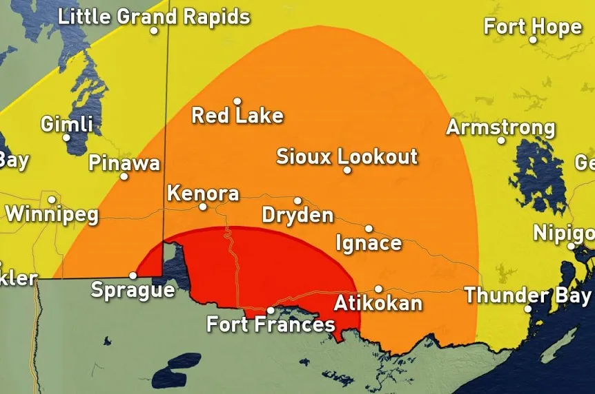
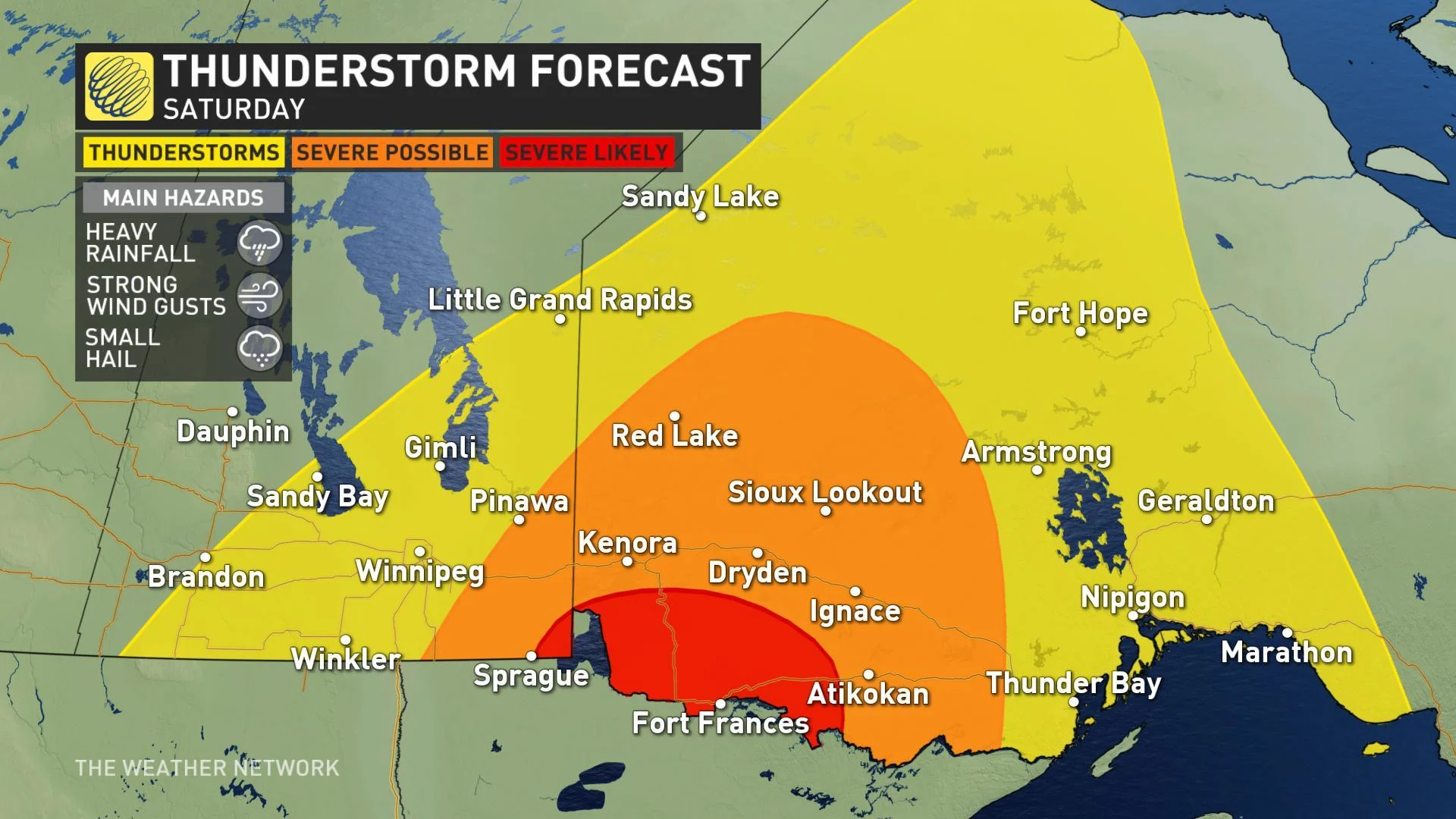
Storm risk shifts mainly to northwestern Ontario for Saturday
Risk of localized flooding in slow-moving storms
Heavy rain, strong wind gusts, small hail all possible
Stay up-to-date on the ALERTS in your area
WATCH BELOW: TRACKING STORMS FOR MANITOBA, NORTHERN ONTARIO
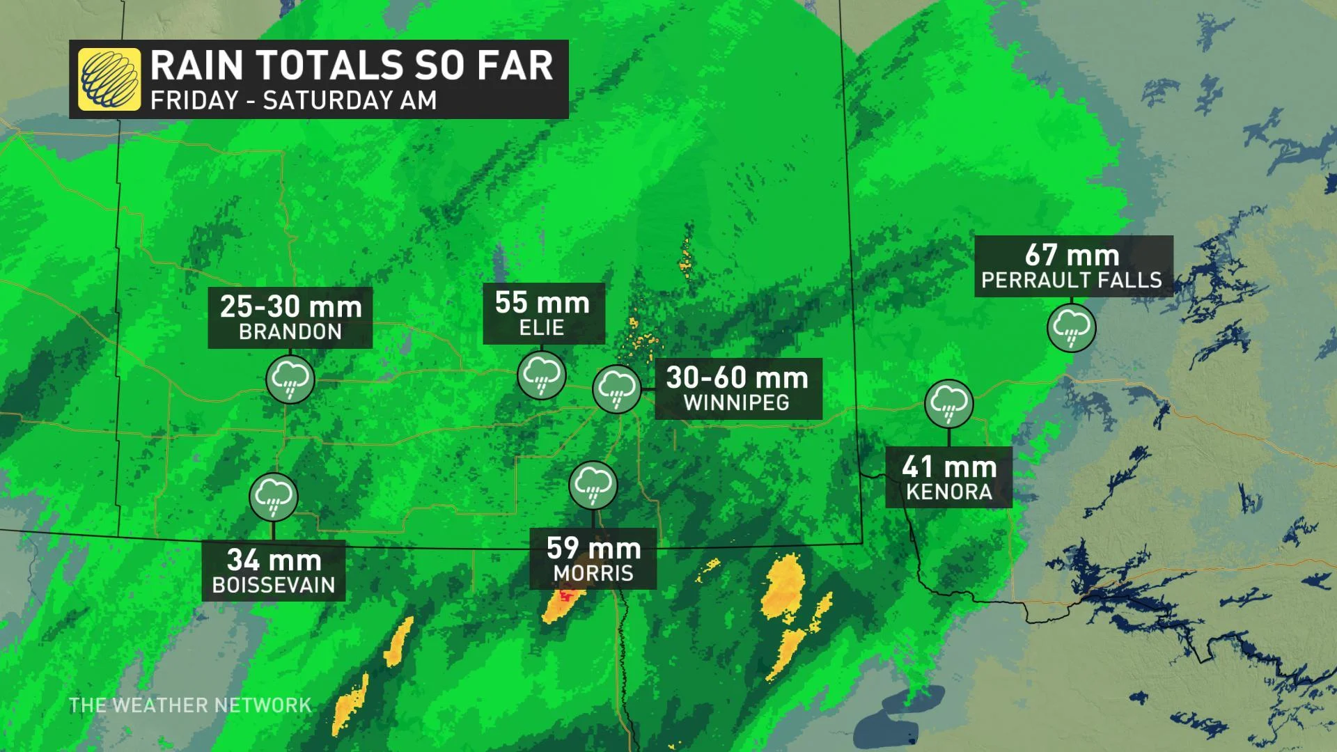
Showers and lingering thunderstorms still dotted the sky Saturday morning after a Friday evening filled with severe weather in southern Manitoba. A second low pressure system crossing the border will fuel storms through the day, with the risk building into the afternoon and evening as another cold front approaches.
Additional pockets of heavy rain are expected, and while the heaviest will lift well into northwestern Ontario, another 50 to 75 mm isn't out of the question for soggy southern Manitoba.
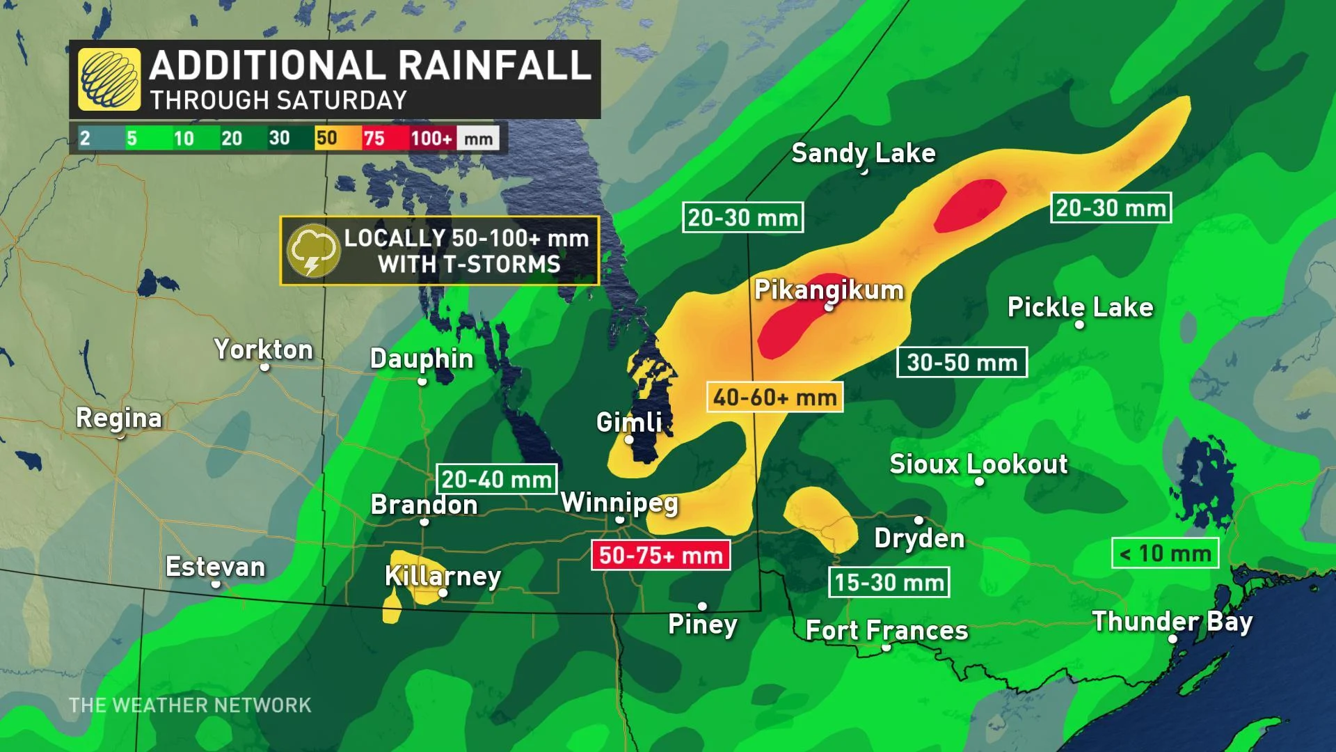
Environment Canada has issued rainfall warnings for a swath of southern Manitoba, including Winnipeg, and a special weather statement for northwestern Ontario, warning of three-day rainfall accumulations approaching 175 to 200 mm by the time rain ends early Sunday.
Weather Network meteorologist Dr. Doug Gillham says cooler temperatures will follow behind this system but only briefly before a return to above-seasonal temperatures to start off the next week.
"A significant blast of much colder weather is expected late next week and continuing into the start of October," Gillham says. "A much colder pattern could include some significant snow – at least for the Rockies, but potentially extending into the foothills and beyond. It's much too early for any specifics, but something to watch over the next few days."