Major snowstorm forces closures in northern Ontario, risk of 50 cm by Friday
A powerful winter storm ramps up in northern Ontario Thursday, bringing 15-40+ cm of snow and strong wind gusts. Ongoing road closures and difficult travel conditions are expected
A strong clipper will persist across much of northern Ontario on Thursday, bringing heavy snow and hazardous winter travel.
DON'T MISS: Simple steps you can take to prepare for a winter storm
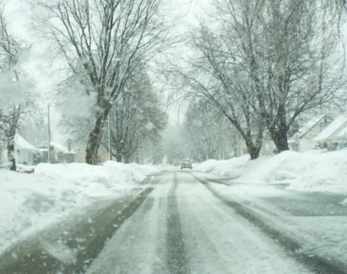
Snowfall totals of 15-40+ cm are forecast, along with strong winds causing blowing snow and reduced visibility. Several road closures are ongoing.

A flash freeze is also expected as temperatures drop rapidly into the minus teens and even -20s.
Expect disruptions to services, and utilities, including school closures, and bus cancellations. Stay alert to the changing and deteriorating conditions, and monitor the latest weather warnings in your area.
Heavy snowfall and hazardous winter travel conditions Thursday
A clipper system will bring widespread snow to northwestern Ontario into Thursday, resulting in hazardous travel conditions.
Moisture from the Gulf of Mexico enhances snowfall in northeastern Ontario, as well, increasing totals there.
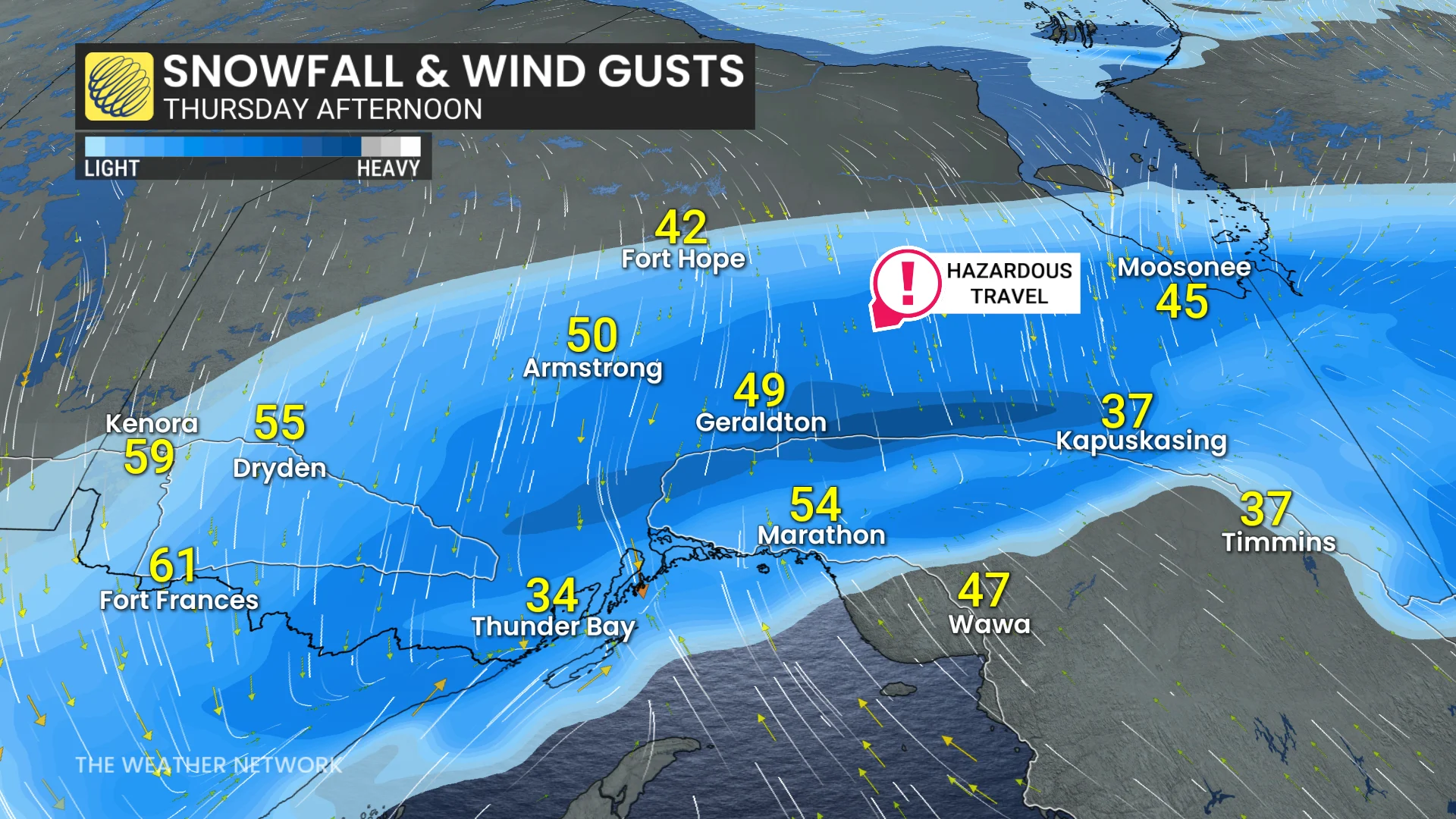
Heavy snow will still continue in Thunder Bay on Thursday, with strong winds through the afternoon. Snow then lightens from west to east in the evening and overnight in northwestern Ontario.
On the back end of the system strong winds with gusts of 40-70 km/h will continue to cause blowing snow and poor visibility.

Snow continues into Friday for northeastern Ontario, while northwestern Ontario sees light flurries.
"Roads and walkways will likely be difficult to navigate. Visibility will likely be suddenly reduced to near zero at times," says Environment and Climate Change Canada (ECCC) in a winter storm warning for the region. "Allow extra time for travel."
More widespread snow expected through the weekend
Another strong clipper system is set to move through the region Friday night into Saturday, bringing widespread snowfall, particularly to areas within the Nickel Belt and Sault Ste. Marie.
DON'T MISS: You asked for a white Christmas, and you may just get it!
The system will maintain changeable temperatures and an active weather pattern, which is expected to persist through Christmas and beyond.