Major ice storm potential as Quebec faces long-lasting freezing rain, snow
A significant ice storm is forecast for southern Quebec, bringing up to 30 mm of freezing rain. The storm will also carry the threat of damaging, high winds, which could lead to long-lasting power outages, along with dangerous travel
An incoming ice storm is set to hit southern Quebec with prolonged freezing rain, potentially causing damage and multi-day power outages.
Environment and Climate Change Canada (ECCC) has issued an orange-coded warning for freezing rain, urging residents to avoid any non-essential travel.
RELATED: Staying safe during a power outage
In anticipation of the ice storm, numerous schools, education classes, daycare services and administrative offices have been pre-emptively closed in southern Quebec for Wednesday, including in Montreal, CBC reported.

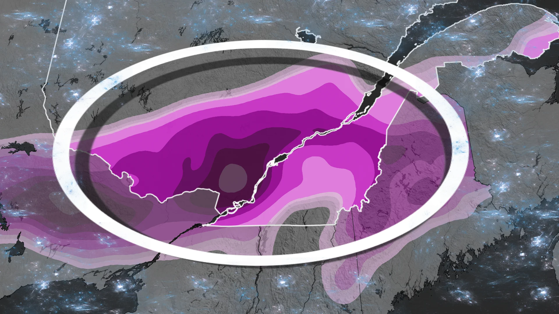
An elongated region of freezing rain is expected to last 20-24 hours. Prepare for long-lasting power outages.
"There will likely be transportation delays and cancellations," says ECCC in the warning. "Prolonged utility outages are likely. Significant damage to property, including some buildings and trees, is likely due to the weight of ice."
Significant ice storm, heavy snow expected to impact parts of Quebec
A prolonged weather event arriving Tuesday night could bring a significant ice storm to parts of Quebec.

Orange-coded freezing rain warnings are in effect for southern Quebec, alerting to the potential for total freezing rain amounts of 10 to 30 millimetres. The event could last up to 24 hours and affect many services.
An elongated region of freezing rain is expected to last 20-24 hours.
Precipitation rates will increase in intensity through Wednesday morning from Gatineau to Montreal, and regions south.

Initially, ice pellets are forecast, including in Mont Tremblant, Mont Laurier in the Laurentians and Trois-Rivières, before changing to freezing rain by the afternoon.
WATCH: Are you ready? 3 things you need to know ahead of the storm
By Wednesday evening and overnight, all precipitation rates increase, with some rainfall in Montreal, the Eastern Townships and Gatineau.
Precipitation eases Thursday morning but is replaced by 70-90 km/h wind gusts near Montreal and surrounding regions. That could dramatically increase power outage numbers.

15-30+ mm of freezing rain is possible, with local totals exceeding 30 mm possible north of Montreal in the North Shore communities.
Not all freezing rain will accrete due to factors like wind and precipitation rates.
The ice storm may result in multi-day power outages, broken tree branches, and slick untreated surfaces. Flight delays and cancellations are likely in Montreal.

As well, expected snowfall totals include 20-40+ cm of snow for the Outaouais, Laurentians, Quebec City, and Gaspé, 20-30+ mm of rain for the Eastern Townships.
Stay with The Weather Network for more information and updates on your weather across Quebec.