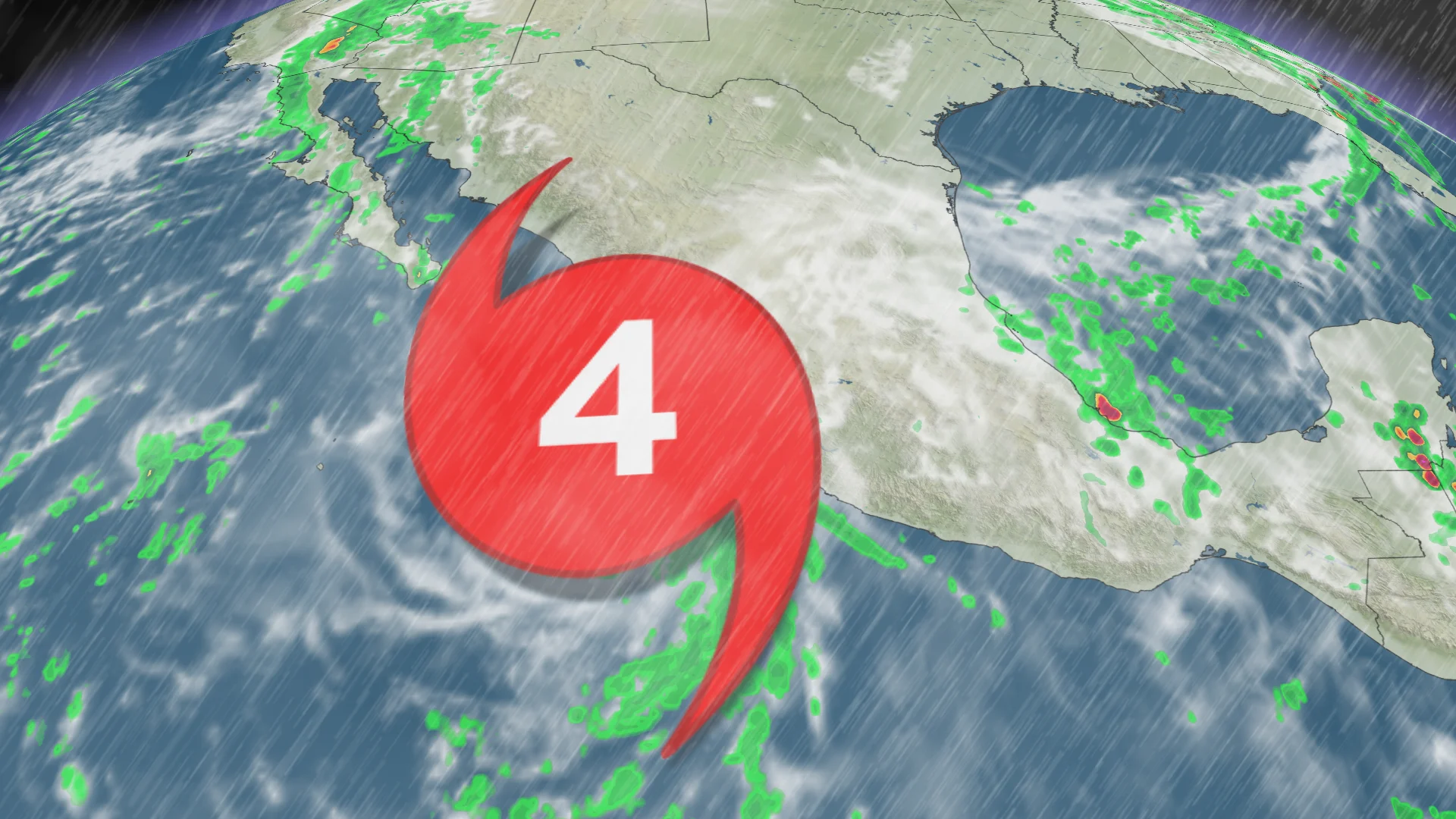
Simon nears the Mexico coast as major hurricane with life-threatening impacts

The extremely dangerous Hurricane Simon is nearing the coast of west-central Mexico. Even if the core remains offshore, Simon will bring excessive rainfall, life-threatening flooding, catastrophic winds and a hazardous storm surge
Western Mexico is on high alert on Sunday as the major Hurricane Simon lurks just offshore.
The Category 4 hurricane is teetering on the brink of a landfall Sunday or Monday with destructive winds and life-threatening flooding from storm surge and tropical downpours.
DON’T MISS: Staying safe from flash floods, a serious and deadly hazard
However, forecasters with the U.S. National Hurricane Center (NHC) note there’s some uncertainty surrounding exactly when or if the storm will officially come ashore.
Big questions remain over landfall
Serious uncertainty about whether this hurricane will actually make landfall on Sunday or Monday. Hurricane Simon has a robust inner core, and some satellite radar estimates suggest it’s reaching Category 5 intensity, but recent observations show a slight weakening trend.
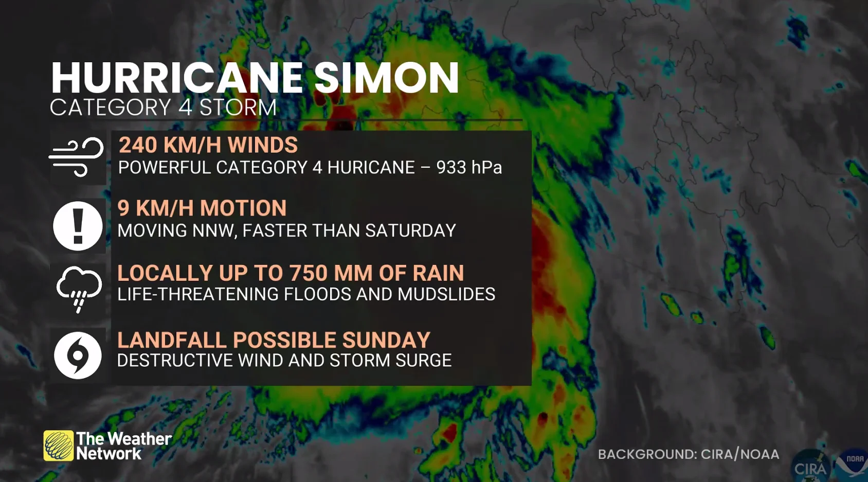
Its maximum, sustained winds have dropped a tad, from 250 km/h to 240 km/h, remaining a Category 4 hurricane as of Sunday morning.
The hurricane, which is centred about 95 km west of Manzanillo, is expected to be near or just inland over west-central Mexico later today, and move very close to the coast on Monday.
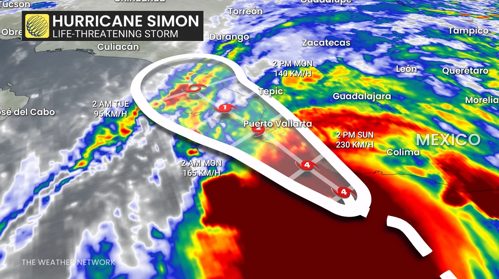
NHC has shifted forecast track farther offshore, and it’s too close to call if a landfall will occur on Sunday or Monday.
This would be a worst-case scenario, especially if it stays on the western envelope of guidance, prolonging coastal storm surge and severe impacts.
What's changed?
Why the change? A weak ridge has developed north of Simon, and now it’s a wait-and-see approach by forecasters to see how much of the Sierra Madre mountains affects the hurricane over the next 24 hours. Intensity forecasts are highly sensitive to land interactions.
Regardless, a track very close to the coast is forecast on Monday.
AI Models
Google DeepMind’s AI Weather model highlights the storm will track just offshore rather than making a definite landfall through Monday. DeepMind was the best-performing model during Hurricane Isaias, impressively forecasting the Florida Panhandle landfall days in advance.
Later updates on Sunday will provide more detail on whether a slight weakening trend holds through the day, and how the uncertain track position evolves.
Catastrophic wind and life-threatening storm surge impacts are likely along a portion of the west-central coast of Mexico.
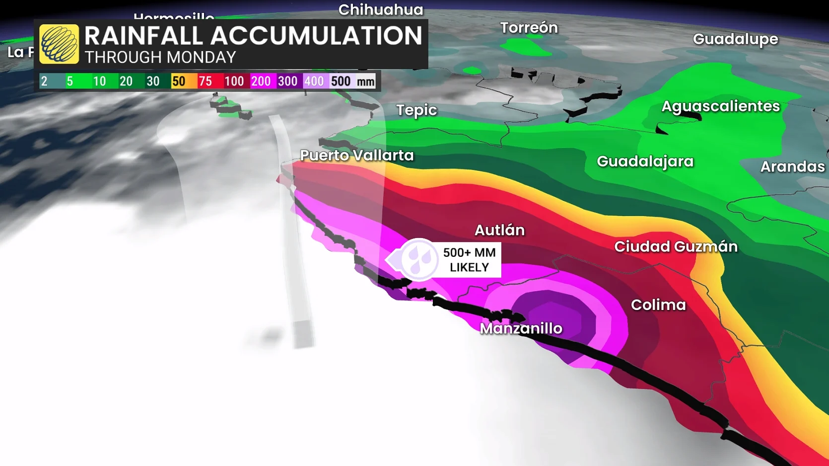
Torrential downpours will lead to widespread rainfall totals of 250-500 mm, with isolated totals up to 760 mm possible at higher elevations. This part of Mexico is highly susceptible to flash flooding and mudslides.
Simon is likely to push the northeastern Pacific basin over the top for its most active hurricane season since records began in 1949.
Thumbnail courtesy of CIRA/NOAA.