Lingering thunderstorm threat needs close attention in southern Ontario
Stay alert: Ongoing thunderstorms may disrupt travel across southern Ontario Thursday
After a night of heavy rain and gusty winds, ongoing thunderstorms are expected to continue affecting parts of southern Ontario through Thursday morning and afternoon.
Lingering atmospheric instability from the strong overnight low is sparking isolated heavy downpours and lightning over the Greater Toronto Area (GTA).
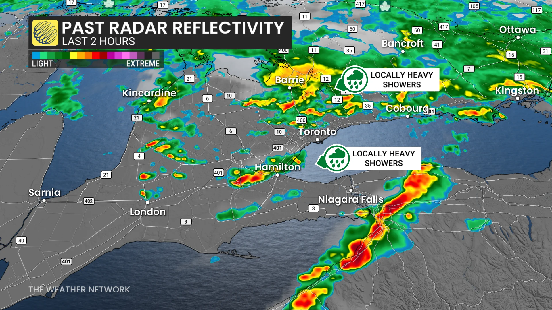
While current radar shows non-severe storms, elevated wind shear has introduced high spin in the atmosphere, warranting close monitoring as storms track eastward.
Areas of concern include Hamilton, Kitchener, Highway 400 north of Toronto, and regions north of Oshawa. Drivers should be prepared for sudden reductions in visibility and wet road conditions in affected areas.
RELATED: How severe weather alerts are issued, and potentially save lives
As the low pressure system advances eastward into eastern Ontario and Quebec, wind gusts are expected to intensify by Thursday afternoon.
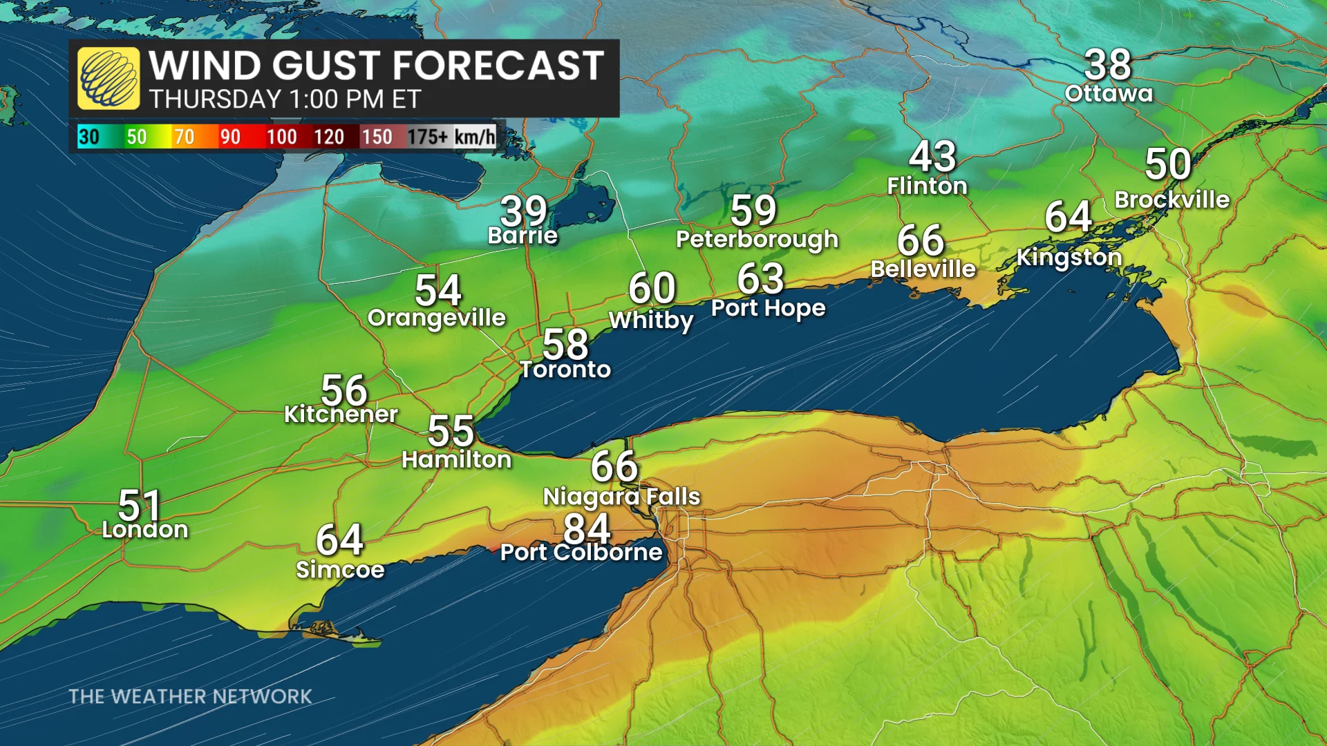
The strongest winds will occur in areas downwind of Lake Ontario and Lake Erie, with local gusts potentially reaching 80–90 km/h. Residents in these regions should secure loose objects and prepare for the possibility of minor disruptions.
Monitor updates for changes in storm severity throughout the day.
WATCH: Severe thunderstorm risk with tornado threat for Ontario and Quebec
Stay with The Weather Network for the latest across Ontario and Quebec