Lightning threat, wildfire smoke may spell trouble for Central Canada

While there is much-needed rain around the corner for Ontario and Quebec, the cost could be twofold. A lightning threat could spark new wildfires and the smoke from existing blazes may cause hazardous air quality
Visit The Weather Network's wildfire hub to keep up with the latest on the active start to wildfire season across Canada.
The National Capital Region and Montreal, Que., may be in for poorer air quality to begin the work week, with hazy skies that could span all the way into the Greater Toronto Area. An incoming cold front will change the wind direction, pushing wildfire smoke from northern Quebec to southern areas of both provinces through Monday afternoon.
The front could also feature much-needed rain in Quebec and Ontario, but it comes with a risk for additional lightning activity that could spark new wildfires.
RELATED: This ‘Omega block’ will dominate Canada’s weather this week
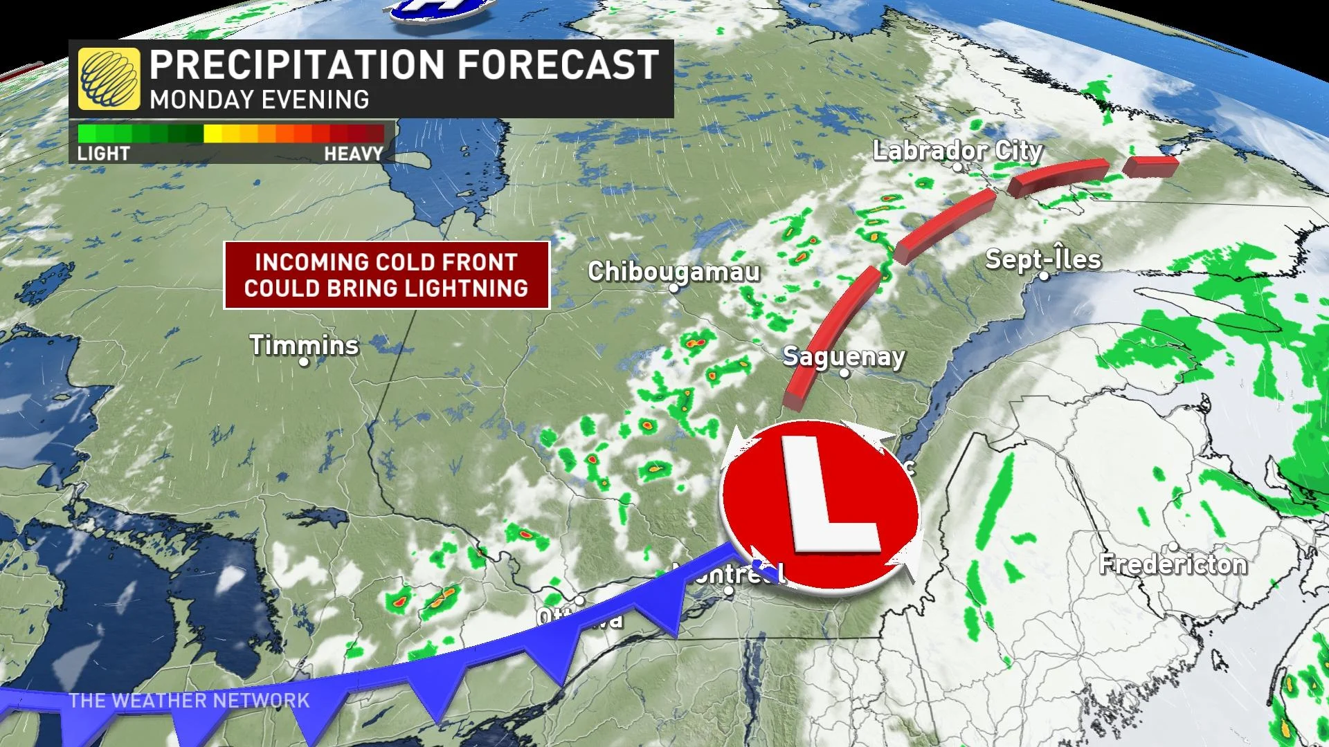
Lightning risk in Ontario and Quebec
Local states of emergency and thousands of evacuations persist as hundreds of wildfires rage on in Quebec. On Thursday, 100 new fires were started as a result of lightning. Once again, worries grow that Monday may feature another moisture-starved cold front.
Helpful rains will be quite spotty from thunderstorms popping up along the front in the afternoon and evening. The activity could nudge toward the Ontario border, with Ottawa included in the mostly non-severe threat.
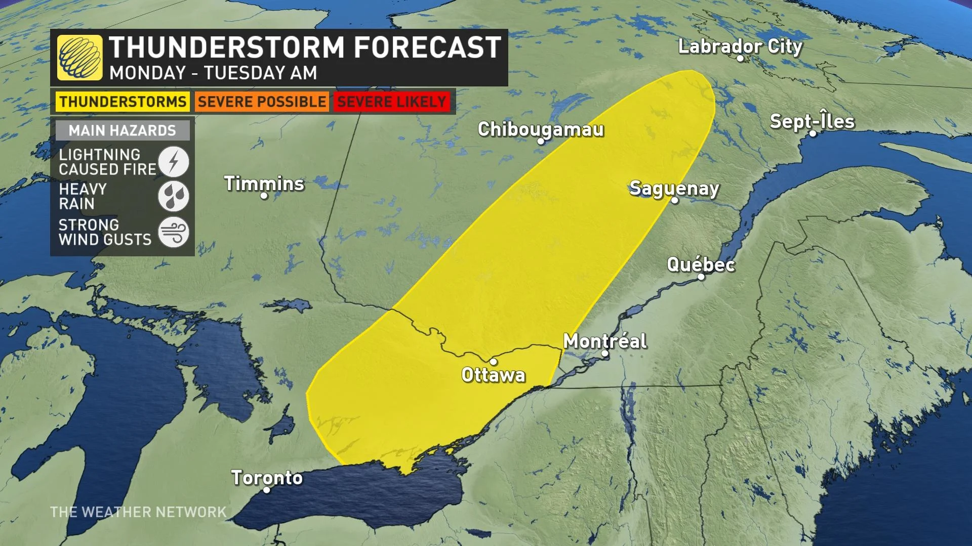
Locally heavy downpours and gusty winds are possible hazards. Because much of Ontario and Quebec remain in an extreme-fire danger rating, additional lightning-induced blazes are a concern.
Quebec wildfires and smoke
The front will also shift the winds, forcing smoky and hazy skies south. By Monday afternoon, the haze could stretch hundreds of kilometres into the GTA. But closer cities such as Montreal and Ottawa may experience poorer-than-normal air quality.
The air quality for Ottawa could possibly reach record-bad territory. At points during the day Tuesday, it may sufficiently be thick enough to obstruct a significant portion of the sunlight. Even on Monday, that smoke will disperse to the ground level throughout the GTA. It may even be potent enough to locally smell like a campfire.
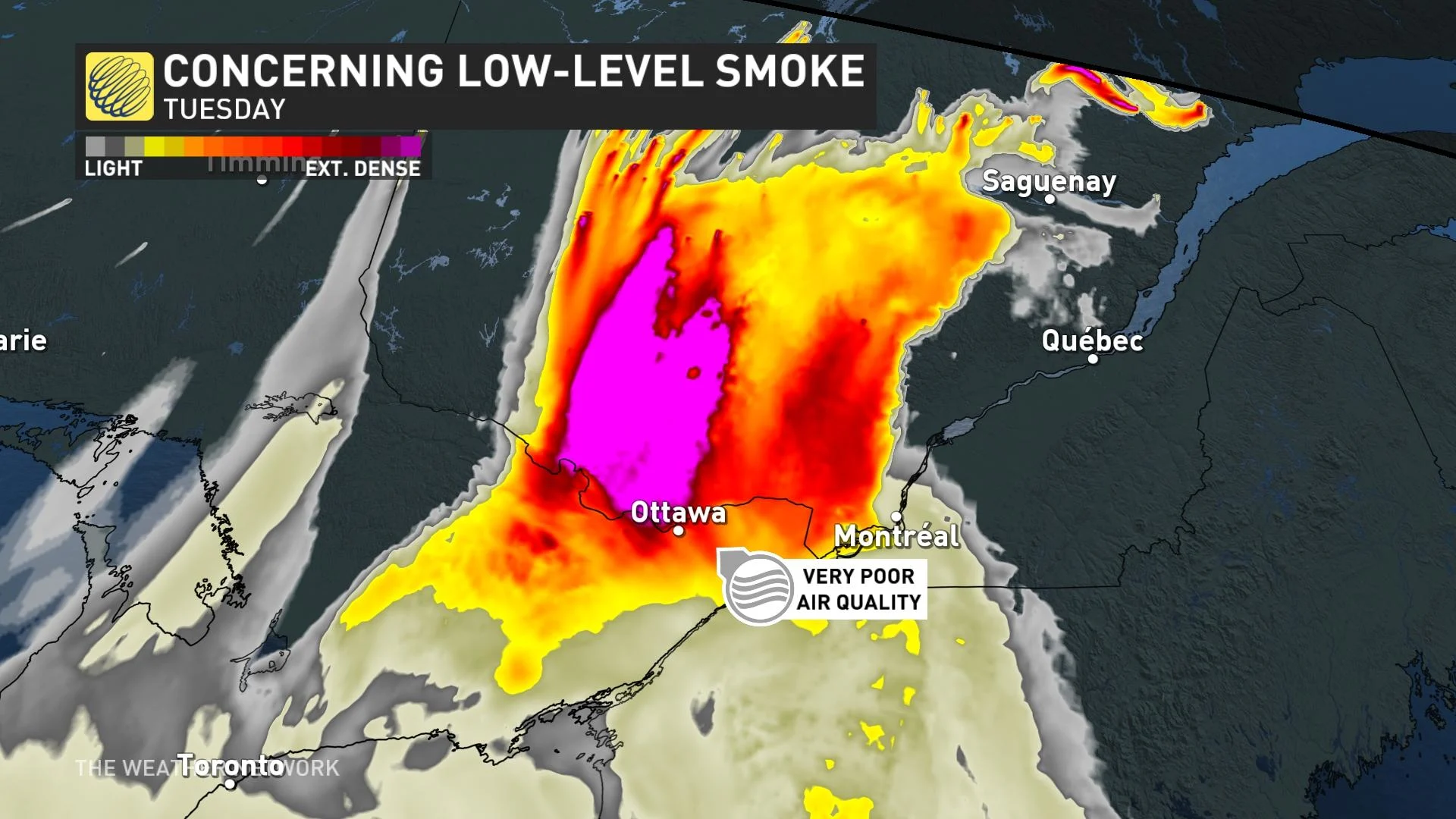
Wildfires in northern Ontario and Quebec recently sent upper-level smoke spiralling down to southern areas of both provinces, blanketing the skies and creating poor air quality for many.
Smog warnings and special air quality statements span a good portion of northern Ontario and Quebec. Residents should keep updated with special air quality statements and limit time outdoors.
SEE ALSO: Quebec bans access to more forests as fires burn
Relief is coming
In the longer range, Quebec may benefit from the same rainy system that has aided Nova Scotia's fire-relief efforts.
A slow-moving low over the Maritimes brought widespread showers through the weekend. It begins retrograding by Tuesday, moving backwards towards Quebec's Gaspe Peninsula. Models indicate the St. Lawrence River and the northeastern shorelines may see shower activity through the day.
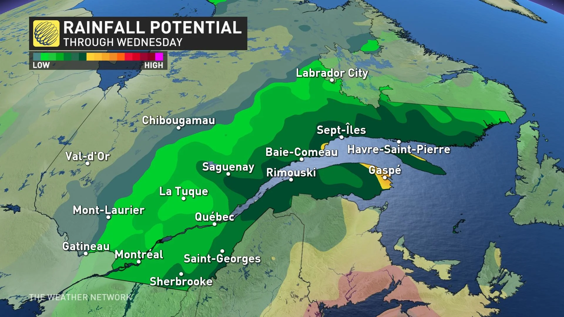
The Sept-Îles region, where a local state of emergency was declared, may benefit by mid-week.
Cooler, more seasonal temperatures are also in store for much of Ontario, Quebec and Atlantic Canada as the low deepens and remains in place for the second week of June.
With files from Rachel Modestino, a meteorologist at The Weather Network, and Nathan Howes, a digital journalist at The Weather Network.
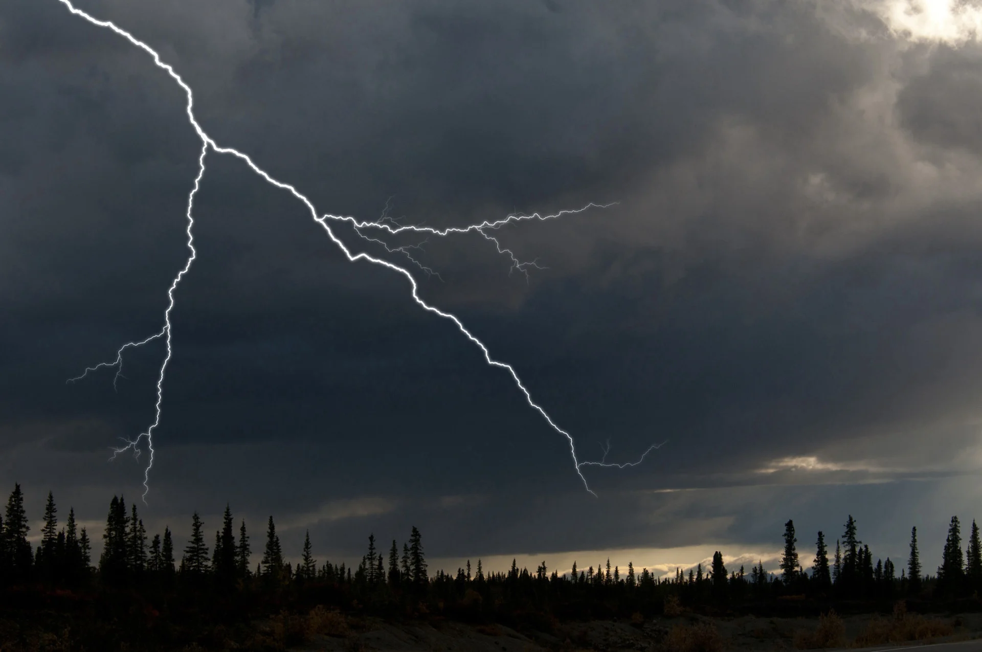
Thumbnail courtesy of Mark Newman/The Image Bank/Getty Images.
Stay tuned to The Weather Network for the latest forecast updates for Ontario and Quebec.